
Dail Na Drochaide


Hut Circle(S) (Prehistoric)
Site Name Dail Na Drochaide
Classification Hut Circle(S) (Prehistoric)
Canmore ID 6254
Site Number NC75NW 5
NGR NC 7200 5747
Datum OSGB36 - NGR
Permalink http://canmore.org.uk/site/6254


- Council Highland
- Parish Farr
- Former Region Highland
- Former District Sutherland
- Former County Sutherland
NC75NW 5 7200 5747.
(A: NC 7201 5748 and B: NC 7199 5746) Enclosures (NR)
OS 6" map, (1964)
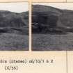
In undulating moorland are two enclosures (a and b), probably hut circles (A and B), both overgrown with turf and bracken. Hut 'A' measures 12.0m northwest-south east by 11.0m transversely within a wall 0.2m high and spread to 3.0m broad. The entrance of simple form is in the south east arc. 'B', set into a knoll is of more massive construction measuring 12.5m north west-south east by 11.0m transversely within a mutilated wall about 2.1m wide and at best 1.0m high. Several large facing slabs on edge (of typical hut circle construction) are exposed. The entrance of simple form is in the south east arc. This hut is similar in its position and its unusual strength to the example on the west side of Strathnaver (see NC75NW 1).
The only evidence of contemporary cultivation in the immediate vicinity of the huts are three or four stone clearance heaps. Run-rig lies close by to the south east, and there are stone rows (see NC75NW 34) some 40.0m to the east.
Revised at 1:10,000.
RCAHMS 1911, visited 1909; Visited by OS (J L D) 2 May 1960 and (N K B) 15 August 1978.

