Barhapple Loch
Crannog (Period Unassigned), Paddle (Period Unassigned), Logboat (Period Unassigned), Logboat (Period Unassigned)(Possible)
Site Name Barhapple Loch
Classification Crannog (Period Unassigned), Paddle (Period Unassigned), Logboat (Period Unassigned), Logboat (Period Unassigned)(Possible)
Canmore ID 62139
Site Number NX25NE 2
NGR NX 2595 5915
Datum OSGB36 - NGR
Permalink http://canmore.org.uk/site/62139
- Council Dumfries And Galloway
- Parish Old Luce
- Former Region Dumfries And Galloway
- Former District Wigtown
- Former County Wigtownshire
NX25NE 2 2595 5915.
(NX 2595 5915 and 2598 5916) Lake Dwelling (NR) (sites of) (2 symbols shown).
OS 6" map (1957)
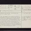
In 1878, when Barhapple Loch was drained, traces of a crannog became visible, and in 1880 and 1884, the loch was systematically examined and the crannog excavated. The crannog was situated opposite the centre of the W shore, and 280' from it. It was surrounded by a row of oak piles enclosing an area, 175' N-S by 127', rounded at the angles, and consisted, as far as could be ascertained, 'mainly of piles and platforms of wood with rough stones at some points.' It was estimated that some 3000 trees must have been used in its construction, and appearances indicated that it had been destroyed by fire. The crannog appeared to be connected to the N and E shores of the loch by gangways on piles.
Only a few relics were recovered by the excavators. They consisted of a cannal coal ring 2 1/4" in diameter, two broken shale rings, fragments of a canoe and paddle, hammer- and grinding-stones and a spoon-like wooden implement. Most of the items are in the NMAS.
The loch was again a sheet of water in 1911.
G Wilson 1882; R Munro 1885; RCAHMS 1912, visited 1911.
No further information, and no traces of the crannog. From Wilson's plan it would seem that it was situated at NX 2595 5915.
Visited by OS (JP) 15 June 1976.
(Barhapple Loch 1-2, and paddle). In 1878 drainage operations revealed a crannog in Barhapple Loch, which is situated in an area of rough pasture and extensive drainage at an altitude of about 85m OD. When it was subsequently excavated, the following objects (which are now lost) were found:
1. In 1880, 'two broad pieces of oak', each measuring about 4'6" (1.4m) in length, were found beneath a layer of stones. They were identified as possibly parts of a logboat. The published account is confused, and it is unclear whether they were built into the crannog, or were discovered about 150m to the NNE (at NX c. 2598 5929).
2. In 1884 a 'broken canoe paddle and half a canoe' were discovered during further excavation of the crannog.
G Wilson 1882; R Munro 1885; R J C Mowat 1996.
As the underwater component of Phase 2 of the South West Crannog Survey, the state of preservation of 14 crannog sites was evaluated in 12 lochs throughout Dumfries and Galloway as part of the Scottish Wetland Archaeology Programme (SWAP).
NX 2595 5915. Poor visibility limited the inspection of the fully submerged crannog in Barhapple Loch. No discernible mound exists, though deep silt across the entire loch bed is likely to have obscured this. The area of the crannog itself consisted of firm silts and peat in comparison to the soft unconsolidated natural silts of the loch bed. Some 40 piles were observed, including examples of oak, alder and birch, and in several areas large flat horizontal timbers were noted. Some of these had supporting piles at either end. Many of the timbers were in poor condition and showed evidence of recent exposure.
Nothing was seen of the walkway, lying between the site and the E shore, mentioned and planned by Munro. It is likely that the deep silts have obscured this.
Sponsors: HS, Scottish Trust for Archaeological Research, AOC Archaeology Group, University of Nottingham
M G Cavers and J C Henderson 2002
The second season of the South West Crannog Survey Phase 2 was carried out in September 2003 (DES 2002, 25-7) and comprised detailed digital survey of submerged and dry areas of selected crannog sites in Dumfries and Galloway. Small-scale underwater excavations were also carried out in order to stabilise and record exposed eroding timbers. The project was conducted by the Underwater Archaeology Research Centre as part of the Scottish Wetland Archaeology Programme (SWAP).
NX 2595 5915. A survey was carried out of the timber remains in the loch. A total of 144 vertical piles of oak, alder and birch as well as 31 horizontal timbers were noted, arranged in a roughly circular grouping with a diameter of approximately 42m. No evidence was seen of the causeway noted by Munro and others in the 19th century.
Full report to be lodged with the NMRS.
Sponsors: HS, Scottish Trust for Archaeological Research, Nottingham University, AOC Archaeology Group.
J C Henderson and M G Cavers 2003.
This crannog was recognised in 1878, when the loch was drained. Excavations in 1880 and 1884 revealed a row of oak piles enclosing an area measuring about 50m by 40m, within which there were 'mainly' piles and platforms of wood with rough stones at one point'. The crannog was said to be connected to the N and E shores by gangways on piles. The few finds recovered included a cannel coal ring, two broken shale rings, a spoon-like wooden implement, hammer and grinding stones, and fragments of a logboat and paddle.
The remains of this crannog were surveyed in July 2002 during the 2nd phase of the South-West Scotland Crannog Survey, with the intention of establishing an effective system of monitoring the rate of organic decay. The main threats to the monument was recognised as posed by the combined effects of the fluctuating water table and the shallow depth of the water; monitoring of the loch level was recommended, as was that of the ongoing erosion of the sapwood on the exposed timbers.
This crannog is situated in a very shallow loch (rarely more than about 0.8m deep) in an area of rough pasture; no natural streams flow into it, but it is supplied by ditches from, surrounding higher ground all around. The loch bed could not be detected beneath a layer of silt at least 1m deep.
There were no surface indications of the crannog, which lay about 20m S of a dense concentration of reeds within an area where the silt was very soft and up to 1.5m deep. Poor underwater visibility precluded the definition of the full extent or structure of the disguised mound. Instead, piles, horizontal timbers and a few stones were scattered across an area firmer and more compact than the surrounding soft lake silts. Over 40 piles were identified, most of them oak. Non-oak piles were also identified, while the horizontal piles scattered among the piles also appeared to be oak. In many places, horizontal timbers were observed with vertical piles at both ends.
Many of the timbers were in a poor state of preservation, having a spongy consistency. The shallow depth of water means that small changes in loch level may have drastic effects on the surviving timbers. Areas of very shallow water (0.3m or less) were choked with aquatic plants and algae, presumably as a result of photosynthesis. Sapwood was noted on several of the timbers projecting above the silt. This is very susceptible to decay and biological attack, so that its presence indicates recent exposure.
Only a few oak piles were identified of the wooden causeway postulated by Munro as running eastwards. These were sampled for radiocarbon assay. [Result not cited].
J C Henderson, B A Crone and M G Cavers 2003.
A third season of fieldwork and survey (see DES 2003, 42-3) on selected crannog sites in Dumfries and Galloway was carried out in July 2004 as part of the Scottish Wetland Archaeology Programme (SWAP). This comprised the underwater examination of six crannog sites selected for monitoring, the installation and surveying of monitoring probes at those sites, and the sampling of timbers from Loch Heron for radiocarbon dating.
NX 1206 6047 Cults Loch (Inch parish), NX16SW 14.
NX 2717 6482 Loch Heron (Kirkcowan parish), NX26SE 2.
NX 9028 6898 Loch Arthur (New Abbey parish), NX96NW 1.
NX 2047 5631 Whitefield Loch (Old Luce parish), NX25NW 7.
NX 2595 5915 Barhapple Loch (Old Luce parish), NX25NE 2.
NX 2047 5631 Barlockhart (Old Luce parish), NX25NW 7.
NX 8388 7188 Milton Loch (Urr parish), NX87SW 4.
Sponsors: HS, Scottish Trust for Archaeological Research, University of Nottingham, AOC Archaeology Group, Underwater Archaeology Research Centre.
J Henderson and M G Cavers 2004.
Diver Inspection (July 2004 - July 2004)
A third season of fieldwork and survey (see DES 2003, 42-3) on selected crannog sites in Dumfries and Galloway was carried out in July 2004 as part of the Scottish Wetland Archaeology Programme (SWAP). This comprised the underwater examination of six crannog sites selected for monitoring, the installation and surveying of monitoring probes at those sites, and the sampling of timbers from Loch Heron for radiocarbon dating.
NX 1206 6047 Cults Loch (Inch parish), NX16SW 14.
NX 2717 6482 Loch Heron (Kirkcowan parish), NX26SE 2.
NX 9028 6898 Loch Arthur (New Abbey parish), NX96NW 1.
NX 2047 5631 Whitefield Loch (Old Luce parish), NX25NW 7.
NX 2595 5915 Barhapple Loch (Old Luce parish), NX25NE 2.
NX 2047 5631 Barlockhart (Old Luce parish), NX25NW 7.
NX 8388 7188 Milton Loch (Urr parish), NX87SW 4.
Sponsors: HS, Scottish Trust for Archaeological Research, University of Nottingham, AOC Archaeology Group, Underwater Archaeology Research Centre.
J Henderson and M G Cavers 2004.


