
Pricing Change
New pricing for orders of material from this site will come into place shortly. Charges for supply of digital images, digitisation on demand, prints and licensing will be altered.
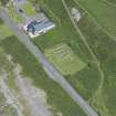
Chapel Finian


Chapel (10th Century)
Site Name Chapel Finian
Classification Chapel (10th Century)
Alternative Name(s) Chapel Finnian; Corsewall Point
Canmore ID 62114
Site Number NX24NE 2
NGR NX 27840 48920
Datum OSGB36 - NGR
Permalink http://canmore.org.uk/site/62114


First 100 images shown. See the Collections panel (below) for a link to all digital images.
- Council Dumfries And Galloway
- Parish Mochrum
- Former Region Dumfries And Galloway
- Former District Wigtown
- Former County Wigtownshire
NX24NE 2 27840 48920.
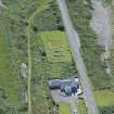
(NX 2784 4892) Chapel Finian (NR) (Remains of)
OS 6" map (1957)
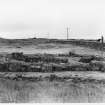
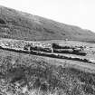
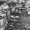
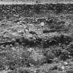
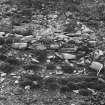
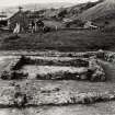
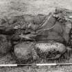
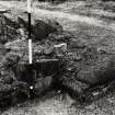
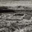
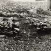
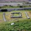
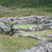
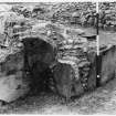
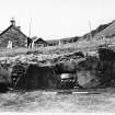
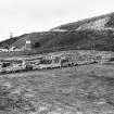
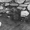
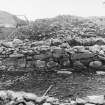
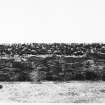
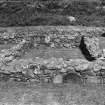
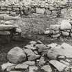
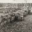
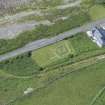
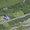
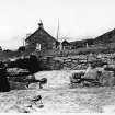
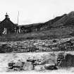
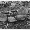
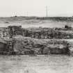
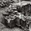
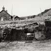
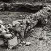
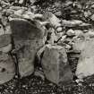
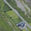
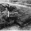
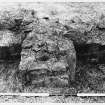
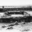
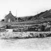
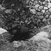
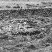
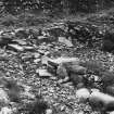
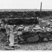
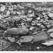
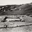
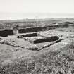
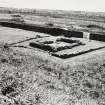
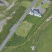
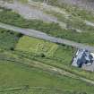
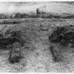
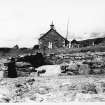
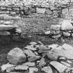
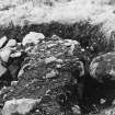
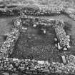
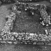
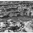
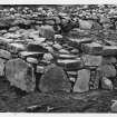
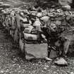
Excavations were carried out at this site in 1950 by the Dumfriesshire Galloway Natur Hist Antiq Soc. The foundations and lower walls remain of Chapel Finian, a mortared rectangular stone chapel or oratory, measuring some 6.7m by 4.1m internally and buttressed. It is surrounded by a possibly earlier drystone wall enclosing a sub-rectangular area which contains a well (see NX24NE 1). "The chapel is named after St Findbar and is dated to the 10th or 11th century. Its situation near the shore suggests that it was for the use of pilgrims landing nearby.
C A R Radford 1951; E W MacKie 1975; S Piggott and W D Simpson 1970
Plaster from the excavations is in Dumfries Museum (Accession no. 1972/61).
A E Truckell 1972
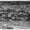
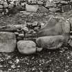
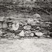
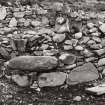
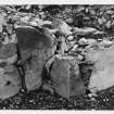
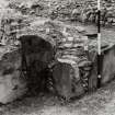
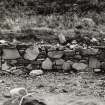
Chapel Finian (Department of the Environment nameplate) is a simple buttressed rectangular chamber entered by a 0.9m wide doorway in the south wall. It measures 6.7m NE-SW by 4.1m within a wall 0.7m thick and up to 0.9m high. A stone wall (originally dry built but necessarily consolidated with lime mortar to preserve it) encloses the chapel in a manner characteristic of Early Christian sites. This wall, surviving on all but the south-west side is 0.9m thick and up to 1.3m high. There are wall footings 0.7m wide and 0.1m high immediately outside the door of the chapel and outside the enclosing wall in the south east; their purpose is not clear.
Surveyed at 1:2500.
Visited by OS (TRG) 17 May 1977.
Publication Account (1986)
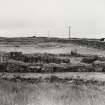
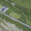
The foundations of this small rectangular chapel lie close to the coastal road and the shore on the old raised beach at Corwall Port. Oriented east-west, it has a south doorway and there are three buttresses on each of the side-walls, one in the centre and one against each corner. Excavation revealed evidence of a stone bench, possibly encased in wood, set against the inner eastern face of the south wall. The mortared masonry includes use of large upright stones set on edge to form foundation-courses and door-jambs. The building is tightly enclosed within the footings of a drystone boundary wall, and a stone-lined well lies outside, close to the entrance-gateway in the roadside dyke.
In 1684 this building was described as 'a little ruinous chapel call'd by the country people Chapel Finzian'. It probably takes its name from St Finian of Moville (Co. Down, Ulster), who was educated at Whithom and died in about 579. The site may mark an episode in the life of the saint, and it may have been a landing place for Irish pilgrims to St Ninian's shrine.
Information from ‘Exploring Scotland’s Heritage: Dumfries and Galloway’, (1986).
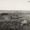
Watching Brief (29 January 2010 - 1 March 2010)
NX 2783 4892 A programme of archaeological work was carried out 29 January–March 2010 in advance of the
proposed construction of a lay-by opposite Chapel Finian. A 450mm deep test trench recorded a man-made verge of silt and pebbles and two modern drains were identified in or bordering the development area. A watching brief was carried out during the machine excavation of a c23 x 3m x 450mm deep trench, but no significant archaeological finds or features were recorded.
Archive: RCAHMS (intended)
Funder: Historic Scotland
D Gorman – Kirkdale Archaeology
Measured Survey (14 October 2021)
NX 27840 48920 A 3D survey was carried out, on 14 October 2021, of this small rectangular chapel, which lies close to the coastal road and the shore on the old raised beach at Corwall Port.
The chapel was surveyed using a combination of laser scanning and photogrammetry.
Archive: NRHE (intended) Funder: Whithorn Trust
Jamie Humble – AOC Archaeology Group
(Source: DES Vol 22)

