
Following the launch of trove.scot in February 2025 we are now planning the retiral of some of our webservices. Canmore will be switched off on 24th June 2025. Information about the closure can be found on the HES website: Retiral of HES web services | Historic Environment Scotland
West Freugh Airfield


Airfield (20th Century)
Site Name West Freugh Airfield
Classification Airfield (20th Century)
Alternative Name(s) Luce Bay
Canmore ID 61306
Site Number NX15SW 22
NGR NX 1086 5470
NGR Description Centred NX 1086 5470
Datum OSGB36 - NGR
Permalink http://canmore.org.uk/site/61306


- Council Dumfries And Galloway
- Parish Stoneykirk
- Former Region Dumfries And Galloway
- Former District Wigtown
- Former County Wigtownshire
NX15SW 22.00 centred 1086 5470
For northern part of airfield see also NX15NW 134.00.
The eastern part of West Freugh aerodrome takes in the western part (including the technical area) of Luce Bay air station NX15NW 56.
NX15SW 22.01 Centred NX 10743 54306 Aircraft Hangars; Buildings; Huts
NX15SW 22.02 NX 10942 54523 Control Tower
NX15SW 22.03Centred NX 1067 5405 and NX 1003 5374 Military Camps
NX15SW 22.04 NX 1030 5388 Sewage Works
NX15SW 22.05 NX 11578 54142 Pillbox
NX15SW 22.06 NX 11673 54782 Pillbox
NX15SW 22.07 c.NX 1116 5405 Gas Decontamination Centre
NX15SW 22.08 NX 10945 53995 and NX 10988 53998 Houses
NX15SW 22.09 NX 10337 54613 Pillbox
NX15NW 134.00 Centred NX 1139 5531 Bomb Store
NX15NW 134.01 Centred NX 11288 55703 Dispersal Bays
NX15NW 134.02 NX 11212 55429 Pillbox (possible)
NX15NW 134.03 NX 11445 55271 Pillbox (possible)
This pre-war airfield dates to 1936. Still used for Ministry of Defence trials permission is required for entry.
D J Smith 1983.
A sketch plan of April 1943 of this airfield shows that the main type of aircraft based here were Avro Ansons with some Hampdens. There was also a WAAF presence and most of the normal airfield facitlities such as NAAFI, Sports and Fire services.
Information RCAHMS (DE), May 2001
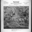
West Freugh airfield is situated on level ground immediately to the NW of the sand dune system on the W side of Luce Bay. The airfield presently occupies about 140 hectares of land, has two main runways, NE-SW of 1874m and a NW-SE of 885m and a technical site, including eight aircraft hangars on the S side of the active runways. The airfield is presently used by the Ministry of Defence (MoD).
The airfield orignally occupied about 87.7 hecatres of land, but has been extended since World War II. Many of the dispersed wartime structures such as armoured dispersal bays, hutted camps, sewage works and pillboxes have been removed in recent years.
The airfield is visible on vertical air photographs (106G/Scot/UK 42, 3127-3130, flown 4 May 1946), which show that at that date their were accommodation camps to the S and W of the main technical site. An oblique aerial photograph (Mr J Norrie) of the site shows that many buildings within the technical site such as the gas decontamination centre, temporary married quarters and other buildings have been removed in the postwar period.
Information from RCAHMS (DE), April 2006 and Mr J Norrie (by letter), February 2006.
Watching Brief (26 June 2023 - 5 July 2023)
Archaeological Services WYAS (ASWYAS) undertook a watching brief to monitor the ground investigation works at MoD West Freugh between the 26th of June and the 5th of July 2023. The work comprised the monitoring of twenty borehole test pits. Layers of concrete relating to the former hanger and barracks were encountered along with signs of obvious truncation. No archaeological remains were encounted.
Information from Archaeological Services WYAS.

