
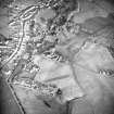
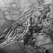
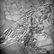
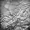
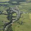
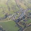
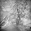
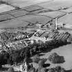
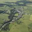
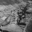
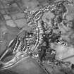
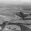
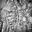
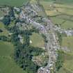
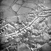
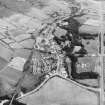
Glenluce


Burgh (Medieval), Village (Period Unassigned)
Site Name Glenluce
Classification Burgh (Medieval), Village (Period Unassigned)
Alternative Name(s) Glen Luce
Canmore ID 61198
Site Number NX15NE 52
NGR NX 19910 57605
NGR Description Centred NX 19910 57605
Datum OSGB36 - NGR
Permalink http://canmore.org.uk/site/61198


- Council Dumfries And Galloway
- Parish Old Luce
- Former Region Dumfries And Galloway
- Former District Wigtown
- Former County Wigtownshire
NX15NE 52 centred 19910 57605
Extends onto map sheet NX25NW.
Existing burgh of barony, 1705; erected burgh of regality, 1707.
G S Pryde 1965.

