
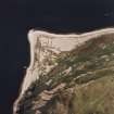
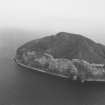
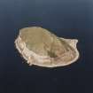
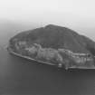
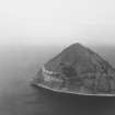
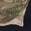
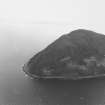
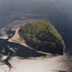
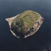
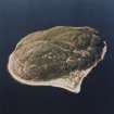
Ailsa Craig, Castle


Castle (Medieval), Well (Period Unassigned)
Site Name Ailsa Craig, Castle
Classification Castle (Medieval), Well (Period Unassigned)
Alternative Name(s) Castle Ailsa Craig; Ailsa Castle; Ailsa Craig Castle
Canmore ID 60964
Site Number NX09NW 1
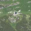
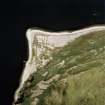
NGR NX 02240 99512
Datum OSGB36 - NGR
Permalink http://canmore.org.uk/site/60964


- Council South Ayrshire
- Parish Dailly
- Former Region Strathclyde
- Former District Kyle And Carrick
- Former County Ayrshire
NX09NW 1 02240 99512
(NX 02239952) Castle (NR) (Rems of)
(NX 02179956) Castle Well (NAT).
OS 6" map (1958)
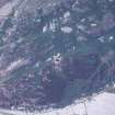
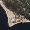
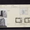
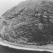
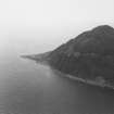
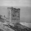
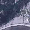
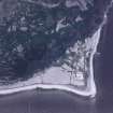
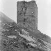
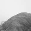
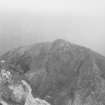
The ruins of a small keep three storeys high with vaulted basement situated on a ledge on the steep side of the Craig, the only approach being by a very steep and narrow pathway. It has few features to indicate its date but the Border keeps of the early 16th century are suggested by the thinness of the walls, 2 ft 6 ins, and the internal arrangements. The door has been in the seaward side and appears to have been approached by an outer stair.
A courtyard about 30 ft lond by the width of the keep appears to have existed on the north side to judge by indications at the NW and NE angles. The castle was in ruins in 1580 but was restored by Thos Hamilton whose arms are high up on the south gable.
The 'Castle Well' is now a modern tank.
D MacGibbon and T Ross 1889
Visited by OS (JLD) 4 October 1955
In 1597 Hew Barclay of Ladyland, Kilbirnie, seized and fortified the Craig in the Spanish interest. His machinations were countered by the militant Rev Andrew Knox, and thereafter the Earl of Cassillis placed the castle in a proper state of defence; explaining its fair preservation today.
J G Cruickshank 1968
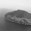
The castle ruin is in a stable condition and is as described. No outer defensive works are visible here or at the level landing area of Foreland Point, the only two likely places where fortifications could, or would need to be placed if the craig itself was fortified in 1597 as suggested by Cruickshank.
Surveyed at 1:10 000.
Visited by OS (JRL) 5 May 1977.
Castle (rems of) [NAT]
Castle Well [NAT]
OS (GIS) MasterMap, May 2010.

