
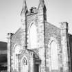
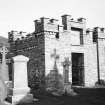
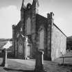
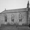
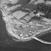
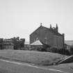
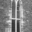
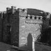
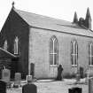
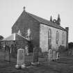
Lochryan Church And Burial-ground


Burial Ground (19th Century), Church (19th Century)
Site Name Lochryan Church And Burial-ground
Classification Burial Ground (19th Century), Church (19th Century)
Canmore ID 60661
Site Number NX06NE 23
NGR NX 06177 68891
NGR Description Centred on NX 06177 68891
Datum OSGB36 - NGR
Permalink http://canmore.org.uk/site/60661


- Council Dumfries And Galloway
- Parish Inch
- Former Region Dumfries And Galloway
- Former District Wigtown
- Former County Wigtownshire
NX06NE 23.00 06177 68891
NX06NE 23.01 NX 0621 6878 War Memorial
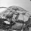
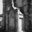
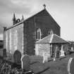
Lochryan Church is depicted on Ordnance Survey Epoch 2 map which dates from 1888 to 1915. It was been demolished in the 1990s.
Information from RCAHMS (LKFJ), May 2002.
NX06NE 23.00 06177 68891
Lochryan Church is depicted on Ordnance Survey Epoch 2 map which dates from 1888 to 1915. It has subsequently been demolished. Information from RCAHMS (LKFJ), May 2002

