
Pricing Change
New pricing for orders of material from this site will come into place shortly. Charges for supply of digital images, digitisation on demand, prints and licensing will be altered.
Westerside


Farmstead (Period Unassigned)
Site Name Westerside
Classification Farmstead (Period Unassigned)
Canmore ID 59792
Site Number NT86NE 32
NGR NT 8897 6869
Datum OSGB36 - NGR
Permalink http://canmore.org.uk/site/59792


- Council Scottish Borders, The
- Parish Coldingham
- Former Region Borders
- Former District Berwickshire
- Former County Berwickshire
NT86NE 32 8897 6868.
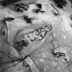
Situated immediately SE of settlement NT86NE 17. A rectangular building-platform measuring 8.8m by 4m and mutilated by a later kiln-like structure occupies the N corner of a rectangular enclosure measuring 16m by 15m within a stony bank 2.5m thick. A semi-circular annexe adjoins the NW side of the enclosure.
RCAHMS 1980, visited July 1979.
Field Visit (May 1911)
82. Fort-like Enclosures, Coldingham Loch.
Situated on the end of a knoll, at an elevation of 520 feet above sea-level, to the west of the northwest end of Coldingham Loch and some 550 yards to the north- west of Westloch House, is a small circular enclosure surrounded by a low stony bank, measuring some 135 feet by 111 feet, and entered from the north-west and south-east. In the interior are two circular depressions measuring in diameter respectively 27 and 24 feet (fig. 44). On lower ground, some 12 feet to the south-east, is a smaller and oblong enclosure of similar character measuring 90 feet by 51, containing two circular foundations of 30 and 24 feet in diameter, and a smaller and rectangular enclosure. The entrance appears to have been from the south-east. Some 34 yards further to the south-east lies a third enclosure, elliptical in outline, measuring 69 feet by 57 feet.
RCAHMS 1915, visited May 1911.
Sbc Note
Visibility: This is an upstanding earthwork or monument.
Information from Scottish Borders Council

