Ladykirk
Enclosure (Period Unassigned), Motte And Bailey (Medieval), Rig And Furrow (Medieval) - (Post Medieval)
Site Name Ladykirk
Classification Enclosure (Period Unassigned), Motte And Bailey (Medieval), Rig And Furrow (Medieval) - (Post Medieval)
Alternative Name(s) Fairfield
Canmore ID 59522
Site Number NT84NE 15
NGR NT 89320 47720
Datum OSGB36 - NGR
Permalink http://canmore.org.uk/site/59522
- Council Scottish Borders, The
- Parish Ladykirk
- Former Region Borders
- Former District Berwickshire
- Former County Berwickshire
NT84NE 15 NT 89320 47720
(NT 8932 4772) Earthwork (NR)
OS 1:10,000 map, (1980).
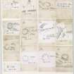
This earthwork, which is probably of medieval date, has been severely reduced by ploughing. Formerly it comprised a roughly circular low mound measuring 50m by 44m, which was flanked on the W and NE by a broad ditch and on the SE by steep river cliffs. Around the N and W edges of the summit of the mound there was a low bank, and the entrance lay on the W. RCAHMS 1915; 1980, visited 1979.
A now crescent-shaped mound, 1.2m high, with a summit measurement of 56m by 40m. A broad shallow ditch runs N from the W, fading out on the N.
On the S, the mound falls away down to the river; there are a large number of stones lying on this side. The bank on the W side noted by the RCAHMS is now ploughed out.
Visited by OS(JD) 11 January 1955.
A few years ago an attempt was made by the farmer to level this site and it is now visible as an oval, flat-topped mound measuring 66.0m ENE-WSW by 53.0m transversely with a maximum height of 1.3m. Slight traces of a ditch survive on the W. Numerous dressed stones on the S side suggest that a substantial building (? castle or tower) formerly stood here.
Resurveyed at 1:2500.
Visited by OS(RD) 6 December 1971.
Photographed by RCAHMS, flown 1977.
Field Visit (22 October 1908)
192. Fort, Fair Field, Ladykirk.
At the south side of the Fair Field, about ¼ mile east of Ladykirk Church and at the top of the Blount Bank, on the north side of the Tweed, is a circular mound (fig. 93 [DP 225491]) with an elevation at highest of some 8 feet 6 inches and a summit measurement of about 162 feet by 144 feet. On the west, where the ground on the outside is higher, there is a shallow trench, crowning the scarp of which is a low bank about 2 feet high; The entrance has been from the north-east.
RCAHMS 1915, visited 22nd October 1908
OS Map: Ber., xxiii. NE. and xxiv. NW.
Sbc Note (21 March 2016)
Visibility: This was the site of an archaeological monument, which may no longer be visible.
Information from Scottish Borders Council
Previously also listed under duplicate site NT96SW 510 -CANCELLED. HES (LCK) 11.6.2024


