Thorntonloch
Fort (Prehistoric)
Site Name Thorntonloch
Classification Fort (Prehistoric)
Alternative Name(s) Thornton Burn
Canmore ID 58892
Site Number NT77SE 5
NGR NT 75110 74090
Datum OSGB36 - NGR
Permalink http://canmore.org.uk/site/58892
- Council East Lothian
- Parish Innerwick (East Lothian)
- Former Region Lothian
- Former District East Lothian
- Former County East Lothian
NT77SE 5 NT 75110 74090
(NT 7511 7409) Earthwork (NR) (site of)
OS 6" map (1971)
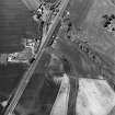
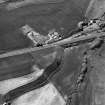
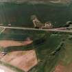
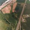
The cropmark of a promontory fort is visible during a dry season about 350 yds SSE of Thorntonloch, on the right bank of the mouth of the Thornton Burn. It occupies a bank which falls 30 to 40ft on the N and W, but slopes more gradually on the other sides.
The interior of the fort measures 90 by 58 yds, with an entrance about the middle of the S side. E of the entrance two trenches 36ft apart can be roughly discerned in favourable circumstances - the inner 12ft wide and the outer 9ft - but the W only one. Close to the entrance the rampart seems to have bifurcated. Two hut circles, each about 15ft in diameter are further suggested within the enclosure.
J H Craw 1919; RCAHMS 1924
No trace of a cropmark can be seen, but from the description given by the RCAHMS and from Craw's plan, the site of the earthwork is at NT 7511 7409.
Visited by OS (RD) 5 April 1966
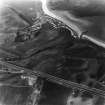
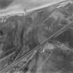
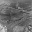
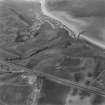
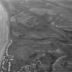
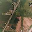
Photographed by the RCAHMS (1978, 1979), who list this feature as a fort.
(Undated) information in NMRS.
Publication Account (1924)
About 350 yards south-south-east of Thorntonloch, on the right bank of the mouth of Thornton Burn, a dry season reveals among the crop the lines of a promontory fort occupying a bank which falls 30 to 40 feet on the north and west, but slopes more gradually on the other sides. The area enclosed measures 90 by 58 yards with an. entrance about the middle of the south side. East of the entrance two trenches 36 feet apart can be roughly discerned in favourable circumstances, the inner 12 feet wide and the outer 9 feet; but to the west one only. Two hut circles of about 15 feet in diameter are further suggested within the enclosure.
RCAHMS 1924.
See Proc. Berwickshire Naturalists' Club,vol. xxiv., p. 106.
Aerial Photographic Transcription (11 December 1997)
An aerial transcription was produced from oblique aerial photographs. Information from Historic Environment Scotland (BM) 31 March 2017.
Aerial Photographic Transcription (20 October 2011)
Note (6 January 2016 - 21 October 2016)
This fort occupies a low hillock on the NE side of the AI public road, backing onto a steep escarpment to the S of the mouth of the Thornton Burn. An irregular D-shape on plan, it measures a maximum of 125m from E to W along the sinuous lip of the escarpment by 45m transversely (0.42ha) within an asymmetric arc of two ditches up to 8m broad and 7m apart; a third ditch about 3m in breadth can be traced round the SE flank. James Hewat Craw, who first noted the cropmark from the train in 1919, recorded the inner and outer ditches at 3.6m and 2.7m in breadth respectively, but on the aerial photographs they not only appear much broader, but the mark of the inner displays several lines within its overall breadth, one along the inner lip being particularly prominent; without excavation it is unclear whether this feature simply reflects aspects of the underlying ditch fill, perhaps slumping along the inner lip, or whether the mark of the ditch has become conflated with that of another feature immediately up the slope. Nevertheless, allowing for the presence of an inner rampart commensurate with the ditches, the interior probably extended to about 0.33ha. Craw identified the marks of two hut-circles on the N side of the interior, and though these particular features have not been observed on more recent aerial photographs, there is at least one circular macula adjacent to the lip of the escarpment on the NW. The photographs also show a clearly-defined causeway across the inner ditch on the SW, but it is not clear whether there is a corresponding gap in the second ditch at this point. Conversely the second ditch, and possibly the third, terminate just short of the edge of the escarpment on the NE, implying an entrance-way approaching along its lip, but the inner ditch at this point appears to run straight out onto the slope. If these observations are correct, the defences represent several periods of construction.
Information from An Atlas of Hillforts of Great Britain and Ireland – 21 October 2016. Atlas of Hillforts SC3924


