Pricing Change
New pricing for orders of material from this site will come into place shortly. Charges for supply of digital images, digitisation on demand, prints and licensing will be altered.
Scheduled Maintenance Notice
Please be advised that this website will undergo scheduled maintenance starting on Thursday, 30th January at 11:00 AM and will last until Friday, 31st January at 10:00 AM.
During this time, the site and certain functions may be partially or fully unavailable. We apologise for any inconvenience this may cause.
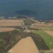
Dunglass Bridge
Road Block (Second World War), Road Bridge (20th Century)
Site Name Dunglass Bridge
Classification Road Block (Second World War), Road Bridge (20th Century)
Alternative Name(s) (Former) A1 Road Bridge; Dunglass Burn; Dunglass Dean
Canmore ID 58885
Site Number NT77SE 43
NGR NT 77106 72192
Datum OSGB36 - NGR
Permalink http://canmore.org.uk/site/58885
- Council Scottish Borders, The
- Parish Cockburnspath
- Former Region Borders
- Former District Berwickshire
- Former County Berwickshire
NT77SE 43 77106 72192
See also NT77SE 37, NT77SE 44, NT77SE 45, NT77SE 114.
Dunglass Bridge [NAT]
OS 1:10,000 map, 1987.
Formerly the A1 road bridge.
(Undated) information in NMRS.
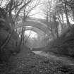
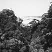
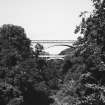
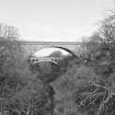
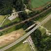
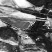
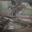
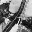
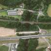
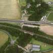
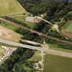
(Location cited as NT 771 722). Bridge, Dunglass, built 1932 by engineers Blyth and Blyth. A reinforced-concrete bridge witha wide central span, with five arched ribs supporting smaller arches (five on each side). There are smaller approach spans at both ends.
J R Hume 1976.
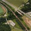
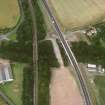
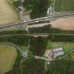
This bridge carries the former line of the A1 public road over the Dunglass Burn, which flows in Dunglass Dean and here forms the boundary between the parishes of Oldhamstocks (East Lothian) and Cockburnspath (Berwickshire). It is the furthest upstream (to the SW) of the five bridges that form this group.
Information from RCAHMS (RJCM), 2 February 2006.
NT77SE 43 77101 72196
NMRS REFERENCE:
James Burn
EXTERNAL REFERENCE:
SCOTTISH RECORD OFFICE GD 150/2338/3
Construction (1932)
An outstanding example of an early reinforced concrete bridge.
R Paxton and J Shipway 2007
Reproduced from 'Civil Engineering heritage: Scotland - Lowlands and Borders' with kind permission of Thomas Telford Publishers
Project (2007)
This project was undertaken to input site information listed in 'Civil engineering heritage: Scotland - Lowlands and Borders' by R Paxton and J Shipway, 2007.
Publication Account (2007)
An outstanding example of an early reinforced concrete bridge. Its main arch springs from the rock on each side of the burn with a span of 157 ft and a rise of 38 ft 6 in. The five arch ribs have parabolic soffits, are 3 ft wide and increase in depth uniformly from 4 ft at the crown to 7 ft at the springings. The centring for the arch had a maximum height of 75 ft and required 5000 cu ft of timber. The engineers were Blyth & Blyth and the contractor, Crowley, Russell & Co., Glasgow. The bridge carried the A1 Trunk Road until recently bypassed by the New Bridge.
R Paxton and S Shipway 2007
Reproduce from 'Civil Engineering heritage: Scotland - Lowlands and Borders' with kind permission of Thomas Telford Publishers.
Field Visit (3 March 2015)
Barclay (2013) mentions a stop line built during the Second World War to prevent enemy movement along the coast. Road and rail blocks were established at this vulnerable point. No evidence for a rail block or road blocks can now be seen on any of the Dunglass bridges. However under the E end of the approach viaduct of the 1930-2 arched concrete bridge there is a small sandbagged enclosure abutting the bridge's E abutment, measuring about 5m NNE-SSW by 3m transversely within sandbagged walls c1m thick and standing up to c.2m high on the NNE. The walls on the other two sides measure about 0.5m to 0.75m high, with the sandbag material now rotting away in many places exposing the hard sand and stone infill. The corners of the sandbagged enclosure use the supporting concrete bridge pillars. The entrance was in the WNW wall.
It is unclear what purpose this sandbagged enclosure was put to but either a store or shelter would seem more probable than a defensive position.
Visited by RCAHMS (AKK) 28 February 2015.
Sbc Note (15 April 2016)
Visibility: Standing structure or monument.
Information from Scottish Borders Council


