Dryburn Bridge
Cist(S) (Prehistoric), Inhumation(S) (Prehistoric), Palisaded Enclosure (Prehistoric), Pit (Prehistoric), Ring Groove House(S) (Prehistoric), Beaker (Pottery)(Bronze Age), Food Vessel (Pottery)(Prehistoric), Knife (Bronze Age), Scraper (Tool) (Prehistoric)
Site Name Dryburn Bridge
Classification Cist(S) (Prehistoric), Inhumation(S) (Prehistoric), Palisaded Enclosure (Prehistoric), Pit (Prehistoric), Ring Groove House(S) (Prehistoric), Beaker (Pottery)(Bronze Age), Food Vessel (Pottery)(Prehistoric), Knife (Bronze Age), Scraper (Tool) (Prehistoric)
Canmore ID 58802
Site Number NT77NW 18
NGR NT 7238 7547
Datum OSGB36 - NGR
Permalink http://canmore.org.uk/site/58802
- Council East Lothian
- Parish Dunbar
- Former Region Lothian
- Former District East Lothian
- Former County East Lothian
NT77NW 18 7238 7547.
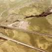
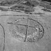
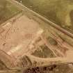
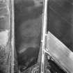
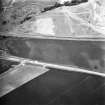
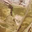
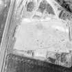
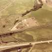
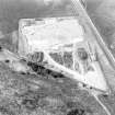
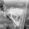
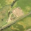
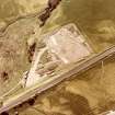
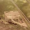
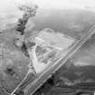
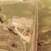
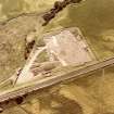
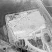
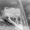
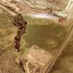
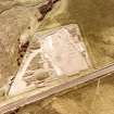
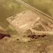
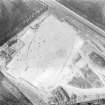
NT 7238 7547. Palisaded Enclosure, Dryburn Bridge: In advance of quarrying operations, rescue excavations were carried out in 1978 and 1979 by Messrs Pollock and Triscott on behalf of the SDD (IAM). The site was initially recognised from aerial photographs (Fairey Surveys Ltd, 20/986-91, flown 1974) which suggested the presence of a palisade trench, with at least one large internal feature, surmounting a low ridge overlooking the Dry Burn Valley.
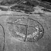
During the two seasons an area of approximately 6000m sq was stripped of topsoil by mechanical excavator. At least eight circular structures were located and excavated within this trench. Of these, three were defined by post hole rings (diameters 17.6, 14.0 and 9.5m to postulated wall lines), three by circular or semicircular depressions inside wall lines of diameters 10.5, 10.0 and 9.0m, one by concentric depressions delimited by two ring-grooves (maximum diameter 13.8m) and one by a single ring-groove (diameter 8.5m). The two larger post-ring structures appear to be associated with the palisade by situation and positioning of entrance. The palisade trench enclosed an oval area of approximately 85m by 50m and appears to have held squared timbers contained within a continuous, stone-packed slot. It was broken by two entrances on the eastern side, 50m apart, with a third, later blocked, possible entrance midway between the two. There is evidence of large-scale refurbishing of the palisade together with remodelling of the NE entrance.
At least four crouched inhumations were archaeologically associated with the palisade, of which one has produced a radiocarbon date of 2210 +/- 70 bp, whilst a further six burials of the same tradition lay within the enclosure. Two rectangular arrangements of post holes (2.3 by 3.0m and 3.5 by 4.0m) forming eight and nine post units are probably contemporary with the enclosure. Several similar arrangements exist elsewhere in the excavated area. Two of the three structures represented by circular depressions were constructed over the palisade trench, and thus appear to represent an unenclosed period. The third, lying just outside the palisade to the SW, is in line with the other two and would appear to be contemporary. On typological grounds the dual ring-groove structure appears to belong to a similar building tradition. A flimsy, polygonal, fence-like existing in the NE corner of the enclosure may represent stock penning in the unenclosed period; it apparently post-dates the largest post-ring structure.
Pre-enclosure activity is represented by two cists, each of which contained a crouched inhumation together with the disarticulated remains of another individual. On the capstones of one of these lay a beaker, this same grave also containing a plano-convex knife and thumbnail scraper as grave goods. Three shallow pits, immediately to the W of the palisade, containing fragments of food vessel type pottery, probably date to this early activity.
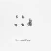
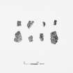
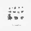
Finds were scarce, with bone and shell rarely surviving. Pottery in small quantities were recovered from the palisade and some pits or post holes, but none from the structures. Those represented by depressions, however, did produce a large assemblage of saddle querns and rubbing stones, together with small quantities of slag.
D C Pollock and J E Triscott 1980.


