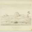
Borthwick Castle
Tower House (Medieval)
Site Name Borthwick Castle
Classification Tower House (Medieval)
Canmore ID 58629
Site Number NT75SE 1
NGR NT 7703 5444
Datum OSGB36 - NGR
Permalink http://canmore.org.uk/site/58629
- Council Scottish Borders, The
- Parish Duns
- Former Region Borders
- Former District Berwickshire
- Former County Berwickshire
NT75SE 1 7703 5444.
(NT 7703 5444) Borthwick Castle (NR) (Remains of)
OS 6"map, (1957).
Borthwick Castle is described by the RCAHMS as being a complete ruin, only a few feet of walling remaining at the E end, and two or three courses of masonry on the N.
Traditionally, it was a small residence and watch tower, not a place of strength, belonging to the Cockburns (Name Book 1857), who owned Langton estate 1314 - 1758.(New Statistical Account [NSA, J Brown] 1845).
RCAHMS 1915, visited 1908.
Although the remains are obscured by debris, the original Borthwick Castle appears to have been an L-shaped tower measuring about 17.0m by 11.0m over walls 2.4m wide, occupying the NE corner of a court. On the S side of the court are the remains of a house standing to gable height. It is generally built of mortared stone but incorporates narrow brick in the fireplace and window openings.
Attached to it are the ruins of three other buildings and nearby are two stone-walled enclosures.
Visited by OS(RD) 21 July 1970.
Excavation carried out prior to the removal of the remains of Borthwick Castle by quarrying showed it to have been an L-plan tower-house, probably of late 16th century date.
RCAHMS 1980, visited 1979; A M T Maxwell-Irving 1982.
Field Visit (21 October 1908)
113. Borthwick Castle.
This castle is situated about ½ mile west of Duns Castle, on the estate of Langton, and is a complete ruin. A few feet of walling remain at the east end, and two or three courses of masonry on the north, but otherwise it is structureless and unmeasurable.
OS Map: Ber., xvi. NW.
RCAHMS 1915, visited 21st October 1908.
Sbc Note (21 March 2016)
Visibility: This was the site of an archaeological monument, which may no longer be visible.
Information from Scottish Borders Council
Previously also listed under duplicate site NT96SW 510 -CANCELLED. HES (LCK) 11.6.2024


