Woden Law
Linear Earthwork (Period Unassigned)
Site Name Woden Law
Classification Linear Earthwork (Period Unassigned)
Alternative Name(s) Hunthall Hill
Canmore ID 58105
Site Number NT71SE 49
NGR NT 7708 1211
NGR Description NT 7708 1211 to NT 7715 1220
Datum OSGB36 - NGR
Permalink http://canmore.org.uk/site/58105
- Council Scottish Borders, The
- Parish Hownam
- Former Region Borders
- Former District Roxburgh
- Former County Roxburghshire
NT71SE 49 7708 1211 to 7715 1220
See also NT71SE 21.
(NT 7708 1211 : NT 7715 1220) Earthwork (NR)
OS 6"map, (1962).
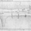
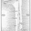
The neck that joins Woden Law to Hunthall Hill is crossed at its junction with the former by a linear earthwork consisting of a mound between two ditches. The mound and the SE ditch extend from just above the SW side of Dere Street for 110 yds SW and die out on the steep slope that descends to White Hope. The NW ditch accompanies them throughout, but its NE end has been involved in a wash-out which has also removed the Roman causeway from the underlying rock surface. It is therefore impossible to say whether this ditch originally terminated at the same point as the other components of the earthwork or continued farther towards the edge of the Twise Hope escarpment. The OS map (1923 edition) marks the earthwork as extending a short distance NE of the road, but no trace of this extension can now be seen.
The mound stands to a height of from 4' to 12', the latter being measured above the bottom of the SE ditch where this has diverged downhill on the steep slope. This ditch is 8' wide, while that on the NW or uphill side is normally 5' wide. At two points near the centre the mound has been worn down by relatively modern tracks.
The position of this work below Woden Law strikingly resembles that of NT71SE 21 - 'A', at the other end of the neck, below Hunthall Hill, but the construction of the two is quite different, the former being a bank between two ditches and the latter a ditch between two banks. The features of this earthwork, which are clearly not those of a defensive barrier, are, however, repeated in linear earthwork NT71SE 8, crossing the hollow below Woden Streethead; it may be suggested that both may have the same historical background.
RCAHMS 1956, visited 1938 and 1945.
As described above.
Visited by OS (WDJ) 13 September 1960.
A linear earthwork as described by RCAHMS.
Visited by OS (BS) 7 September 1976.
Field Visit (24 September 1999)
NT71SE 49
Woden Law
Linear Earthwork
NT 77115 12153
This site was recorded as part of the Kale Water Survey project and is largely as described in the 1956 inventory on the date of visit. This linear earthwork, at the bottom of the SE slope of Woden Law, runs from NE to SW across the neck of the slope and comprises three turf banks and two ditches. The central bank measures 93m in length from NT 77089 12119 to 77142 12196, that to the NE on the outer edge of the ditch can be traced for about 25m from NT 77127 12187 to NT 77141 12210. A further length of bank survives to the S of the central bank and measures 55m in length from NT 77098 12119 to NT 77128 12167.
Recent aerial photographs appear to show the earthwork continues on the N side of Dere Street for at least 50m from SW to NE.
Visited by RCAHMS (MFTR) 24 September 1999, with additional information from RCAHMS (BM) 14 June 2012
Aerial Photography (2019)
NT 753 136 Pennymuir Temporary Camps, NT 765 123 Woden Law fort, NT 769 118 Dere Street Roman road and earlier cross-ridge earthworks.
A preliminary photographic trial using a drone camera was carried out over the Roman camps which flank Dere Street (Canmore ID: 83741). Camps A, B and D responded well where the earthworks were unploughed, while an Infra-red filter revealed parts of the perimeter of Camp C where cultivation had removed all surface traces.
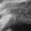
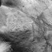
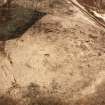
Woden Law fort (Canmore ID: 58068) was subjected to vertical photographic scan and 3D modelling; these picked out the ramparts very clearly, as well as some of the extensive cord-rig that covers the slopes immediately below the outermost ‘Roman’ earthworks on the east side.
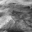
The Roman road, Dere Street was photographed where it crosses a narrow neck of ground south-east of the fort between Whitehope Cleuch and Twisehope Cleuch; the scan revealed its embankment over five earlier cross-ridge dykes (Canmore ID: 58075, 58105) and tell-tale quarry pits where the road to the south is terraced into the hillside. Part of a nearby palisaded homestead (Canmore ID: 58109) was also included in the survey.
Archive: NRHE (intended); 3D modelling at https://sketchfab.com/3d-models/wodens-law-hill-fort-3b241068ffe0463dad356942d5801711;
Funder: Private individuals
Tony Hunt and John Dent
(Source: DES Vol 20)
Sbc Note
Visibility: This is an upstanding earthwork or monument.
Information from Scottish Borders Council


