
Stanshiel Hill


Palisaded Settlement (Period Unassigned)
Site Name Stanshiel Hill
Classification Palisaded Settlement (Period Unassigned)
Canmore ID 58077
Site Number NT71SE 23
NGR NT 7805 1334
Datum OSGB36 - NGR
Permalink http://canmore.org.uk/site/58077


- Council Scottish Borders, The
- Parish Hownam
- Former Region Borders
- Former District Roxburgh
- Former County Roxburghshire
NT71SE 23 7805 1334.
(NT 7805 1334) Enclosure (NR)
OS 6"map, (1962).
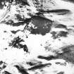
The summit of Stanshiel Hill is encircled by a trench which encloses an area 455' in length NNE-SSW by 175' in maximum breadth. The trench measures about 2' in width and presumably held a palisade. For much of its length it is partially or wholly obscured by the marshy vegetation; it is impossible to tell in which of the numerous gaps the original entrance lay. Although the interior is featureless, this may be due to the fact that the enclosure contained houses of a kind that leave no surface remains, rather than its having been merely for stock. Feachem suggests that palisaded works were being built in North Britain soon after 500 BC.
RCAHMS 1956; 1967; R W Feachem 1965; A Ritchie 1970.
As described above.
Visited by OS(WDJ) 8 September 1960.
No change to previous field report.
Visited by OS(DWR) 25 May 1973.
The trench of this palisaded enclosure is best preserved on the NNE and SSW where it is 0.8m wide and up to 0.3m deep. On the W it has been worn down to a terrace while on the E it is often indiscernible in hummocky grass.
Although there are no signs of habitation within, the size and situation of this enclosure suggest it was a settlement.
Visited by OS(BS) 1 September 1976.
Field Visit (6 October 1999)
NT71SE 23
Stanshiel Hill
Palisaded Settlement
NT 78047 13353
This palisaded settlement encloses the summit of Stanshiel Hill and measures 137m from N to S by 53m transversely. The palisade trench can be traced in an almost continuous oval around the summit. There are two gaps on the E side, one of which may represent an entrance. The interior is featureless.
Visited by RCAHMS (DCC) 6 October 1999
Note (9 September 2015 - 2 August 2016)
A palisade trench encircles the summit of Stanshiel Hill, which overlooks the Moat Knowe fort at Buchtrig from the SE. Oval on plan it measures 137m from N to S by 50m transversely (0.52ha) within a palisade trench that can be traced intermittently round the entire circuit. The palisade trench is a substantial feature and particularly along the steep W flank of the hill, is set down the slope in a manner that replicates the typical position of the outer faces of fort walls. It is thus best regarded as a timber rampart rather than simply a wooden fence, and would relatively easily have been provided with a raised walkway carried on spars bridging from uprights set in the trench back onto the slope. In the most recent survey by RCAHMS in 1999 two gaps were noted on the E, one of which may be the entrance, but no timber round-houses can be seen within the interior.
Information from An Atlas of Hillforts of Great Britain and Ireland – 02 August 2016. Atlas of Hillforts SC3410
Sbc Note
Visibility: This is an upstanding earthwork or monument.
Information from Scottish Borders Council

