
Pricing Change
New pricing for orders of material from this site will come into place shortly. Charges for supply of digital images, digitisation on demand, prints and licensing will be altered.
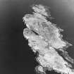
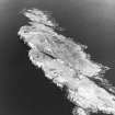
Isle Of May, Pilgrim's Well


Holy Well (Period Unassigned)
Site Name Isle Of May, Pilgrim's Well
Classification Holy Well (Period Unassigned)
Alternative Name(s) Pilgrim's Haven
Canmore ID 57877
Site Number NT69NE 5
NGR NT 6591 9888
Datum OSGB36 - NGR
Permalink http://canmore.org.uk/site/57877


- Council Fife
- Parish Anstruther Wester
- Former Region Fife
- Former District North East Fife
- Former County Fife
NT69NE 5 6591 9888
(NT 6591 9888) Well (NAT)
OS 6" map (1921)
The Pilgrim's Well is on a slope leading from Pilgrim's Haven, Isle of May. In the 14th and 15th century the May became a place of pilgrimage and the well was credited with miraculous virtues.
J Dickson 1899
This well measures 1.0m in diameter and is set into a SW-facing slope. It has a dry-stone retaining wall 3.0m in diameter around it with an approach gap in the SW.
Surveyed at 1/10 000.
Visited by OS (JM) 1 October 1975.

