Pricing Change
New pricing for orders of material from this site will come into place shortly. Charges for supply of digital images, digitisation on demand, prints and licensing will be altered.
Evelaw Tower
Tower House (16th Century)
Site Name Evelaw Tower
Classification Tower House (16th Century)
Canmore ID 57425
Site Number NT65SE 2
NGR NT 66116 52565
Datum OSGB36 - NGR
Permalink http://canmore.org.uk/site/57425
- Council Scottish Borders, The
- Parish Westruther
- Former Region Borders
- Former District Berwickshire
- Former County Berwickshire
NT65SE 2 66116 52565.
(NT 6611 5256) Evelaw Tower (NR) (Remains of)
OS 6" map, (1957).
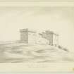
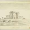
Evelaw Tower, a small, ruinous, 16th century fortalice, is still fairly entire to the wallhead. It is three storeys and a garret in height and L-shaped on plan. The angles are rounded, but corbelled out to the square at eaves-level. There are wide splayed gunloops in the S and E fronts. Farm buildings adjoin and abut to the N, screening that front and the re-entrant. The basement and, unusually, the top storey are vaulted.
N Tranter 1970; D MacGibbon and T Ross 1889.
When visited in 1955 and 1963, Evelaw Tower was in a similar condition to that described above.
Surveyed at 1/2500.
Visited by OS (JFC) 15 February 1955 and (WDJ) 7 November 1963.
The tower is generally as described although parts are in imminent danger of collapse.
Visited by OS (MJF) 11 May 1979.
Field Visit (6 October 1908)
283. Evelaw Tower.
Situated about 2 miles north-east of Westruther village is the ruinous keep of Evelaw Tower on an L plan, with only part of the outer walls standing. The main block measures 33 feet in length by 22 feet in width, and the wing, which is at the north-west angle, 14 feet 6 inches by 11 feet. The external angles are all rounded. See Cast. and Dom. Arch., iii. p. 546 (plan and illus.).
RCAHMS 1915, visited 6th October 1908.
OS Map: Ber., xv. SW.
Photographic Survey (May 1961)
Photographic survey of Evelaw Tower, Berwickshire, by the Scottish National Buildings Record in May 1961.
Sbc Note
Visibility: Upstanding building, which may not be intact.
Information from Scottish Borders Council


