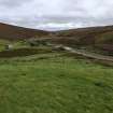
Kersons Cleugh
Farmstead (Medieval), Rig And Furrow (Period Unassigned), Bead (Glass)(Period Unassigned), Knife (Iron)(Period Unassigned), Loomweight(S) (Period Unassigned), Spindle Whorl(S) (Period Unassigned), Unidentified Pottery (Period Unassigned)
Site Name Kersons Cleugh
Classification Farmstead (Medieval), Rig And Furrow (Period Unassigned), Bead (Glass)(Period Unassigned), Knife (Iron)(Period Unassigned), Loomweight(S) (Period Unassigned), Spindle Whorl(S) (Period Unassigned), Unidentified Pottery (Period Unassigned)
Alternative Name(s) Byrecleugh; Dye Water
Canmore ID 57415
Site Number NT65NW 10
NGR NT 6114 5888
Datum OSGB36 - NGR
Permalink http://canmore.org.uk/site/57415
- Council Scottish Borders, The
- Parish Longformacus
- Former Region Borders
- Former District Berwickshire
- Former County Berwickshire
NT65NW 10 6114 5886.
Situated on either side of Kersons Cleugh at its junction with the Dye Water there are the remains of six closely-spaced rectangular or sub-rectangular buildings measuring up to 13m by 4m. A number of less clearly defined building-sites are also visible and immediately to the SE there is an area of rig-and-furrow cultivation.
RCAMS 1980, visited August 1979.
Excavation (23 February 2011 - 28 April 2011)
A programme of fieldwork was undertaken during the construction phase of Fallage Rig windfarm in the Lammermuir Hills. Previously identified sites were fenced off and a watching brief took place during the construction of access roads. No sites were discovered. At the confluence of Kersons Cleugh and the Dye Water, part of an NMRS settlement (NT65NW 10) was excavated. Two small rectangular buildings of similar overall size but different construction were shown to probably date to the Middle Saxon period. Pottery, loom weights, spindle whorls, a glass bead and an iron knife were recovered. Other curving walls, a trackway and a bank were recorded.
Information from Oasis (cfaarcha1-100676) 12 June 2013
Excavation (March 2011 - January 2013)
NT 6111 5885 A programme of archaeological work was carried out, March 2011 – January 2013, on an access road leading to Fallago Rig Wind Farm in the upper River Dye valley at the confluence with Kersons Cleugh. Two well defined small buildings were investigated and a third trench examined what may have been the remains of a third.
The first structure measured 5.6 x 3.1m internally. Most of the internal area was of beaten earth but that closest to the entrance and the NE-facing entrance passage itself was paved. The wall was poorly defined but consisted of an earth bank with a stone capping. The second structure measured 6 x 3.6m internally. The SE portion of the internal area was paved but there was no clear entrance. The wall was of dry stone construction with a deposit of orange silt banked against the external face. The third trench contained at least three walls and a ditch but they did not represent a third building. Finds included loom weights, spindle whorls, a glass bead and a sherd of pottery which suggest a 7th- to 9th-century date for the settlement. An assemblage of lithics may indicate an earlier presence on the site.
Several watching briefs took place during the period of construction work. Five possible fire pits and a possible track were the only archaeological features identified.
Archive: RCAHMS and Scottish Borders Council HER (intended)
Funder: Wind Prospect Ltd
Ian Suddaby, CFA Archaeology Ltd, 2013
(Source: DES)
Sbc Note
Visibility: This is an upstanding earthwork or monument.
Information from Scottish Borders Council


