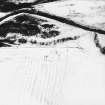
Dye Water
Farmstead (Post Medieval)
Site Name Dye Water
Classification Farmstead (Post Medieval)
Alternative Name(s) Fosterside Walls
Canmore ID 57406
Site Number NT65NE 23
NGR NT 67004 58227
NGR Description Centre
Datum OSGB36 - NGR
Permalink http://canmore.org.uk/site/57406
- Council Scottish Borders, The
- Parish Longformacus
- Former Region Borders
- Former District Berwickshire
- Former County Berwickshire
NT65NE 23 6699 5822
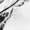
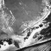
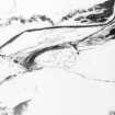
This farmstead named Fosterside Walls (site of) on OS 6"map, 1862, by which time it was abandoned, was probably built in the early 19th century. It comprises of the remains of three buildings ranged round a yard.
RCAHMS 1980, visited 1979
One unroofed building and an attached enclosure, both marked by pecked lines, are depicted on the 1st edition of the OS 6-inch map (Berwickshire 1862, sheet ix), but they are not shown on the current edition of the OS 1:10000 map (1982).
Information from RCAHMS (SAH) 14 September 2000
Note (20 December 2019)
The location, classification and period of this site have been reviewed.
Sbc Note
Visibility: Unknown. The state of preservation of this structure or monument is unknown.
Information from Scottish Borders Council.


