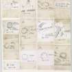
Knock Hill
Fort (Prehistoric), Rig And Furrow (Medieval) - (Post Medieval)
Site Name Knock Hill
Classification Fort (Prehistoric), Rig And Furrow (Medieval) - (Post Medieval)
Canmore ID 57389
Site Number NT64SW 8
NGR NT 6163 4411
Datum OSGB36 - NGR
Permalink http://canmore.org.uk/site/57389
- Council Scottish Borders, The
- Parish Gordon
- Former Region Borders
- Former District Berwickshire
- Former County Berwickshire
Knock Hill is a gently rising hill about 800m from Corsbie steading. Crowning the summit there are the remains of an oval-shaped earthwork. Traces of rig-and-furrow cultivation, possibly medieval or later in date, can be seen on the northern and north-western flanks of Knock Hill.
The summit of the hill is enclosed by two ramparts, and the earthworks are best preserved on the south-east and north-west. They appear to be further apart on the less defensive eastern approach. Both are composed of earth and stone, though the site has been extensively quarried in more recent times. Traces of at least five timber round-houses have been observed inside the fort.
Text prepared by RCAHMS as part of the Accessing Scotland's Past project
NT64SW 8 6163 4411.
(NT 6163 4411) Fort (NR)
OS 6" map, Berwickshire, 2nd ed.,(1909).
The summit of Knock Hill is occupied by an oval fort, measuring 420ft by 220ft within double ramparts, the stones of which have been almost all removed, though they are still traceable all round, except where quarried away at the W end, as low, broad mouds, breaks in which show rough built stones but no facing. The entrance is in the E. There are some questionable indications of chambers on each side of the entrance of the inner wall. There is no trace of a ditch. There are some faint and doubtful saucer-like depressions in the interior.
D Christison 1895.
The defences are much dilapidated; on the SW and S, one rampart only remains, but on the SE and round towards the NW, two are still visible. The summit is rocky, and any signs of foundations in the interior are very indefinite.
RCAHMS 1915, visited 1908.
Generally as described above. The ramparts have been reduced to terraces on the N and S.
Visited by OS (JD) 27 April 1955.
Resurveyed at 1:2500.
Visited by OS (EGC) 29 August 1963.
Fort. There is the site of at least one circular timber house within the interior.
RCAHMS 1980, visited 1979.
The remains of this fort are generally as previously described except that within the western half of the interior there are traces of at least five round-houses. Four are of ring-groove construction and the site of the fifth is marked by a simple platform set immediately behind the inner rampart.
The remains of rig-and-furrow cultivation are visible on the slopes to the N and NW respectively of the fort.
Visited by RCAHMS (JRS/RJCM) 30 September 1993.
Field Visit (10 August 1908)
166. Hill Fort, Knock Hill.
On the summit of Knock hill, at an elevation of about 890 feet above sea-level and 1000 yards north of Upper Huntlywood farm buildings, is a regular oval enclosure (fig. 87) with defences much dilapidated, especially on the south. On the south-west and south one rampart only remains, but on the south-east and round towards the north-west two are still visible. At the east end they seem to have been quarried out for stones. The interior measurement has been some 410 feet by 192 feet. The summit is rocky, and any signs of foundations in the interior are very indefinite.
See Antiquaries, xxix. p. 144.
RCAHMS 1915, visited 10th August 1908.
OS Map: Ber, xx. SE.
Note (26 January 2016 - 16 August 2016)
This fort, which encloses the summit of Knock Hill, is oval on plan and measures 114m from by 52m transversely (0.53ha) within two heavily robbed stone ramparts. The inner has been reduced to little more than a robber trench along which occasional outer-facing stones are visible, while the outer can be traced along the E, N and W flanks. Indeed, the fort is so heavily robbed that the position of the entrance cannot no longer be identified with any confidence. In 1979 RCAHMS investigators identified a shallow circular groove about 1.5m broad some 30m W of the OS triangulation station on the summit, but a subsequent visit in 1993 noted traces of at least four ring-grooves and a platform.
Information from An Atlas of Hillforts of Great Britain and Ireland – 16 August 2016. Atlas of Hillforts SC4038
Sbc Note
Visibility: This is an upstanding earthwork or monument.
Information from Scottish Borders Council


