
Gordon Castle, Bogle Plantation


Castle (Medieval)(Possible), Fort (Period Unassigned)
Site Name Gordon Castle, Bogle Plantation
Classification Castle (Medieval)(Possible), Fort (Period Unassigned)
Canmore ID 57387
Site Number NT64SW 6
NGR NT 6456 4375
Datum OSGB36 - NGR
Permalink http://canmore.org.uk/site/57387


- Council Scottish Borders, The
- Parish Gordon
- Former Region Borders
- Former District Berwickshire
- Former County Berwickshire
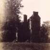
To the north of Gordon village, on a long ridge, is a site traditionally known as 'Gordon Castle', where the Gordon family who once owned the surrounding land had a residence.
In 1834, the minister for the parish, James Patterson, wrote in the New Statistical Account that it was still possible to trace a moat or ditch in an area known locally as 'The Castles'. No earthworks survive today, but aerial survey has revealed the cropmarks of what are probably a prehistoric fort.
Text prepared by RCAHMS as part of the Accessing Scotland's Past project
NT64SW 6 6456 4375.
(NT 6456 4375) Gordon Castle (NR) (Supposed Site of)
OS 6"map, Berwickshire, 2nd ed.,(1908).
A little to the N of the village of Gordon is an eminence pointed out as the spot on which the ancestors of the Duke of Gordon had their residence. A moat or ditch may still be traced, but is now covered with plantations.
New Statistical Account (NSA, J Paterson) 1845; RCAHMS 1915.
The reputed site of Gordon Castle. No trace of a moat which surrounded the site can be traced.
Name Book 1858.
This site is on a long, fairly high, ridge. The 'ditch', traceable on the E side of the site, in a plantation, is the ditch of an old tree bank. No remains of a castle are to be found.
Visited by OS(JD) 24 May 1955.
"I have always understood that the site of the Gordon castle (Recardus de Gordon, mentioned 1165, the estate remaining with the family till Sir James Seton succeeded in 1580 - see NT64SW 5) was in the field on the west side of the road just north of Gordon station. The fields on the other side of the road are called the castle parks."
M Lyal 1962
There are no visible remains at the supposed site of this castle.
RCAHMS 1980, visited 1979.
Gordon Castle is said to have been sited on a knoll which lies about 150m W of the now disused Gordon station. The earthworks referred to in earlier accounts, but of which there are now no surface remains, were probably those of an oval fort, whose W side is visible as cropmarks on aerial photographs.
Visited by RCAHMS (JRS/RJCM) 30 September 1993.
Aerial Photographic Transcription (5 December 1990 - 9 January 1991)
An aerial transcription was produced from oblique aerial photographs. Information from Historic Environment Scotland (BM) 31 March 2017.
Note (25 January 2016 - 18 May 2016)
What is probably a fort is situated on the knoll immediately N of the disused railway line on the W side of the bridge carrying the A6089 public road northwards out of the village of Gordon. Traces of the defences, which were traditionally held to be a seat of the 'ancestors of the Duke of Gordon' (NSA, ii, Berwickshire, 34), remained visible into 19th century, but their character has only been revealed more recently by cropmarks in the field to the W of what was formerly Bogle Plantation. These show two ditches forming the NW half of an oval enclosure measuring internally up to 120m from NNE to SSW by at least 35m transversely, and possibly as much as 50m on the basis of the projected circuit and the contours within the old plantation; making some allowance for an inner rampart the interior may have enclosed about 0.35ha. The ditches are most clearly defined at the SW end where the outer ditch turns sharply out to either side of the causeway and unites with a third ditch, which can be traced for a short distance to either side, apparently on a convergent line. There is no corresponding gap in the rather broader innermost ditch, but at this point any trace of its terminals are lost in a large, almost square, macula. An isolated linear mark outside the defences on the N does not seem to be part of the fort and may be no more than an old trackway climbing the slope and appearing intermittently across the field to the W. Several irregular maculae are visible within the interior but their precise character is uncertain. While the features of the entrance are unusual there is no compelling reason to identify them as castle works, and in any case the Gordon's may have reoccupied an earlier fortification.
Information from An Atlas of Hillforts of Great Britain and Ireland – 18 May 2016. Atlas of Hillforts SC4034
Sbc Note (21 March 2016)
Visibility: This was the site of an archaeological monument, which may no longer be visible.
Information from Scottish Borders Council
Previously also listed under duplicate site NT96SW 510 -CANCELLED. HES (LCK) 11.6.2024

