Pricing Change
New pricing for orders of material from this site will come into place shortly. Charges for supply of digital images, digitisation on demand, prints and licensing will be altered.
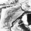
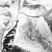
Broomhill Black Dyke
Track (Period Unassigned)
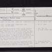
Site Name Broomhill Black Dyke
Classification Track (Period Unassigned)
Alternative Name(s) Black Dikes; Blackadder Water
Canmore ID 57301
Site Number NT64NE 6
NGR NT 6922 4797
NGR Description NT 6922 4797 to NT 6999 4669
Datum OSGB36 - NGR
Permalink http://canmore.org.uk/site/57301
- Council Scottish Borders, The
- Parish Greenlaw
- Former Region Borders
- Former District Berwickshire
- Former County Berwickshire
NT64NE 6 6922 4797 to 6999 4669.
(NT 6922 4797 - NT 6999 4669) Black Dyke (NAT) (Course of)
OS 6" map, (1957).
(NT 6922 4797 - NT 6999 4669) Black Dikes (NR)
(NT 6935 4792 - NT 6946 4823)
OS 6" map, Berwickshire, 2nd ed., (1909).
On the S side of the Blackadder Water, exactly opposite Blackcastle Rings (NT64NE 5) is the beginning of an entrenchment which runs about half a mile along the bank, and then turns off south in the direction of Hume Castle.
That part of it which runs in a southerly direction is called the Black Dikes. A number of gold and silver coins of Edward III (1327-77) were found about two years ago (i.e. 1832) when removing the turf for a quarry in the line of this trench. (See NT64NE 10)
NSA 1845.
Broomhill Black Dyke: This dyke has, especially in its northern half, more the appearance of a road of not very early date; there are no signs of a mound, and its windings are those of a road rather than of a Black Dyke.
The manner in which it descends to the Blackadder is also suggestive of a road, and it is also significant that the NSA (supra) states that the name Black Dikes was only given to that portion in Blackdikes and Crawlee Strips.
J H Craw 1928.
The OS surveyor noted a length of ditch with banks on each side in the plantation N of Crawlee - NT 6998 4660 to 6995 4647; and the OS 1st ed 6" of 1862 shows 'supposed site of' to the course of 'Black Dyke' in a field between NT 6971 4685 and 6993 4647.
Visited by OS 12 January 1955
At NT 6895 4797: Hollow way up to 5m wide an 1.7m deep (RD 1970).
Possible course of the dyke. (Craw 1928)
NT 6910 4795 to NT 6902 4757: No sign of a mound. This stretch appears to be more like a cart track, being a slight hollow in the ground (JD 1955; RD 1970).
NT 6902 4757 to NT 6938 4714: There is no trace of the dyke (JD 1955; RD 1970).
NT 6945 4824 to NT 6930 4805: Not a dyke. Shows as a track (JD 1955).
NT 6930 4805 to 6936 4795: This is not a dyke. It is a track, possibly sheep, which descends from the top of a steep slope to the river (JD 1955).
Visited by OS (JD) 1955; (RD) August 1970
Information from OS.
J H Craw 1928
The course of the dyke depicted on the OS 6" 1909 follows, for a greater part of its length, the top edge of a very steep (almost vertical in places) valley slope. It then runs along the top of a gently sloping ridge until it reaches a crossing point of Blackadder Water. This route indicates that it is almost certainly not a dyke but it is probably a track as suggested by Craw. There are no surveyable remains of this linear on the ground.
Visited by OS(MJF) 26 June 1979.
Sbc Note
Visibility: This is an upstanding earthwork or monument.
Information from Scottish Borders Council


