Nenthorn, Town Green
Settlement (Period Unassigned)
Site Name Nenthorn, Town Green
Classification Settlement (Period Unassigned)
Canmore ID 57158
Site Number NT63NE 6
NGR NT 682 374
Datum OSGB36 - NGR
Permalink http://canmore.org.uk/site/57158
- Council Scottish Borders, The
- Parish Nenthorn
- Former Region Borders
- Former District Roxburgh
- Former County Berwickshire
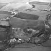
The village of Nenthorn is now much smaller than it was a few hundred years ago. While the western portion remains inhabited, the eastern part was abandoned at some date, perhaps prior to the agricultural improvements of the late eighteenth century. No traces of it are shown on the 1st edition of the Ordnance Survey 6-inch map of Berwickshire, which indicates that the houses had already been removed by the mid- to late nineteenth century.
The remains of the deserted village lie in fields on either side of the main road, the A6089. North of the road, a field known as Town Green was crossed by a track which once formed the village street. Nearby, traces of at least three buildings have been identified, along with a former mill dam and lade. There were also traces of an associated field-system, with each field defined by a low bank, and associated with well-preserved traces of rig-and-furrow cultivation.
South of the road, there are additional fields containing evidence of rig-and-furrow cultivation. These once formed the cultivated land associated with the predecessor of the farmstead named Burnbrae.
Text prepared by RCAHMS as part of the Accessing Scotland's Past project
Sbc Note
Visibility: This is an upstanding earthwork or monument.
Information from Scottish Borders Council


