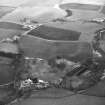
Nenthorn Old Church
Church (Medieval)
Site Name Nenthorn Old Church
Classification Church (Medieval)
Canmore ID 57155
Site Number NT63NE 4
NGR NT 6781 3686
Datum OSGB36 - NGR
Permalink http://canmore.org.uk/site/57155
- Council Scottish Borders, The
- Parish Nenthorn
- Former Region Borders
- Former District Roxburgh
- Former County Berwickshire
Historical sources suggest that there was a church at Naithansthirn, now Nenthorn, in the late twelfth century. In 1316, the church was granted to the monks of Kelso, who possessed it until the Reformation.
Alhough the graveyard is still shown on the current edition of the Ordnance Survey I:10000 map, little trace of the church building survives, though the ruined footings of a later burial vault are visible.
Nenthorn may have been one of the many ecclesiastical sites to suffer as a result of hostile relations between the Scots and the English in medieval and early modern times. Documents refer to the burning of 'Nenthorn Spittal' in 1542; since there was no medieval hospital at Nenthorn, it is possible that this mistakenly refers to the nearby hospital at Smailholm. However, it could indicate that the monastic settlement at Nenthorn also suffered at the hands of invading English soldiers.
Text prepared by RCAHMS as part of the Accessing Scotland's Past project
NT63NE 4.00 6781 3686
NT63NE 4.01 NT 678 368 Midden
NT63NE 4.02 Centred NT 67826 36866 Churchyard
(NT 6781 3686) Chapel (NR) (Site of).
OS 6"map, Roxburghshire, 2nd ed.,(1909).
The church of Naithansthirn, now Nentorn, existed in the latter part of the 12th century, and in 1316 came into the possession of the monks of Kelso, who retained it until the Reformation. The foundations of the church are traceable in the centre of the churchyard.
J Robson 1896; J Ferguson 1892; G Chalmers 1810.
Portions of the south and east walls, both about 4.0m long and 0.3m high, are all that now remains of the church. The churchyard is now disused, and completely overgrown.
Visited by OS(JD) 26 May 1955.
The outline of the church cannot be determined with certainty, while the remains described by OS surveyor (JD) have more the appearance of a latter burial enclosure or vault.
Visited by OS(RDL) 15 November 1963.
Sbc Note (21 March 2016)
Visibility: This was the site of an archaeological monument, which may no longer be visible.
Information from Scottish Borders Council
Previously also listed under duplicate site NT96SW 510 -CANCELLED. HES (LCK) 11.6.2024


