
Pricing Change
New pricing for orders of material from this site will come into place shortly. Charges for supply of digital images, digitisation on demand, prints and licensing will be altered.
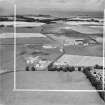
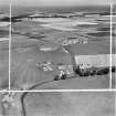
Chapel's Wass, Dairy Cottages


Cairn (Bronze Age), Cist(S) (Bronze Age)
Site Name Chapel's Wass, Dairy Cottages
Classification Cairn (Bronze Age), Cist(S) (Bronze Age)
Canmore ID 56743
Site Number NT58SW 14
NGR NT 5124 8215
Datum OSGB36 - NGR
Permalink http://canmore.org.uk/site/56743


- Council East Lothian
- Parish Dirleton
- Former Region Lothian
- Former District East Lothian
- Former County East Lothian
NT58SW 14 5124 8215.
(NT 5124 8215) Cairn (NR) (site of)
OS 6" map (1968)
A well-preserved tumulus was removed from this spot in 1852, revealing a number of crude 'stone coffins' containing human bones which were then scattered over the surrounding field, and are still to be seen mixed with earth around them. There were several other tumuli in this locality, but no vestige of them remains.
Name Book 1853
There is no evidence of any cairns in this area.
Visited by OS (JP) 8 July 1975
Numerous tumuli have been found near the Chapel's Waas, at the cross roads (at NT 512 821). "These were generally formed of two pieces of pavement, one on each side, the same number above and beneath, with one at each end. bones imbedded in black earth were frequently found in these graves, which were almost all of short dimensions, being about 3ft long."
NSA 1845 (J Ainslie)

