|
Photographs and Off-line Digital Images |
A 40491 |
RCAHMS Aerial Photography |
Aerial view of land to W of castle. |
1985 |
Item Level |
|
|
Photographs and Off-line Digital Images |
A 40492 |
RCAHMS Aerial Photography |
Aerial view. |
1985 |
Item Level |
|
|
Photographs and Off-line Digital Images |
EL 6270 |
List C Survey |
General view. |
1975 |
Item Level |
|
|
Photographs and Off-line Digital Images |
EL 1185 |
Photographs by H D Wyllie, photographer, Edinburgh, Scotland |
General view. |
1961 |
Item Level |
|
|
Photographs and Off-line Digital Images |
EL 1815 |
Brian C Clayton |
General view. |
c. 1928 |
Item Level |
|
|
Photographs and Off-line Digital Images |
B 54286 CS |
|
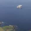
General view with Bass Rock in distance. |
6/1976 |
Item Level |
|
|
Photographs and Off-line Digital Images |
EL 172 |
|
General view. |
1924 |
Item Level |
|
|
Photographs and Off-line Digital Images |
A 46725 |
Historic Buildings and Monuments/Scottish Development Department photographs |
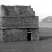
View from W with dovecot in foreground. |
13/9/1955 |
Item Level |
|
|
Photographs and Off-line Digital Images |
A 49668 |
Historic Buildings and Monuments/Scottish Development Department photographs |
View of fore-tower and dovecot from SW. |
7/1924 |
Item Level |
|
 |
On-line Digital Images |
SC 833230 |
Photographs by H D Wyllie, photographer, Edinburgh, Scotland |
General view. |
1961 |
Item Level |
|
|
Photographs and Off-line Digital Images |
E 52173 |
RCAHMS Aerial Photography |
Oblique aerial view centred on the excavation of the chapel and cemetery with the remains of the castle, dovecot and laird¿s house adjacent, taken from the SE. |
7/6/2005 |
Item Level |
|
|
Photographs and Off-line Digital Images |
E 52174 |
RCAHMS Aerial Photography |
Oblique aerial view centred on the excavation of the chapel and cemetery and the remains of the castle and dovecot with the scientific research establishment, farmsteading and remains of the laird¿s house adjacent, taken from the ESE. |
7/6/2005 |
Item Level |
|
|
Photographs and Off-line Digital Images |
E 62796 CN |
RCAHMS Aerial Photography |
Oblique aerial view centred on the excavation of the chapel and cemetery and the remains of the castle and dovecot with the scientific research establishment, farmsteading and remains of the laird¿s house adjacent, taken from the ESE. |
7/6/2005 |
Item Level |
|
|
Photographs and Off-line Digital Images |
E 62797 CN |
RCAHMS Aerial Photography |
Oblique aerial view centred on the excavation of the chapel and cemetery and the remains of the castle and dovecot with the scientific research establishment, farmsteading and remains of the laird¿s house adjacent, taken from the ESE. |
7/6/2005 |
Item Level |
|
|
Print Room |
PA 229/2/30/1 |
G A G Peterkin |
View from S of the doocot at Tantallon Castle. |
8/1962 |
Item Level |
|
|
Print Room |
PA 229/2/30/2 |
G A G Peterkin |
View from SW of the doocot at Tantallon Castle. |
25/4/1983 |
Item Level |
|
|
Print Room |
PA 229/2/30/3 |
G A G Peterkin |
View from SSW of the doocot at Tantallon Castle showing the Bass Rock. |
6/1986 |
Item Level |
|
 |
On-line Digital Images |
DP 020075 |
RCAHMS Aerial Photography Digital |
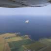
General oblique aerial view centred on the remains of the castle and dovecot with the farmhouses and farmsteadings adjacent and Bass Rock in the distance, taken from the S. |
25/7/2006 |
Item Level |
|
 |
On-line Digital Images |
DP 020076 |
RCAHMS Aerial Photography Digital |
General oblique aerial view centred on the remains of the castle and dovecot with Bass Rock in the distance, taken from the SSE. |
25/7/2006 |
Item Level |
|
|
Print Room |
PA 229/13/157 |
G A G Peterkin |
Historic photograph of the doocot at Tantallon from the SSW.
|
c. 1920 |
Item Level |
|
|
Print Room |
PA 229/13/158/1 |
G A G Peterkin |
View from the SSW of the doocot at Tantallon.
|
19/11/1938 |
Item Level |
|
|
Print Room |
PA 229/13/158/2 |
G A G Peterkin |
View from the SSW of the doocot at Tantallon.
|
19/11/1938 |
Item Level |
|
|
Print Room |
PA 229/13/158/3 |
G A G Peterkin |
View from the SE of the doocot at Tantallon.
|
19/11/1938 |
Item Level |
|
|
Print Room |
PA 229/13/159 |
G A G Peterkin |
View from the NW of the doocot at Tantallon with a figure (J B D) standing at the entrance.
|
19/11/1938 |
Item Level |
|