Accessibility

Font Size

100% 150% 200%

Background Colour

Default Contrast
Close Reset

Haddington, Whittinghame Drive, Gimmers Mill

Grain Mill(S) (19th Century), Watermill (19th Century)

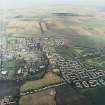
Site Name Haddington, Whittinghame Drive, Gimmers Mill

Classification Grain Mill(S) (19th Century), Watermill (19th Century)

Alternative Name(s) Bermaline Mills; Gimmersmill House; River Tyne

Canmore ID 56575

Site Number NT57SW 80

NGR NT 51860 74017

NGR Description Centred NT 51860 74017

Datum OSGB36 - NGR

Permalink http://canmore.org.uk/site/56575

Ordnance Survey licence number AC0000807262. All rights reserved.
Canmore Disclaimer. © Bluesky International Limited 2025. Public Sector Viewing Terms

Toggle Aerial | View on large map

Digital Images

Haddington, Whittinghame Drive, Bermaline Mills
View from S showing part of weir with mills in background
Haddington, Whittinghame Drive, Bermaline Mills
View from S showing part of weir with mills in backgroundOblique aerial view.View Gimmers Mill from W.Oblique aerial view centred on the mills, taken from the WSW.Oblique aerial view.Oblique aerial view.Haddington, Whittinghame Drive, Bermaline Mills
View from SSW showing part of weir with mills in backgroundOblique aerial view centred on the mills, taken from the SW.Oblique aerial view centred on the mills, taken from the SSW.Oblique aerial view.Oblique aerial view.View of W end of Gimmers Mill from NE (part of the Bermaline complex), including two kilns.View Gimmers Mill from W.Oblique aerial view.Oblique aerial view centred on the mills, taken from the S.Oblique aerial view.Oblique aerial view.Haddington, Whittinghame Drive, Gimmers Mill, NT57SW 80, Ordnance Survey index card, RectoView of E end of Gimmers Mill from NW (part of the Bermaline complex).General view of of Gimmers Mill from NW (part of the Bermaline complex).View from W of Gimmers Mill house and associated range of outbuildings.Haddington, Whittinghame Drive, Bermaline Mills, Sluice
General ViewOblique aerial view centred on the mills, taken from the E.Oblique aerial view centred on the mills, taken from the E.Oblique aerial view centred on the mills, taken from the SSE.General view of Gimmer's Mill (Bermaline), Haddington.Oblique aerial view.Oblique aerial view.General oblique aerial view of Haddington centred on the church, grain mills, maltings and bridges with golf course adjacent, taken from the SSE.View of W end of Gimmers Mill from NE (part of the Bermaline complex), including two kilns.View from SE of Gimmers Mill house and associated range of outbuildings.General view of Gimmers Mill from SSW, with weir in foreground.View looking NNW showing part of weir with mills in backgroundOblique aerial view centred on the mills, taken from the WNW.View from SSE of W end of Gimmers Mill.General view of Gimmers Mill from SSW, with weir in foreground.Oblique aerial view centred on the mills, taken from the NNE.Oblique aerial view.Oblique aerial view.View of Gimmers Mill from NNW, with two kilns (right) and two arches over the tailrace.

Administrative Areas

  • Council East Lothian
  • Parish Haddington
  • Former Region Lothian
  • Former District East Lothian
  • Former County East Lothian

Archaeology Notes

NT57SW 80.00 centred NT 51860 74017

Location formerly cited as NT 518 740.

Bermaline Mills [NAT]

OS 1:2500 map, 1969.

NT57SW 80.01 NT 51860 74017 maltings ('Bermaline Maltings')

NT57SW 80.02 NT 51804 73958 weir and sluices

NT57SW 80.03 NT 51782 74166 mill-lade and tail-race ('Mill Stream')

NT57SW 80.04 NT 51815 74024 Gimmersmill House

(Location cited as NS 518 740). Gimmers' Mills, founded 1408, taken over 1897 by John Montgomery. A most attractive 4-storey and attic, 7-bay rubble building, with a pyramidal-roofed kiln, both pantiled, with a modern extension. Associated with the mills is an early 20th century, 5-storey, 4- by 10-bay coursed rubble block of maltings (NT57SW 80.01) with a pyramidal-roofed kiln. Produces malt flour for baking.

J R Hume 1976.

Gimmers Mill is now part of the Bermaline Mill complex.

Information from RCAHMS (MKO), October 1995

Activities

Photographic Survey (1953)

Photographs of buildings in Haddington, East Lothian, by the National Buildings Record Scottish Council in 1953.

References

MyCanmore Image Contributions


Contribute an Image

MyCanmore Text Contributions