|
Photographs and Off-line Digital Images |
EL 3631 |
RCAHMS Aerial Photography |
Oblique aerial view. |
1977 |
Item Level |
|
|
Photographs and Off-line Digital Images |
EL 3632 |
RCAHMS Aerial Photography |
Oblique aerial view. |
1977 |
Item Level |
|
|
Photographs and Off-line Digital Images |
EL 3633 |
RCAHMS Aerial Photography |
Oblique aerial view. |
1977 |
Item Level |
|
|
Digital Files (Non-image) |
GP 000286 |
Traprain Law Environs Project |
Geophysical study raw data. |
2004 |
Item Level |
|
|
Photographs and Off-line Digital Images |
E 36871 |
RCAHMS Aerial Photography |
Oblique aerial view centred on the cropmarks of the settlement, taken from the NNE. |
22/7/2003 |
Item Level |
|
|
Photographs and Off-line Digital Images |
E 36872 |
RCAHMS Aerial Photography |
Oblique aerial view centred on the cropmarks of the settlement, taken from the NNW. |
22/7/2003 |
Item Level |
|
|
Photographs and Off-line Digital Images |
E 36873 |
RCAHMS Aerial Photography |
Oblique aerial view centred on the cropmarks of the settlement, taken from the WNW. |
22/7/2003 |
Item Level |
|
|
Manuscripts |
MS 7208 |
Traprain Law Environs Project |
Report: 'Traprain Law Environs Project, East Lothian, Scotland. Phase 1: geophysical survey interim report'. |
2002 |
Item Level |
|
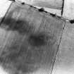 |
On-line Digital Images |
SC 1745850 |
RCAHMS Aerial Photography |
Oblique aerial view. |
1977 |
Item Level |
|
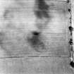 |
On-line Digital Images |
SC 1745851 |
RCAHMS Aerial Photography |
Oblique aerial view. |
1977 |
Item Level |
|
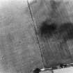 |
On-line Digital Images |
SC 1745852 |
RCAHMS Aerial Photography |
Oblique aerial view. |
1977 |
Item Level |
|
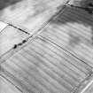 |
On-line Digital Images |
SC 1745897 |
RCAHMS Aerial Photography |
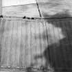
Oblique aerial view centred on the cropmarks of the settlement, taken from the NNE. |
22/7/2003 |
Item Level |
|
 |
On-line Digital Images |
SC 1745898 |
RCAHMS Aerial Photography |
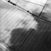
Oblique aerial view centred on the cropmarks of the settlement, taken from the NNW. |
22/7/2003 |
Item Level |
|
 |
On-line Digital Images |
SC 1745899 |
RCAHMS Aerial Photography |
Oblique aerial view centred on the cropmarks of the settlement, taken from the WNW. |
22/7/2003 |
Item Level |
|
 |
Digital Files (Non-image) |
WP 006859 |
Traprain Law Environs Project |
Report: 'Traprain Law Environs Project, East Lothian, Scotland, Phase 1: Geophysical Survey Interim Report', March 2002 |
1/2002 |
Item Level |
|
 |
Digital Files (Non-image) |
WP 006861 |
Traprain Law Environs Project |
Two reports: 'Geophysical Survey on Enclosure Cropmarks in the Environs of Traprain Law, East Lothian - Part 2'; and 'Excavations at Whittingehame, East Lothian 2002' |
2003 |
Item Level |
|
|
Digital Files (Non-image) |
WP 006869 |
Traprain Law Environs Project |
Abstract: 'Geomagnetic surveys over cropmarks in the environs of Traprain Law, East Lothian' |
8/2003 |
Item Level |
|
|
Digital Files (Non-image) |
WP 006870 |
Traprain Law Environs Project |
Report: 'Geomagnetic surveys over cropmarks in the environs of Traprain Law, East Lothian' |
8/2003 |
Item Level |
|
|
Digital Files (Non-image) |
WP 006873 |
Traprain Law Environs Project |
Report: 'Geophysical surveys for the Traprain Law Environs Project' |
c. 3/2007 |
Item Level |
|
 |
On-line Digital Images |
DP 330909 |
Traprain Law Environs Project |
Zipped folder containing figures relating to report 'Geophysical surveys for the Traprain Law Environs Project' |
c. 3/2007 |
Item Level |
|
 |
On-line Digital Images |
SC 2451127 |
Records of the Ordnance Survey, Southampton, Hampshire, England |
Northrig, NT57SE 50, Ordnance Survey index card, Recto |
c. 1958 |
Item Level |
|
|
All Other |
551 76/5/11 |
Traprain Law Environs Project |
Figures from report: 'Geophysical surveys for the Traprain Law Environs Project' |
c. 3/2007 |
Batch Level |
|
|
All Other |
551 76/3 |
Traprain Law Environs Project |
Geophysical study raw data, Traprain Law Environs Project |
2004 |
Sub-Group Level |
|
|
All Other |
551 76/4 |
Traprain Law Environs Project |
Reports from archaeological work undertaken as part of the Traprain Law Environs Project |
3/2001 |
Sub-Group Level |
|


