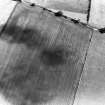
 |
On-line Digital Images |
SC 1745850 |
RCAHMS Aerial Photography |
Oblique aerial view. |
1977 |
Item Level |
|
 |
On-line Digital Images |
SC 1745851 |
RCAHMS Aerial Photography |
Oblique aerial view. |
1977 |
Item Level |
|
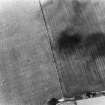 |
On-line Digital Images |
SC 1745852 |
RCAHMS Aerial Photography |
Oblique aerial view. |
1977 |
Item Level |
|
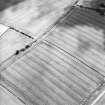 |
On-line Digital Images |
SC 1745897 |
RCAHMS Aerial Photography |
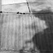
Oblique aerial view centred on the cropmarks of the settlement, taken from the NNE. |
22/7/2003 |
Item Level |
|
 |
On-line Digital Images |
SC 1745898 |
RCAHMS Aerial Photography |
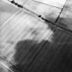
Oblique aerial view centred on the cropmarks of the settlement, taken from the NNW. |
22/7/2003 |
Item Level |
|
 |
On-line Digital Images |
SC 1745899 |
RCAHMS Aerial Photography |
Oblique aerial view centred on the cropmarks of the settlement, taken from the WNW. |
22/7/2003 |
Item Level |
|
 |
On-line Digital Images |
DP 330909 |
Traprain Law Environs Project |
Zipped folder containing figures relating to report 'Geophysical surveys for the Traprain Law Environs Project' |
c. 3/2007 |
Item Level |
|
 |
On-line Digital Images |
SC 2451127 |
Records of the Ordnance Survey, Southampton, Hampshire, England |
Northrig, NT57SE 50, Ordnance Survey index card, Recto |
c. 1958 |
Item Level |
|