Huntington
Barrow (Prehistoric)
Site Name Huntington
Classification Barrow (Prehistoric)
Canmore ID 55882
Site Number NT54NW 53
NGR NT 5334 4968
Datum OSGB36 - NGR
Permalink http://canmore.org.uk/site/55882
- Council Scottish Borders, The
- Parish Lauder
- Former Region Borders
- Former District Ettrick And Lauderdale
- Former County Berwickshire
NT54NW 53 5338 4970.
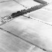
Aerial photography has recorded the cropmarks of a circular enclosure, about 16m in diameter, 190m WSW of Huntington farmsteading. A centrally placed pit could be interpreted as a burial, suggesting that the enclosure is a barrow. Cropmarks of a settlement (NT54NW 50) have been recorded 20m to the WSW, and a linear cropmark (NT54NW 76) passes through the NE corner of the same field.
Information from RCAHMS (KB) 21 June 1999
Sbc Note
Visibility: This site is visible as a cropmark.
Information from Scottish Borders Council


