
Following the launch of trove.scot in February 2025 we are now planning the retiral of some of our webservices. Canmore will be switched off on 24th June 2025. Information about the closure can be found on the HES website: Retiral of HES web services | Historic Environment Scotland
Darnick, Skirmish Field


Battle Site (16th Century)
Site Name Darnick, Skirmish Field
Classification Battle Site (16th Century)
Alternative Name(s) Darnick
Canmore ID 55734
Site Number NT53SW 27
NGR NT 533 346
Datum OSGB36 - NGR
Permalink http://canmore.org.uk/site/55734


- Council Scottish Borders, The
- Parish Melrose
- Former Region Borders
- Former District Ettrick And Lauderdale
- Former County Roxburghshire
NT53SW 27 533 346.
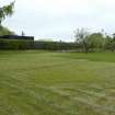
Skirmish Hill (Name: NT 5330 3465 on O S 25" 1859) derives its name from an engagement which took place here on the 18th July 1526, by the Scotts, Kerrs and Elliots, endeavouring to intercept King James V, then under the guardianship of the Douglasses.
Name Book 1859; A Milne 1743
A battle between the Earl of Angus and Scott of Buccleuch took place on 25th July 1526; Buccleuch was compelled to retire. The conflict is said to have taken place on Skirmish Hill, near Darnick, and several places in the neighbourhood including Charge Law and Turn-again are said to be named from it. The struggle was to gain possession of James V.
G Douglas 1899
Charge Law Plantation is at NT 54 330. No further information.
Visited by OS (WDJ) 10 February 1961
Metal Detector Survey (October 2015 - March 2016)
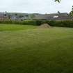
A metal decting survey was carried out by AOC Archaeolgy Ltd. in a field south of Broomilees Road, Darnick between October, 2015 and March, 2016. This was on the projected line of the retreat by Scott's forces at the Battle of Darnick. The field was heavily contaminated by modern detritus, and no finds relating to the battle were discovered.
Metal Detector Survey (1 June 2016)
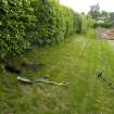
NT 531 342 A metal detector survey was undertaken, 1 June 2016, on land N of Lye Road, Darnick, in advance of development work. The work recovered no finds and this may be due in part to extensive landscaping undertaken in the creation of the cottages and gardens along the Lye Road.
Archive: NRHE (intended)
Funder: Mr P Burns
Steven Watt – AOC Archaeology Group
(Source: DES, Volume 17)

