Accessibility

Font Size

100% 150% 200%

Background Colour

Default Contrast
Close Reset

Newstead

Rectilinear Enclosure (Roman)

Site Name Newstead

Classification Rectilinear Enclosure (Roman)

Canmore ID 55710

Site Number NT53SE 96

NGR NT 56759 33619

Datum OSGB36 - NGR

Permalink http://canmore.org.uk/site/55710

Ordnance Survey licence number AC0000807262. All rights reserved.
Canmore Disclaimer. © Bluesky International Limited 2025. Public Sector Viewing Terms

Toggle Aerial | View on large map

Digital Images

Newstead, Roman fort and temporary camps: air photograph showing enclosure (NT 567 336) and 40--acre temporary camp (NT 570 337).
Newstead, Roman forts and temporary camps: RCAHMS air photograph showing enclosure (NT 5691 3369), rectlinear enclosure (NT 5675 3361) and 40-acre temporary camp (NT 570 337)Oblique aerial view centred on the cropmarks of the Roman temporary camp with the rectilinear enclosure adjacent, taken from the SSW.Newstead, NT53SE 96, Ordnance Survey index card, page number 1, RectoNewstead, NT53SE 96, Ordnance Survey index card, page number 3, RectoOblique aerial view.Oblique aerial view.Oblique aerial view centred on the cropmarks of the Roman temporary camp with the rectilinear enclosure adjacent, taken from the ESE.Oblique aerial view.Oblique aerial view centred on the cropmarks of the Roman temporary camp with the rectilinear enclosure adjacent, taken from the SW.Newstead, Roman fort and temporary camps: air photograph showing enclosure (NT 567 336), and 40- and 160-acre temporary camps (NT 570 337 and NT 570 344 respectively).
Oblique aerial view centred on the cropmarks of the Roman temporary camp with the rectilinear enclosure adjacent, taken from the NW.Oblique aerial view.Oblique aerial view of Newstead centred on the cropmarks of a Roman temporary camp with enclosures and linear feature adjacent, taken from the NE.Newstead, NT53SE 96, Ordnance Survey index card, page number 2, RectoNewstead, Roman forts and temporary camps: RCAHMS air photograph showing enclosure (NT 5691 3369), rectilinear enclosure (NT 5675 3361) and 40-acre temporary camp (NT 570 337)

Administrative Areas

  • Council Scottish Borders, The
  • Parish Melrose
  • Former Region Borders
  • Former District Ettrick And Lauderdale
  • Former County Roxburghshire

Archaeology Notes

NT53SE 96 NT 56759 33619

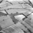
This rectlinear enclosure was incorrectly depicted as a Roman Fortlet on a recent edition of the Ordnance Survey 1:10000 map published in 1992.

Information from RCAHMS (RHJ) 26th April 2001

Activities

Sbc Note (21 March 2016)

Visibility: This was the site of an archaeological monument, which may no longer be visible.

Information from Scottish Borders Council

Previously also listed under duplicate site NT96SW 510 -CANCELLED. HES (LCK) 11.6.2024

References

MyCanmore Image Contributions


Contribute an Image

MyCanmore Text Contributions