|
Photographs and Off-line Digital Images |
RX 2996 PO |
Cambridge University Collection for Aerial Photography |
Oblique aerial view |
1980 |
Item Level |
|
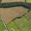 |
On-line Digital Images |
DP 080865 |
RCAHMS Aerial Photography Digital |
Oblique aerial view of the cropmarks of the field boundary, taken from the NW. |
28/8/2009 |
Item Level |
|
 |
On-line Digital Images |
DP 080866 |
RCAHMS Aerial Photography Digital |
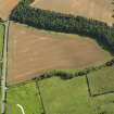
Oblique aerial view of the cropmarks of the field boundary, taken from the WNW. |
28/8/2009 |
Item Level |
|
 |
On-line Digital Images |
DP 080867 |
RCAHMS Aerial Photography Digital |
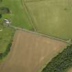
Oblique aerial view of the cropmarks of the field boundary, taken from the SSW. |
28/8/2009 |
Item Level |
|
 |
On-line Digital Images |
DP 080869 |
RCAHMS Aerial Photography Digital |
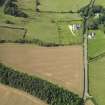
Oblique aerial view of the cropmarks of the field boundary, taken from the ESE. |
28/8/2009 |
Item Level |
|
|
Photographs and Off-line Digital Images |
SC 1930139 |
Cambridge University Collection for Aerial Photography |
Oblique aerial view |
1980 |
Item Level |
|
 |
On-line Digital Images |
SC 2449826 |
Records of the Ordnance Survey, Southampton, Hampshire, England |
Eildontree Plantation, NT53SE 78, Ordnance Survey index card, Recto |
c. 1958 |
Item Level |
|


