Pricing Change
New pricing for orders of material from this site will come into place shortly. Charges for supply of digital images, digitisation on demand, prints and licensing will be altered.
Hillslap
Cultivation Remains (Period Unassigned), Farmstead (Period Unassigned)
Site Name Hillslap
Classification Cultivation Remains (Period Unassigned), Farmstead (Period Unassigned)
Canmore ID 55604
Site Number NT53NW 8
NGR NT 5120 3942
Datum OSGB36 - NGR
Permalink http://canmore.org.uk/site/55604
- Council Scottish Borders, The
- Parish Melrose
- Former Region Borders
- Former District Ettrick And Lauderdale
- Former County Roxburghshire
NT53NW 8 5120 3942
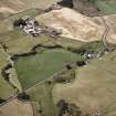
The remains of early modern farm buildings are suggested by a series of low earthen mounds in a field located immediately to the west of Hillslap and Colmslie Towers (NT53NW 4 and NT53NW 5 ) and belonging to adjacent Buckholm farm.
Freer deduces this from a grant by Richard de Morville, of which neither its source nor date is given, whereby Melrose Abbey was given permission to have a place holding sixty cows and also a dairy house within the enclosures existing previous to this grant at Buckholm on the west side of the Alvent or Allen. Freer says this is the only field on Buckholm farm that fits the description (but was it the only field at the time of the grant?); additionally he says that there are traces of rectangular cottages, on the south side of the larger enclosures.
J Freer 1892
Centred at NT 5120 3942 are the remains of a possible early modern farmstead. Only one house was found; it measures 22.0m by 5.0m formed by a turf-covered stone wall now spread to 2.6m wide and is 0.8m high on the inside; it is divided into 4 compartments. A number of enclosing banks surround it with average width of 3.3m and height of from 0.4 to 0.6m. Rig and furrow occupies the field to the south but does not extend into the farmstead area.
Although not quite agreeing with Freer's description, no other near parallel remains were found in the area.
Visited by OS (WDJ) 25 January 1961
One enclosure is depicted on the 1st edition of the OS 6-inch map (Roxburghshire 1854-62-3, sheet iii). One unroofed building is shown on the current edition of the OS 1:10000 map (1983).
Information from RCAHMS (SAH) 13 July 2000
Sbc Note
Visibility: This is an upstanding earthwork or monument.
Information from Scottish Borders Council


