
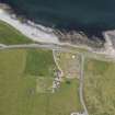
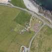
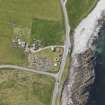
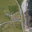
Sumburgh Airport


Broch (Iron Age), Settlement (Period Unassigned)
Site Name Sumburgh Airport
Classification Broch (Iron Age), Settlement (Period Unassigned)
Alternative Name(s) The Cletts; Betty Mowat's Croft; Old Scatness
Canmore ID 556
Site Number HU31SE 21
NGR HU 3898 1065
Datum OSGB36 - NGR
Permalink http://canmore.org.uk/site/556


- Council Shetland Islands
- Parish Dunrossness
- Former Region Shetland Islands Area
- Former District Shetland
- Former County Shetland
HU31SE 21 3898 1065.
See also:
HU31SE 21.01 Stone: Incised
HU31SE 21.02 Stone: Symbol Incised
HU 3898 1065. During the construction of a perimeter road at Sumburgh Airport, the N arc of a broch was exposed in the edge of a green mound about 3.5m high. The N sector of the broch was partially excavated and though no excavation was in progress at the time of survey revision, Department of Environment staff at the airport verified the classification as a broch.
Surveyed at 1:2500.
Visited by OS (JL) 1 October 1976
(HU 389 106) Excavations at Scatness commenced in 1995, following geophysical and topographic survey (Dockrill, Turner and Wackenhut 1995). A central aspect of the project is the archaeological investigation of both the prehistoric and post-medieval economies of the area, with the documentary and archaeological evidence in the historic period being used to throw light on the purely archaeological data of earlier periods.
Excavation continued in the three main areas (B, C, D) opened in 1995. In addition, two other small areas were excavated (F, G) to locate the 19th-century crofthouse associated with the corn drier and kailyard, and to investigate the buried soil on the periphery of the mound. Other test pits for soil samples were excavated at intervals in the fields surrounding the site.
The crofting-period barn with the remains of the flue in area C proved to be built upon an area of fish-rich midden which also contained quantities of 17th-century pottery. The few coins found last year date to this period, as do the coins from this season. The midden sealed rubble and earlier much-robbed areas of paving and wall, which in turn sealed midden tips, surrounding the broch wall.
In Area B, remaining evidence of 19th-century activity was removed, including empty sand-filled pits interpreted as potato storage pits. These pits had cut into the ash midden surrounding the broch, and in several places had actually cut into, or exposed, prehistoric walling and other features.
The ash midden layers surrounding the broch appear to have accumulated after the primary use of the tower, and the first stone-robbing activity. Into this midden was dug a Late Iron Age multi-cellular building with single-skinned walls and a blocked doorway into the northernmost cell, indicating at least two phases of use. Finds from the abandonment phase of this building include a steatite line sinker (similar to a piece from Viking-period Jarlshof, and an example from Rogaland, Norway), a pumice fishing float, spindle whorls and many potsherds, including substantial parts of at least three pots. Part of a large, shallow rectangular steatite vessel was found behind the single-skinned wall.
In the S part of area B, further investigation of the post-broch deposits has revealed a wheelhouse with six radials bonded into the wall and evidence for several phases of flooring; a fragment of rotary quern formed part of the latest level of paving. A length of double-faced walling leading away from the wheelhouse and splaying out towards the broch wall suggests that this building may have been part of a larger construction.
The broch wall, some 3m in thickness, is now visible in both areas B and C, giving an estimated diameter of 18m to the broch at this point, though the batter on the wall suggests that its basal diameter will be greater. No features are yet visible in the wall thickness, though the rubble-filled interior of the broch is revealing traces of walling. Excavation next season should reveal the nature of these features. The exterior of the broch is still surrounded by layers of midden and tumble/robbing from the broch wall, which is at present revealed to a height of c 1m; further excavation of the exterior features will also take place next season, and walling downslope to the W of the broch, associated with the midden layers, will be investigated more fully.
In area D, the buried soils which were recognised last season, overlying a series of ard marks in pure sand, were more fully investigated. The later of two man-made soils has now been traced around the SW quadrant of the broch, indicating an infield area of some 2ha associated with this quadrant of the prehistoric settlement.
HU 3 0, HU 3 1, HU 4 0, HU 4 1 Field survey was completed at Sumburgh Head, and on the Scat Ness peninsula, excluding the arable fields. 96ha were systematically fieldwalked and surveyed topographically. Large numbers of wartime remains were recorded as the survey progressed closer to Sumburgh Airport, however the fragmentary remains of earlier field systems could be identified between them.
Geophysical survey was carried out over the putative stalled cairn and adjacent field system. A small excavation trench was opened over the stalled cairn, examining the area between two of the stalls. A wall was discovered to have been built through the centre of the structure and the pottery was of a type not previously observed in Shetland. The results were inconclusive as a means of characterising the site, and further excavation is proposed. The project will continue in 1997.
Sponsors: British Academy, European Regional Development Fund (Highlands & Islands Partnership Programme), Shetland Amenity Trust, Shetland Islands Council, Bradford University, DITT, Farquhar & Jamieson, Commercial Services.
V E Turner, S J Dockrill and J M Bond 1996.
(HU 389 106) Excavations continued for a third season (Turner, Dockrill and Bond 1996), the end of the first phase of the project. The two main excavation areas were extended to examine the buildings surrounding the broch.
Extension of the excavated area to the S of the broch wall revealed a later corn drier, in a fragmentary state with only the furnace bowl remaining. Pottery associated with this structure dated it to the 17th century and linked it to middens excavated on the W of the mound last year.
The Late Iron Age semi-subterranean, multi-cellular building, partially excavated in 1996, was further investigated, an area of the N baulk being removed to allow access to a blocked cell noted in last year's excavation. This cell proved to have alcoves on either side of the doorway, and to lead into a corridor-like area. It appears that this 'corridor' is part of an earlier structure, and that the rest of the multi-cellular building had been built on later, confirming that the building had gone through several phases of modification and use.
Excavation also continued in the late wheelhouse to the SE of the broch, the excavation area being extended so that the entire building could be investigated. This structure also proved to have several phases of use, with a secondary paved floor and the construction of internal dividing walls. The presence of large quantities of fish and bird bone, some articulated, suggests that this building may have been used as a food preservation or processing area in its later phases. The broken fragments of a rotary quern were also found in this structure, and a rotary grindstone, possibly a reused and cut-down quernstone, was found just outside. The piers of this building currently stand to a height of 1m or more; on the corner of one pier, facing S, there is a pecked, abstract design. This wheelhouse overlies an earlier structure.
Within the broch itself, the secondary interior structure was more clearly defined this year. A single-skinned wall had been built against the inner wall of the broch, against which were butted other internal walls, forming cells and passageways. The southernmost of these cells had a wall which was rebuilt at least three times. The entrance to this cell possessed an in situ lintel, demonstrating the height to which these structures still survive.
The broch wall itself was more clearly defined, the central walls having collapsed on the SW side into what is assumed to be the gallery. There was an enigmatic structure in the W of the broch wall which appears to have been an original opening from the interior of the broch through into the middle of the wall, where it turned to run N into the baulk. From the height of this feature above the projected contemporary ground level, it would appear to have been a first-floor gallery entrance to the first floor, or a (rather large) weight-relieving alcove, rather than a ground-floor entrance or cell.
To the W of the broch, excavation has revealed more settlement; all, like the wheelhouse and other features to the E, buried beneath a reddish ash midden. A large circular structure c 10m in diameter, was surrounded by other 'satellite' structures built onto its outer wall; one to the S had piers, wall-cupboards and a scarcement ledge, suggesting that the walls have survived to very nearly their original height. This building was very similar in its architectural details to the aisled roundhouse at Jarlshof. Another building, less well-preserved, was situated to the W. To the N of the central circular structure was another range of buildings, including one with a set of seven (possibly originally eight or more) small 'cupboards' let into the interior wall. E of this building and closer to the broch, a circular inward-tilting arrangement of stones appeared to be the partially collapsed top of the roof of a corbelled cell, again buried beneath the later ash midden. The corbelled interior structure of the upper part of this cell was visible beneath the stone capping.
To the W of the large circular structure, on the edge of the slope formed by the settlement mound, was a sub-rectangular building built onto the outer wall. Unlike the other structures, this building had stalls made from orthostats, though it also had drystone piers. Beneath the ash midden the building was filled with loose large rubble, which has not been removed.
An unusual feature of all the buildings surrounding the central circular structure was the presence of patches of a very bright yellow clay on and between the stones of the walls and in the cupboards. This clay is not grouting or bonding for the walls, but a purely surface feature; it appears to have formed an inner facing to the walls.
Amongst the many finds from this year's excavation was a cache of 25 loomweights, some made from reused fragments of steatite vessels. Broken pieces of other vessels were also present, perhaps intended for recycling. Preliminary examination suggests that the vessels are Viking or Norse in form, but there is no evidence of an associated structure. A line sinker from last year's excavations and spindle whorls recovered this year are also of Viking/Norse type.
Field survey
HU31SE; A third season of topographical field survey saw the completion of the mapping of the area S of the excavation site and Sumburgh airport. Work concentrated on a complex of WWII remains associated with the wartime use of the airport.
The survey also took in the area to the N of the Pool of Virkie, centred on the broch site at Eastshore. The area immediately around the broch is a microcosm of settlement in Dunrossness, with remains of the broch site and associated settlement, a possible Norse house site and crofting remains all visible.
The survey showed that the landscape is multi-period, with burnt mounds, prehistoric and later field systems, and cairns being recorded, together with crofting period buildings. This northern area is outwith the area of WWII remains.
Geophysical survey, funded by Historic Scotland, was carried out by John Crummett of Bradford University at the guardianship site at Jarlshof in order to ascertain the possible extent and nature of the unexcavated remains on the site.
Sponsors: Historic Scotland, British Academy, European Regional Development Fund (Highlands & Islands Partnership Programme), Shetland Amenity Trust, Shetland Islands Council, Bradford University, DITT, Farquhar & Jamieson, Commercial Services.
S J Dockrill, V E Turner and J M Bond 1997.
(HU 389 106) Excavation of the Old Scatness settlement mound commenced in 1995 as part of the Old Scatness/Jarlshof Environs Project (Dockrill, Turner and Bond 1997). 1998 was the first excavation season in Phase II of the project.
This year the excavation areas were again extended, to encompass greater portions of structures uncovered in 1997, to further investigate the extent of the settlement area, and to locate the inner edge of the ditch which geophysical survey and the 1995 excavation had indicated surrounded the site.
The broch at the centre of the settlement can now be seen to have had at least three major phases of use; the primary tower, a rebuilding of the broch interior which involved the addition of a secondary skin to the S and E part of the inner broch wall, and a set of radial piers to form a new interior structure. The building of this inner skin wall, although not particularly substantial, suggests either that the original broch wall had collapsed or become unstable at this point, or that a secondary wall was required to key in new features (such as an internal stair). Later, another building was constructed inside the broch, consisting of six or more curvilinear cells clustered around a central area, with a corridor leading out towards the broch wall to the E.
To the western (seaward) side of the broch the limits of the settlement have been established. Work this season and in 1995 has located the eastern and western edges of a ditch, possibly stone-revetted, which also appears on the geophysical surveys, and appears to encircle the settlement. Beyond this ditch are the man-made soils and ard marks recorded in earlier seasons. The southern limit of the settlement and the edges of this ditch have not yet been defined.
The excavation of the Late Iron Age ash midden filling the buildings surrounding the broch continued. The removal of layers of midden and rubble from a sub-rectangular structure on the western limits of the settlement revealed part of the destruction sequence. It seems that the building stood open, perhaps partly roofed, long enough for ash midden to be dumped inside and for yellow clay (which seems to have coated the interior walls of many of the buildings) to have washed down and been deposited on top of the ash. Thereafter more of the walls and larger slabs, possibly the caps of corbelled cells, had fallen into the structure before tipping recommenced.
To the E of the broch, the small wheelhouse was excavated down to its original floor level. This building, too, showed evidence of several phases of use and modification, with an earlier and a later hearth and a final stage where the floors of the cells had been repaved and the entrances partly blocked.
The later 'Pictish' multi-cellular building was completely excavated and its walls removed in the 1998 season, the midden with which it was filled proving to contain a number of Viking period finds. Its surviving walls were single faced, butted onto the walls of a pit cut into earlier ash midden. During the dismantling of this structure it was noted that one of the central hearth kerbstones carried a carving of a boar. The stone had been placed in such a way that the figure was hidden until the stone was removed from its position. A small pebble carved on one face with an abstract geometric design and on the other with a crude rendering of a Pictish 'crescent and V-rod' symbol was also found with this structure, in the material surrounding the wall top and provisionally interpreted as the remains of a turf bank.
The case for the Viking or Norse reuse of earlier buildings, postulated on the evidence of artefact distribution in the Late Iron Age and Pictish buildings last year, was strengthened by the findings of this year's excavations, including an apparent occupation surface with evidence of a hearth in the upper fill of a Late Iron Age building to the S of the broch. This surface last year produced a cache of over 40 loomweights made of stone and reused steatite vessel fragments, as well as other steatite vessel fragments and spindle whorls. This year?s excavation produced more of all these artefact classes.
Further work was carried out on the post-medieval and 19th-century structures. These included the remains of the byre which was standing on the top of the mound until last season (the foundations of which were excavated and recorded this year), and the fragmentary and enigmatic remains of a 17th-century structure cut into the top of the Late Iron Age middens on the SW of the mound.
Other notable recent finds include a steatite mould with four different patterns, possibly for strap ends, carved into its faces. Although found in a late, mixed context, the patterns and design of this mould suggest an earlier date of manufacture, perhaps in the late Norse or medieval period.
The programme of sampling and research on economic and environmental aspects of the site continued, with a full bulk-sieving programme, standard on-site magnetic susceptibility testing of all major sediment-based contexts, and other specialised sampling programmes for magnetic and OSL dating and soil micromorphology.
Sponsors: Historic Scotland, BP Exploration Operating Company Ltd, EC Objective 1, Robert Kiln Trust, Scottish Hydro-Electric plc, SNH, Shetland Amenity Trust, Shetland Enterprise Company, Shetland Islands Council, University of Bradford.
S J Dockrill, V E Turner and J M Bond 1998
Excavation of the Old Scatness settlement commenced in 1995 as part of the Old Scatness/Jarlshof Environs Project (see Dockrill, Turner and Bond 1998).
In 1999, effort was focused on excavating and understanding the later multi-cellular building inside the broch (Structure 7) and the many later piered structures surrounding the broch (Structures 6, 8, 11, 12, 14, 15 and 17). All these buildings were filled with dumps of ashy material containing much worked stone, pottery, plant remains, and mammal, bird and fish bone. The overall impression gained from this year's investigations is of the complexity of the settlement and the prolonged use of the broch and the other piered structures, which display numerous occupation levels and extensive rebuilding. The state of preservation of the buildings also allows interpretation of the construction. Two types of radial pier are present. The first, which is either bonded into the inner wall face or butts against it, can be interpreted as supporting a corbelled or semi-corbelled roof; this type is seen for example in Structures 6 and 11, and is similar to the radial divisions supporting the corbelling within the Jarlshof wheelhouses. The second type of pier is free-standing, rising to the level (in one case) of a scarcement ledge which runs around the inner wall. This type of pier, which is seen for example in Structure 14, may well form the support for an upper floor; it is paralleled in the aisled roundhouse at Jarlshof.
The later Iron Age buildings continued to yield Viking-period artefacts from apparent occupation deposits high in the ash fill of the structures, strengthening the evidence for long occupation and the Viking/Norse reuse of these buildings. Among the finds are two steatite weights, one with possible interlace graffiti on one face (from Structure 11) and an intact ladle or bowl of steatite with a rounded bottom and a handle, found in a 'passageway' between Structures 11 and 17.
It can now be seen that the small late wheelhouse (Structure 6), excavated in previous years, was built into the remains of a much larger wheelhouse and that there are in fact many more structures surrounding the broch than was at first thought.
Within the broch itself, the last structure (Structure 7), built high within the rubble fill of the tower, was fully excavated. A set of steps led down from within the broch wall into this multi-cellular, cloverleaf-style building, the walls of which still stand to c 1.5m high; a whalebone vertebra, apparently acting as a door pivot, stood on the right-hand side at the bottom of the stair. There was a central hearth with kerbstones. Several of the cells appeared to contain waterlogged or anaerobically preserved deposits, which were sampled for environmental evidence.
To the W of the broch, the large 'roundhouse' Structure 12 also began to show evidence of a long period of use with several phases of rebuilding. A possible primary doorway to the W had been blocked and a new entrance, into Structure 8, inserted next to it. Another late entrance, associated with a rebuilt section of wall and an external cell, had been constructed to the E. Structure 12 is something of an enigma; with an internal diameter similar to that of the broch, it is also, like the broch, the centre of a cluster of other buildings (Structures 8, 13, 14, 15). Structure 15 was excavated to a secondary occupation surface, with a central hearth surrounded by a pebble kerb.
Structure 14, the building with free-standing piers and a scarcement ledge built onto the S side of Structure 12, had been later modified with a doorway through into Structure 15. Structure 14 proved to have another later and completely unexpected phase; two of the free-standing piers had been adapted by the addition of a length of walling between them to form a small cell, blocked off from the main part of the structure but with an entrance out through the wall of Structure 14 into a semi-subterranean amorphous building to the E. The fill of this building contained fragments of two decorated coloured glass bangles.
Structure 8, the westernmost building in the settlement, appears to have been constructed onto the rebuilt wall of Structure 12. Unlike the other buildings, it is sub-rectangular in shape, but it too underwent several rebuilds. Excavation this year revealed a late occupation surface beneath a mass of rubble and flagstones, some of which may be from partial corbelling of bays constructed by lengthening the original short piers. In this late phase, a doorway to the S had been walled up; the entrance into Structure 12 was still sealed by rubble. There was partial flagging in the bays and in the central area, where a hearth with a long kerb of small stones was visible. In one of the bays was found a large unworked piece of steatite and a lump of highly refined white clay.
An odd feature attached to the E wall of Structure 8 appears to be some form of oven. The side walls of this feature were built of orthostats and drystone walling and it was fronted by a large orthostatic slab with a carefully dressed semi-circular hole cut into the bottom edge. When this slab was removed, it could be seen that the inside of the 'box' was also composed of sandstone slabs set as drystone walling, forming a wide space at the base of the feature but narrowing as it rises to form some sort of flue. At the top of the box, a horizontal slab with a central hole cut from it sat above the flue. There was some sooting around the internal components but no evidence of burning within the feature. A dump of charred material and ash by the front of the feature seemed to consist mostly of charred peat, whilst a small orthostatic box feature immediately to the N of the 'oven' contained, and was surrounded by, white ash. This feature is strongly reminiscent of similar features at Howe, mainland Orkney, which were interpreted as ovens. Field survey took place centred on HU 403 120 and a multi-period landscape was recorded. This included two previously unrecorded prehistoric house sites, one of which incorporated the remains of a WW2 hut platform; burnt mounds; and a field system.
This year's experimental archaeology programme included the successful casting of copper alloy, production of a large bloom of iron, the roofed construction of a replica of one of the Pictish houses from the site, and cutting a blank for a soapstone bowl from the unscheduled area of the quarry at Catpund.
Sponsors: Historic Scotland, BP Exploration Operating Company Ltd, EC Objective 1, Pilgrim Trust, Robert Kiln Trust, Scottish Hydro-Electric plc, SNH, Shetland Amenity Trust, Shetland Enterprise Company, Shetland Islands Council, University of Bradford.
S J Dockrill, V E Turner and J M Bond 1999.
Recent excavations by the University of Bradford and Shetland Amenity Trust at Old Scatness, Shetland, have resulted in the discovery of a number of spindle whorls made with reworked potsherds dating from the 17th and 18th centuries. This note describes these examples, together with other unpublished examples from elsewhere in Orkney and Shetland. The re-fashioning of potsherds as spindle whorls is briefly reconsidered within a regional context.
N D Melton 1999.
Awaiting DES 2000 entry (2000/p.79-81).
See Architecture Notes for DES 2000, DES 2002, DES 2004 entries.
Excavation of the Old Scatness settlement (NMRS HU 31 SE 21) commenced in 1995 as part of the Old Scatness/Jarlshof Environs Project (see DES 2000, 79-81).
The broch tower
Removal of the northern baulk of material between the Old Scatness site and the airport access road was necessary for safety reasons, but also provided the opportunity to investigate the unexcavated northern portion of the broch wall and any accompanying structures. This work revealed the full extent of the damage to the northern part of the site, due to the construction of the access road in the 1970s. It is now apparent that all archaeological structures N of the broch wall were removed in the road construction, and that disturbance extends in places down to the basal quartz sands.
A short section of the northern circuit of the broch wall was excavated down to its foundations. The foundations sealed c 20cm of earlier deposits, below which was natural quartz sand.
The tertiary building phase identified within the shell of the broch (Structure 7) is represented by a cellular structure with five peripheral 'lobes' formed by cells. These five cells, each with a single-faced curved wall backed onto the rubble infill of the broch, bound a central area, the junctions of the walls forming triangular piers between the cells. A double kerbed hearth dominates the central area, and to the E is a passage with stairs up to the broch wall. Evidence from the walling and rubble infill of this building strongly suggests that it may have been corbelled.
Structures W of the broch
Excavation of Structure 12, to the W of the broch, also continued. This circular building has an internal diameter of 9.7m and an average wall thickness of 0.95m. Once the building had gone out of use it was used as a depository for ash and midden, with a layer of rubble (not collapse) sealed between the dumps of ash. Beneath this debris was a secondary floor surface, with paving in the cells between the long drystone piers, and a central flagstone hearth with kerbing open to the W. At the present time the walls stand to a maximum height of 2m. Analysis of the long piers on the S side of the building showed that they had originally been aisled piers 1.2m in length, terminating in orthostats on their inner and outer faces and similar to the piers in the aisled roundhouse at Jarlshof. These piers were later extended to butt the inner wall of the structure. The N wall of Structure 12 appears to be original and shows clear signs of corbelling approximately 1.4m above the secondary floor surface. Occupation of the structure evidently ceased when part of the N wall collapsed, knocking over several piers, cracking the long orthostats and burying the floor in rubble.
Excavation continued in Structure 14, a roundhouse to the S of Structure 12 which shares a wall with the latter building. Like Structure 12, this building has a maximum diameter of 9.7m and has several later occupation layers, but Structure 14 is oval in shape. Two types of piers, long piers over 2m in length and short aisled piers over 1m in length, are present in this building. There are clear signs of modification and reconstruction; two of the long piers which butt the N wall obscure cupboards or aumbries in that wall. The surviving height of the piers, level with a scarcement ledge built into the highest surviving N section of wall, suggest either an upper floor or a floored gallery over the piers. A second, later floor surface was excavated below the one identified last season; this too had an informal hearth consisting of a compacted surface of small pebbles, with paving in the cells formed by the piers. A rubble feature running from the hearth to the SE of the building proved to be an irregular pit cut into this secondary floor surface which had been filled with a large quantity of animal bone and rubble.
Structures E of the broch
Excavation continued in Structure 11, a wheelhouse to the SE of the broch, containing seven triangular piers, which appear to have been inserted into a larger and earlier building. The primary flagged floor of Structure 11 was excavated, and proved to contain a central rectangular hearth surrounded by a horseshoe-shaped kerb. This is similar to the distinctive hearth form in Structure 7, suggesting a degree of contemporaneity. Orthostatic settings separated the central zone of this building from four of the cells. A NW doorway leads into a small circular cell, Structure 20, by means of a step behind a short screening wall, forming an 'inner sanctum' to Structure 11. This doorway was later blocked. The triangular piers are secondary, butting the inner wall of the structure and partly sealing the primary flagged floor. Footings for a thin rectangular pier suggest the building originally had a different form.
Structure 21 is a large piered sub-oval building on the eastern flank of the mound. Excavation of the ash fill of this building recovered many fragments of bivalve moulds for pins and penannular brooches. The W wall of this structure butts the broch wall, whilst the E wall is contained by the ditch rampart revetment. The structure has rectangular piers like those in Structures 12 and 14, and like those buildings it has undergone a number of modifications. There is a secondary wall division which runs diagonally across the building, with a still later wall built parallel to it to form a late corridor. To the NE a series of later walls further divided the space into small cells. One unusual feature of this building was a very large flagstone which sloped into the ground at an angle of 45o between two piers, suggesting that the piers were supporting an upper floor or gallery.
Structure 5 was a multi-cellular semi-subterranean building characteristic of 'Pictish' architecture, inserted into the fill of Structure 21 and excavated in previous seasons. Removal of the northern baulk allowed access to features extending to the N and E from this building. These features proved to be a corridor, possibly an entrance passage, running E. It is possible that this passage also connects Structure 5 with Structure 7, inside the broch, though confirmation of this awaits further excavation.
Sponsors: HS, BP Exploration Operating Company, EC Special Transitional Programme, Scottish Natural Heritage, Shetland Amenity Trust, Shetland Enterprise Company, Shetland Islands Council Charitable Trust, University of Bradford.
S J Dockrill, V E Turner and J M Bond 2001
(HU 389 106) Excavation of the Old Scatness settlement commenced in 1995 as part of the Old Scatness/Jarlshof Environs Project (see DES 2001, 86).
The broch tower (HU 31 SE 21). Work continued on the excavation of the broch tower itself on the northern part of the circuit, where the construction of the airport access road in 1975 came close to the broch foundations. A second staircase was found, starting in a cell at what is possibly ground level, with an (unexcavated) passage to the interior of the broch. The stair rises clockwise from this passage, to the top of the standing portion of the walls.
Just to the W at the base of the outer broch wall, at the level of the old ground surface, a deposit of what appeared to be compacted peat was found. This peat was unusual in that it was lying in a hollow in the basal quartz sands, and the sides of the hollow appeared to have been artificially straightened. Initial post-excavation analysis has revealed degraded plant material and other remains, including hair, in this deposit. At present this feature is interpreted as a natural pool or spring which was artificially deepened or cleaned out in the Iron Age, during the occupation of the broch.
The quartz sands underlying the site had been assumed to be natural since coring around the site had shown them to be of some depth, with no anthropogenic input. However, excavation in the small area of exposed ditch deposits to the E of the site showed that a darker, more organic sand underlies the 'natural' sand in this area and, in the small area investigated, produced a number of struck quartz fragments. The date and nature of this feature is as yet unknown, but it is stratigraphically earlier than the broch foundations.
Structures W of the broch. Structure 12, the early roundhouse immediately W of the broch, was investigated further this year. The walls of this building stand to over 2m high in places, and provide evidence of the considerable remodelling the building underwent during its occupation, including the blocking of its original, monumental W-facing doorway and the construction of a simpler doorway to the SE. It is possible that the blocked door was later used as the base of a stair; wear and polish on the stones certainly suggest this. A series of hearths and floor layers were excavated from the centre of the building, and it gradually became apparent that the structure had consisted of raised stone-flagged platforms in the bays around the perimeter, with a sunken central floor level and hearth. The flagged platforms, which were partially hollow underneath, would have been both drier than the ground level and also warmer as hot air rose from the fire. To the N of both the original doorway and the later connecting door into another structure was a cell in which the flagging had collapsed; a pit had been deliberately dug under the floor level and then lined with drystone walling to support the flagged surface, whilst the pit itself had been filled with rubble and cattle bones. The series of floors around the succession of hearths in this building were highly compacted, composed mainly of ash with fragments of both burnt and unburnt peat. A scatter of pumice and serpentine fragments to the N of the hearth suggests an area of activity here. A surprising aspect of this building was that the series of flagstone hearths, surrounded by upright stones carefully bedded in a fine grey clay, were not central to the building but were offset to the SE, as the hearth in the adjoining building (Structure 14) was offset to the W. A whalebone weaving comb was found in the annexe to the E.
The pattern of raised flagged floors in the perimeter cells is one which is also being recognised in other buildings on the site, including the adjoining Structure 14. In this building, a series of informal hearths and ash layers seem to have built up over the central hearth, forming a mound of ash over a more formal flagged hearth surrounded by cobble stones. The top few layers of ash were interleaved with layers of small pebbles. It was at first assumed that these pebbles formed some type of radiant heating layer within the hearth, but not all the pebbles seem to be heat-cracked or scorched, and it is possible that they formed part of some act of sealing when the hearth went out of use. Structure 14 is a building with a complicated history; there seem to be several phases of rebuilding of the walls, with its current ovoid shape perhaps being the result of this. A cell constructed in the rebuilt SE portion of the wall seems to have been blocked in a later phase.
Structures E of the broch. Structure 11, the later wheelhouse to the SE of the broch with late inserted triangular piers, was further investigated this year to sample the earlier phases of the building. Like the earlier buildings to the W, it seems that this structure had raised dais-like platforms in the perimeter cells, surrounding a central pit-hearth substantially different in form to the earlier hearths. In the course of excavation, a flat stone removed from the late occupation surface proved to have a Pictish-style carving on its lower side. The slab of local sandstone has been carefully dressed around the sides; the top of the slab has been broken in antiquity. The carving is of very fine quality, and depicts a bear facing to the right. The stone is awaiting conservation, as the surface is flaking and fragile, and the top of the back has been lost in the break, but the startlingly life-like line of the body and the stylised joint spirals are clearly visible, as are the animal's claws.
Excavation also continued in Structure 21, a large piered sub-oval building on the eastern flank of the mound. The structure had been modified to a great extent in the past, with a wall built across the centre and a small room constructed within the SW part. Inside this room was what appears to have been a corn drier, built in the form of a small semi-subterranean corbelled cell. The floor of the drier contained large quantities of charred cereals and fragments of what appeared to be burnt peat. The room itself had a closely fitted flagged floor, which was heavily cracked, and the S wall contained two small aumbries or cupboards. The only door seems to have been a small irregular affair to the NE, perhaps designed to limit the through flow of air in the room.
Structure 7, the later Iron Age multi-cellular building constructed within the broch walls, was further investigated this year, the removal of material from the N baulk allowing the excavation of a flanking cell matching the one to the S. This cell proved to have a bench or platform at its W end, and contained the top slab of a schist rotary quern as well as a circular dressed slab of sandstone, perhaps a bakestone.
Post-medieval structures. The continued removal of material along the N baulk of the site revealed part of a crofthouse shown on the OS 1st edition 1:2500 map of 1880. The house was found to be of mid-19th-century construction, with a gable end fireplace. It had a beaten earth floor with flagging adjacent to the hearth. Secondary features included an internal wall, a kerb to the hearth and the blocking of the original entrance. Finds from the interior of the house include a quantity of sherds from stoneware flagons and iron objects. The house sealed a post-medieval soil that overlay prehistoric middens and structures.
Report to be deposited in Shetland Museum and the NMRS.
Sponsors: HS, BP Operating Company, EC Special Transitional Programme, SNH, Shetland Amenity Trust, Shetland Enterprise Company, Shetland Islands Council Charitable Trust, University of Bradford.
S J Dockrill, V E Turner and J M Bond 2002
Earth Resistance Survey (1995)
An assessment programme of topographic and geophysical surveys was carried out at Easter 1995, to estimate how much of the broch existed within the settlement mound, to look for associated features and to differentiate between broch-period and other features. This included a resistivity survey.
Sponsors: (Preliminary Geophysical and Topographic Survey) BP Exploration Operating Company, Dunrossness Community Council and Russell Trust; (Excavation and Survey) British Academy, Bradford University, European Development Fund under the Highlands and Islands Partnership Programme, Shetland Amenity Trust, Shetland Enterprise Company, Shetland Islands Council, DITT, Farquahar and Jamieson, Wackenhut UK Ltd.
S J Dockrill, V E Turner and J M Bond 1995.
Magnetometry (1995)
An assessment programme of topographic and geophysical surveys was carried out at Easter 1995, to estimate how much of the broch existed within the settlement mound, to look for associated features and to differentiate between broch-period and other features. This included a magnetometry survey.
Sponsors: (Preliminary Geophysical and Topographic Survey) BP Exploration Operating Company, Dunrossness Community Council and Russell Trust; (Excavation and Survey) British Academy, Bradford University, European Development Fund under the Highlands and Islands Partnership Programme, Shetland Amenity Trust, Shetland Enterprise Company, Shetland Islands Council, DITT, Farquahar and Jamieson, Wackenhut UK Ltd.
S J Dockrill, V E Turner and J M Bond 1995.
Publication Account (2002)
HU31 4 OLD SCATNESS ('Virkie', 'Sumburgh Airport', 'Scatness')
HU390107
Multi-period settlement with broch, wheelhouses and later dwellings in Dunrossness. An arc of the broch wall was exposed in one side of a green mound during the building of the perimeter road at the airport at Sumburgh Head in 1976 [1]. In 1995 excavations were started following a geophysical and topographical survey [2]. By 1996 the circular building had been further revealed, together with ash midden material which had evidently accumulated against it. The broch seems to be standing several metres high with a battered outer wall face; the present dimensions (diameter of c. 18m and a wall thickness of 3m) are therefore likely to be too low.
This site is likely to be at least as important as Jarlshof, and the multi-disciplinary research team involved will doubtless extract a much greater variety of information that was possible at the former site. Excavations are still continuing in 2002.
The excavation director, Dr Steve Dockrull, has recently written the following [4].
"The unique nature of the site -- in terms of preservation, recovery and time period -- provides an unparalleled opportunity to develop an absolute chronological sequence. The stratigraphy, the sequence of layers, provides a relative framework. To this, we have now added over 70 absolute dates using three methods: radiocarbon, archaeomagnetism, and optically stimulated luminescence (OSL).
The backbone of the sequence is provided by the accelerator mass spectrometer radiocarbon dating of carbonised barley grains from secure contexts recovered by flotation: this gives the date of harvesting for each grain. Archaeomagnetic methods are used by Dr Cathy Batt to give the date when hearths and ovens were last fired The OSL dating, by Dr Ed Rhodes of Oxford University, tells us when mineral grains were last exposed to light - a method that has been applied to various deposits, including middens, hearths, wind-blown sands, and buried soils.
Work on dates continues, but the sequence that is emerging provides clear evidence to challenge commonly accepted dates for structures like these at Old Scatness. Especially important are the mid-Iron Age dates for the group of structures to the south-west of the broch, one of which (structure 14) is clearly paralleled by an aisled wheelhouse at Jarlshof. Archaeomagnetic and radiocarbon dates indicate that this group (of buildings) is broadly contemporary and belongs to the period 400 BC - AD 1. The group includes a piered wheelhouse 10m internal diameter (structure 12) which had been filled with ashy waste. Radiocarbon dating of plant material and a sequence of OSL dates on quartz inclusions within the deposits indicate that the dump dates to c. 100 BC to AD 100 Excavation of these structures has not yet reached primary floor surfaces, but, given that they were definitely built after the broch, and given the date of material dumped inside them once they went out of use, the Old Scatness broch must considerably predate the generally accepted range of 100 BC to AD 1 - though by how much we will not know until we excavate down to the primary levels in the broch itself.
The length of the Iron Age chronology is indicated by dates from late Iron Age structures in the south-eastern group of buildings. These were inserted into earlier mid-Iron Age buildings which have yet to be dated. For example, a triangular piered wheelhouse (structure 6), 5m in diameter, has been excavated through at least four floor surfaces, each associated with a central hearth, to its primary floor surface.
These deposits have given a sequence of radiocarbon and archaeomagnetic dates which allow detailed interpretation of the use and re-use of the building. It was in use up to AD 800, and was therefore contemporary with the Pictish buildings (including the cellular building, structure 7, inserted into the broch), which are dated c. AD 600-900. A large Pictish painted pebble was found within the primary levels of a second late Iron Age wheelhouse (structure 11). This building, it seems, was deliberately infilled during the early Norse period to create a level floor. Excavation of this floor revealed a long hearth characteristic of the Norse, and a group of soapstone and schist loom weights lying just as they had fallen from the loom.
A number of later buildings and midden deposits take this occupation sequence through to the mid-twentieth century. "
Sources: 1. OS card HU 31 SE 21: 2. Discovery and Excavation, Scotland, 1995, 104-05; 1996, 94-5: 3. Nicholson and Dockrill, eds., 1998: [4] Current Archaeol. no. 177 (Jan. 2002), 387-88.
E W MacKie 2002
Project (2003)
Excavation of the Old Scatness settlement began in 1995 as part of the Old Scatness/Jarlshof Environs Project (see DES 2002, 105-107). Excavation continued in 2003 with the investigation of the buildings W and E of the broch, the broch tower itself, and the post-medieval and Norse features to the E. A geophysical survey was undertaken at Jarlshof (HU 398 095).
The broch tower
Excavation in 2003 showed that the broch was constructed over a midden on the N face, and over a flag raft (or zone of paving) on the NE and NW arcs. The flag raft appears to have been used in order to disperse the weight of the tower. The initial northern wall construction over the midden appears to have been reinforced by large orthostats running in a parallel arc to the broch wall at this point, which contained a rubble fill and acted as a buttress. The flag raft either side of this stretch of walling and concentric arc of orthostats lay over a buried soil to the NE and peat to the NW. The wall of the broch on the NW side was a course wider in diameter at this point and was keyed into the original northern circuit. This increase in diameter appears to have been intentional and may have provided a greater weight distribution over the softer peat beneath. The flag raft was covered with yellow clay, as was a curved wall concentric with the broch. The application of clay seems to have been intended to act as a sealant for the underlying peat. A blocked entrance to the broch within this northern circuit may have been a constructional feature allowing direct access to the cell and staircase; but the destruction which occurred within this zone in 1975 limits interpretation.
The main western entrance to the broch was investigated and excavated to ground-floor level. The in situ pivot and threshold stones provided evidence for the location of an outer doorway to the broch tower. A massive triangular lintel above the entrance may have been intended to provide an impression of monumentality to anyone entering. A structural function for the triangular lintel can also be envisaged, since it would have acted somewhat like an arch, to distribute the weight of the wall above the entrance. The passageway was found to extend at least 1m beyond the outer wall face of the broch, with a slight funnel-like curvature to the northern wall. Excavation of the passageway was necessarily limited, due to the close proximity of later structures, including the corbelled cell (Structure 24).
Structures W of the broch
Excavation continued in the large early roundhouse (Structure 12) to the W of the broch. It can now be seen that this building was constructed on a raft of flags and small rubble above an earlier red midden. Other features which pre-dated this building, including wall fragments, were also exposed in the central area of the building. The original substantial western entrance to this building, with double bar holes on the S side and a pivot stone still in situ, had been blocked in antiquity, and investigation this season showed that the blocking may have been constructed as a stair to an upper storey, or to the lintelled roof of the entrance passage. The first cell to the N of the western entrance contained the remains of a small oven or wall hearth, later dismantled and flagged over.
Also in this cell was a pit dug into the red midden, containing cattle bone; last season it was thought to be contemporary with the building. Further excavation has shown that the pit was earlier, and that the flagging which sealed it formed part of the raft on which the walls of Structure 12 were constructed. Further investigation showed that the early red midden sealed a darker layer, which in turn sealed a mineral sand layer at least 80cm deep. The eastern annexe to this building was also excavated further, and a clay-lined tank surrounded by paving was discovered.
The sequence of alterations to Structure 12 now seems to be clear. At the point at which the aisled piers were lengthened to butt the walls, the southern wall was rebuilt to remove the corbelling in its upper courses. The main western doorway was blocked but another entrance into the new Structure 8 was added next to it, whilst a new external access was created to the SE. The old doorway was converted to a stair leading to an upper storey or a mezzanine. The annexe to the E seems to have been constructed at the same time, and the hearth was moved from the centre of the building to an off-centre position in the SE, perhaps to allow for a central roof post.
Structure 24, to the N of Structure 12, was a virtually complete small corbelled cell. Further excavation this season showed that it actually utilised the S and E walls of a much larger, older building, and that what appeared to be its earliest floor, a compacted clay surface, actually belonged to the earlier structure (Structure 33). This earlier building was itself constructed from the northern exterior wall of Structure 12 and the exterior wall of the Structure 12 annexe. This floor appears to have sealed a yet earlier structure: what at first appeared to be a flagstone on the present surface is actually the top of an orthostat.
To the S of Structure 12, and sharing its southern wall, was Structure 14 which, with its scarcement ledge and long piers replacing aisled ones, seems to have been converted at much the same time. The western doorway of this building was similar in style to that of Structure 12, with evidence for a bolt hole and an in situ pivot, as well as a paved entrance which leads out towards the settlement ditch. The furthest extent of this pavement cannot be known, as it was damaged by machine activity before the site was purchased. Last season, excavation showed a drain or flue running in front of the cells, and this year more evidence for drains in front of the cells was found. There was also a stone-capped drain or flue which led from the 'aisle' behind one of the western cells, under the wall and out towards the ditch.
Between the outer broch wall and S of Structure 12, Structure 22 was also further investigated. This building was originally thought to be an external space or courtyard, but it is now apparent that a set of orthostats for piers surrounded a central hearth similar in construction to the hearths in Structures 12 and 14, formed from a flagged base with a cobble kerb set in white clay. A structure interpreted as a possible ash box was discovered immediately to the N of this hearth, and just to the W the bottom stone of a saddle quern, suggesting that this may have been a food preparation area. A clay-luted tank constructed and capped with stone was also investigated. The NW corner of this structure, where the outer E wall of Structure 14 and the southern wall of Structure 12 met, seemed to be subsiding, and excavation showed again that there were earlier walls underlying these deposits. It seems that most of the subsidence on the western part of the settlement may have been due to the presence of earlier buildings.
Structures E of the broch
The slightly later roundhouse (Structure 21), to the E of the broch, had the greatest diameter of any of the buildings on site - approximately 12m internally. It seems originally to have had short piers, later rebuilt as long thin ones. As excavated last year, the building was seen in its later phases, with a central wall dividing the structure into two and a corn drier built into one half, probably in the early centuries AD. The fill of this building, excavated this year, contained a very large dump of animal bone. To the W, the outer wall of the building produced further evidence that some of the Old Scatness roundhouses had an upper storey; stones bonded into the outer wall and butting against the outer face of the broch wall formed an external stair which may have emerged into the building at approximately the point where a large sandstone slab, c 1.5m across, was found tipped into the building as if it had slipped from a position overlying the pier and wall head. This large slab would presumably have formed part of the upper floor. Finds from Structure 21 include fragments of pale green vessel glass and copper alloy. After the piers in this building started to collapse, it was effectively abandoned; the southern half used only for access, whilst the northern half had a series of later buildings revetted into the midden infill, abandoned in their turn before the construction of the corn drier.
Further investigation in a small sondage on the E flank of the site revealed the large build-up of midden layers above the ditch cut with its stone wall revetting, giving evidence of another part of the ditch circuit.
Area P; post-medieval and Norse
Two small trenches were excavated to the E of the main area, by the side of the airport access road, to further investigate possible Norse contexts identified in an earlier soil sampling pit. Trench P1 contained midden-rich layers dominated by the bones of large gadids (fish of the cod family), some of which were still articulated. These middens sealed a layer with a high proportion of burnt stones, from which several copper-alloy fragments and pieces of steatite vessels were recovered. The only structural element identified was in trench P2: a length of stone wall with a midden infill, running N-S. No floor surface was found in association with this wall. On the western side of the wall a number of windblown sand layers had built up, sealing a shell-rich layer of periwinkles and limpets, whilst on the eastern side the middens contained proportionately more large animal bones than fish remains. On either side of this wall the midden layers sealed soils which could be stratigraphically related to the Iron Age soils identified around Old Scatness. The greatest proportion of finds from both trenches consist of fragments from large steatite vessels. Other finds include worked bone and a number of iron objects, including two possible tanged knives. In both trenches, the Norse contexts were sealed by post-medieval layers, suggesting that the extent of the post-medieval settlement was much greater than formerly supposed. Finds include a 17th-century coin.
Jarlshof
Geophysical surveys were carried out within the terraced zone of the NE corner of the Guardianship area at Jarlshof, using magnetic (fluxgate gradiometry) and resistance survey (using an experimental square array configuration). The surveys allowed investigation of geophysical anomalies associated with both Norse and Early Bronze Age cultural zones of the site.
Investigation by magnetic survey of an area of approximately 1ha within the cultivated field to the N of the Guardianship area indicated two spurs of archaeology running from the main site. These anomalies, one to the W end of the Guardianship area and the other to the E end, were consistent with accumulations of magnetically enhanced material indicative of settlement.
Sponsors: HS, BP Operating Company, EU Special Transitional Programme, SNH, Shetland Amenity Trust, Shetland Enterprise Company, Shetland Islands Council Charitable Trust, University of Bradford.
S J Dockrill, V E Turner and J M Bond 2003
Excavation (2004)
HU 389 106 Excavation of the Old Scatness settlement began in 1995 as part of the Old Scatness/Jarlshof Environs Project (see DES 2003, 118-19). Excavation of the settlement in 2004 focused on the large roundhouse to the E of the broch and the exterior of the broch tower. A small evaluation trench to the NE of the main site was excavated to investigate the further extent and survival of the Norse and earlier midden deposits excavated to the E of the main site in 2003 (Area P).
The broch tower
Excavation of the broch in 2004 was limited to a small area W of the main broch entrance and adjacent to the corbelled cell (Structure 24) and the western annexe to the large aisled roundhouse (Structure 12). This was undertaken with the intention of clarifying any connection between the passageway leading N from the Structure 12 annexe and a similar passageway leading out from the broch entrance. The excavation in this area removed large amounts of rubble formed of tumble from both the broch wall and the back of Structure 24. The removal of this material uncovered (in section) the back of the inner face and cupboards of Structure 24. It appears that Structure 24 had an outer wall face in at least part of its southern circuit, but as yet it is unclear how far N this extends and whether it has been partially robbed out.
The material butting the wall N of the broch entrance appears well sorted, containing large beach cobbles rather than dressed stone tumble from the two structures. Further excavation is needed to understand the relationship between these two passages and Structure 24.
Structures E of the broch
Excavation in this area centred solely on Structure 21: the large piered sub-oval roundhouse to the E of the broch. This is the largest building on site, with an internal diameter of approximately 12m and a large central dividing wall running NW¿SE. Before excavation began several of the piers in the southern half were partly dismantled due to their instability. A well-preserved copper-alloy knife was recovered from the centre of one of these piers. A number of sondages were excavated through the middens in the area S of the medial wall, and extensive environmental sampling was undertaken. The middens contained large quantities of animal bone, particularly in the western cells; some of the bone was articulated. The midden deposits sealed a flagged surface, identified in the 2003 season in a small excavation in the SE cell. This paving covered the entirety of the central area, butting up against the medial wall and extending slightly into a number of the cells. A greasy black occupation layer found in several of the western cells is thought to be contemporary with this paving. A small rough hearth was found in the centre of the flagging from which archaeomagnetic dating samples were taken. This surface does not represent the primary occupation surface of this structure, which has still to be investigated.
A large number of copper-alloy artefacts were recovered from the area S of the medial wall. As well as the knife mentioned above, these include a degraded penannular brooch, two bars and a ring. Many of the unidentifiable fragments are fairly substantial and work continues on their consolidation and identification. Worked whalebone was also found in abundance in this area of the structure; the majority of the artefacts are fragments of vessels or cups, but amongst this assemblage is what appears to be a blank for a weaving comb and an object similar to a chisel. Towards the end of the excavation a pair of iron scissors or shears was recovered from the southern cell of this structure, underneath a piece of worked whalebone.
The northern half of the structure was excavated down to an occupation surface with small areas of flagging, from which small shards of Roman glass were recovered. A small hearth with an orthostatic surround was identified and sampled for archaeomagnetic dating (this hearth is partially obscured by an unexcavated baulk supporting a wall of the corn drier in the eastern part of the structure). The removal of some later walling, forming a passageway out of the structure to the N, revealed the curve of the original outer wall, the majority of which was destroyed by the 1975 machine cut when the access road to the airport was constructed.
Area R
A small trench, 4 x 1m, was cut to the N of the airport access road, just to the E of the main site. The aim was to assess the extent and survival of the post-medieval and Norse midden sequence which had been located S of the access road in 2003, and to take samples for dating and economic evidence. A series of windblown sands and the very top of a post-medieval midden deposit were found, which had been truncated by a later feature. This cut was only located on the S-facing E-W section, indicating a pit or trench either ending here, or on a different alignment to the excavated trench. The fill of this cut to the W and the windblown sands to the E were sealed by a sandy deposit that was in turn sealed by a wall to the W. The rough walling ran NE-SW and was made up of three courses. Ard marks were visible in the top of the windblown sands in the eastern half of the trench. These sand layers sealed a post-medieval midden deposit which in turn sealed a sequence of middens which included a shell-rich (winkle) midden. Augering showed that the sequence continued 315mm below the bottom of the trench. A schist weight and a fragment of steatite vessel were recovered from these lower deposits.
Sponsors: HS, BP Exploration Operating Company, European Union (European Agricultural Guidance and Guarantee Fund), SNH, Shetland Amenity Trust, Shetland Enterprise Company, Shetland Islands Council, University of Bradford, HLF, Shetland Islands Council Development Trust.
S J Dockrill, J M Bond and V E Turner 2004
Excavation (June 2006 - July 2006)
HU 390 111 Excavation of the Old Scatness settlement began in 1995 as part of the Old Scatness/Jarlshof Environs Project (see DES 2005, 126-7). Excavation of the settlement in June and July 2006 focused on the large roundhouse to the E of the broch (Structure 21) and the excavation of an extension to the excavated area to the NW of the broch.
Structure 21
At the end of the 2005 season early floor surface deposits had been discovered in both the northern and southern halves of Structure 21, an Iron Age building divided by a central wall. These were very different to the overlying midden layers, which contained large quantities of animal bone and copper alloy artefacts. The occupation surfaces contained micro-refuse and occasional waterlogged plant material. These surfaces were extensively sampled at the end of the 2005 season.The aims of the 2006 season were to excavate the remaining floor surfaces in order to determine their relationships with the medial and outer walls of the structure and to gain an understanding of the early construction phases of the structure.
The northern half of Structure 21 was divided into a number of discrete areas. The cells to the N and NE were both divided off from the central area by a series of orthostats. Deposits in the N cell were quite different from those in the central area and consisted of a rough flagging and gravel, which were removed to reveal the yellow clay layer seen in section at the end of the 2005 season. The NE cell was composed of a layer of rough paving overlying midden and rubble layers which were almost completely devoid of finds. At the back of this cell was a possible bench feature.
The central and W parts of the northern half appeared less segregated and were dominated by ashy spreads. Excavation of the remains of a possible surface or midden layer yielded many copper alloy fragments and removal of this layer revealed what was thought to be an informal hearth, a circular deposit of grey and black ash with two small orthostats set on opposing sides.
In the NW cell, further ashy midden or occupation layers were found, sealing a small area of rough paving. Removal of this paving and the midden beneath exposed the primary layer in this part of the building, equivalent to the yellow clay found in the N cell.
The westernmost cell of the N half contained one of the entrances into Structure 21 and a drain leading up to it. This drain was first uncovered in the 2003 excavation season and was thought to be a later addition to the structure. However, at the end of the 2005 excavation season the drain was found to slope downward, leading past the end of the medial wall and into the S half of the structure.
Excavation of the southern half of Structure 21 began with the sampling and removal of the final parts of the occupation surfaces discovered at the end of the 2005 season. Removal of these layers revealed rough paving which covered most of the central part and extended into the southern cell that holds the southern entrance into the building. In addition to this, the SE and SW cells each had a line of rough paving across their front, running between the ends of the piers. Closer examination of the flagging revealed that much of it was in fact drain capping. Two short drains or soak'aways were situated in the SE and SW cells. A third drain ran from the S entrance cell, and out into the centre of the structure before turning slightly to the W and towards the gap between the end of the medial wall and the outer wall where it joined with (ie was part of) the drain in the NW entrance passage. It is thought that these drains are part of the primary activity within the building and are likely to have been installed soon after the construction of the walls.
In two of the cells (SE and SW) the bottom course of the outer wall was reached this season and the deposits sealed by this wall were partially excavated and sampled. One was a shillet-rich layer, possibly associated with the construction of the wall itself, and the other a large area of in situ burning from which archaeomagnetic dating samples were taken.
Extension to the excavation area
The area to the NW of the broch was extended by a further 84m2. The first deposits encountered related to the croft house (Structure 3) excavated in 2003. A pathway made of angular stones set on edge butted the exterior wall of the building on the S side and a yard wall butted the NW corner of the structure. At the W end of the trench, partially sealed by the yard wall and path, walling was uncovered which formed the end of a rectangular structure. Within the centre of this structure a linear drain feature, aligned E-W and running down slope, was excavated.
Structure 3 and its associated post medieval deposits sealed a Pictish multi-cellular complex. Against the N edge of the trench a small cell with corbelled walls was excavated to a depth of 0.5m. To the E the cell joined a wall which appeared to form the entranceway to a large circular structure. A secondary entrance was identified to the S, giving access into Structure 13. There were two further cells positioned at either side of this entrance. The W cell appeared to be slightly corbelled; the E cell, uncovered in 2003, had a basal course of orthostats with coursed walling built on top. This E cell is thought to be a later addition to the complex. These two cells lead into a third (Structure 13; excavated in 1998) comprising of a small oval cell with a series of aumbries built into its wall. On its W side, the wall linking the third cell to the complex is only partially visible and it is possible that a fourth cell exists, though only further excavation will be able to answer this.
While inspecting the road cut section edge for stability, a further corbelled cell was identified adjacent to the Broch wall. It is possible that this structure is complete, or nearly so. A similar corbelled cell (Structure 24) was excavated in 2000 (see DES 2000, 79-81). Structure 24 had been infilled from the open roof before being recapped and it is thought that the corbelled cell identified in the section was similarly infilled and capped. The two cells are less than 5m apart and may at one time have been linked, but further excavation to confirm this is unlikely for safety reasons.
Archive to be deposited with NMRS once post-excavation is completed.
Sponsor: Shetland Amenity Trust, Shetland Development Trust, Shetland Islands Council, University of Bradford.
S J Dockrill, J M Bond, V Turner, J E Cussans, D J Bashford, L D Brown 2006
Project
An assessment programme of topographic and geophysical survey was carried out at Easter 1995, to estimate how much of the broch existed within the settlement mound, to look for associated features and to differentiate between broch-period and other features. Four main methods were employed: conventional survey using EDM linked to a surveying package (Penmap), resistivity and conventional magnetometry, and a technique under development which creates a 'resistivity pseudosection' across the site.
The surveys located a large and deep circular feature, interpreted as the broch. The resistivity pseudosection indicated that this feature might stand several metres high. Both the resistance and magnetometer surveys located anomalies on the western flank of the mound suggesting deep deposits and a linear feature close to the mound's edge. Other features relate to the post-medieval/crofting period occupation of the site.
Three main excavation areas were opened; one over the supposed eastern edge of the broch (area B), one over the post-medieval buildings and the area thought to contain the western side of the broch (area C) and the last over the mound (area D).
Excavation of area B revealed a series of post-medieval walls and a deep topsoil over a layer of rubble and the top courses of a circular feature, corresponding to that noted in the geophysical surveys. this appears to be the surviving circuit of the broch wall. Many hundreds of fragments of pottery were recovered, as well as a fragment of decorated broch-period pottery, a bronze plain wire projecting ring-headed pin, several fragments of steatite vessel and what appear to be two steatite bakestones. A second structure to the E of the broch was built into the rubble and midden surrounding the tower.
Excavation on area C concentrated on the post-medieval building seen on the geophysical survey. Several phases of building are apparent. A robbed structure at the eastern end of the building appears to be the flue and part of the wall of a kiln. The western end of area B revealed midden layers containing prehistoric pottery and curvilinear walls.
Area D was the trench located on the anomaly suggesting a deep-soil feature on the edge of the mound. Excavation revealed that this feature was formed by in situ deep soil deposits, bordered by a stone boundary. To the W of the boundary was a buried soil with ardmarks. Pottery from this area included some of possibly Bronze Age date. Excavation in all areas will continue in 1996.
Field survey was carried out on the Scat Ness peninsula and in the Sumburgh head area. 130 hectares were systemically fieldwalked and then surveyed using an EDM and Grid Pad. The aim is to cover the area as far N as Eastshore, examining the hinterland between the brochs at Jarlshof, Scatness and Eastshore (and including the forts at Scat Ness, Ness of Burgi and Sumburgh Head). The fragmentary remains of field systems (dykes and lynchets) both of prehistoric and later periods were recorded, together with wartime remains in the area. The most unusual discovery was a possible stalled cairn near Sumburgh Head. The site is oval and divided into segments by slabs on edge. Further investigation of the site is proposed for 1996. If the site proves to be a burial cairn it will be the first Orcadian-type of Neolithic site found in Shetland.
Sponsors: (Preliminary Geophysical and Topographic Survey) BP Exploration Operating Company, Dunrossness Community Council and Russell Trust; (Excavation and Survey) British Academy, Bradford University, European Development Fund under the Highlands and Islands Partnership Programme, Shetland Amenity Trust, Shetland Enterprise Company, Shetland Islands Council, DITT, Farquahar and Jamieson, Wackenhut UK Ltd.
S J Dockrill, V E Turner and J M Bond 1995.

