
Following the launch of trove.scot in February 2025 we are now planning the retiral of some of our webservices. Canmore will be switched off on 24th June 2025. Information about the closure can be found on the HES website: Retiral of HES web services | Historic Environment Scotland
Black Hill


Fort (Prehistoric)
Site Name Black Hill
Classification Fort (Prehistoric)
Canmore ID 55534
Site Number NT53NE 5
NGR NT 5859 3702
Datum OSGB36 - NGR
Permalink http://canmore.org.uk/site/55534


- Council Scottish Borders, The
- Parish Earlston
- Former Region Borders
- Former District Ettrick And Lauderdale
- Former County Berwickshire
NT53NE 5 5859 3702.
(Centred NT 58593702) Fort (NR)
OS 6" map (1909)
Hill Fort, Black Hill: Around the actual summit of the hill are the remains of a fort, now much dilapidated. The main enclosure, surrounded by a slight and incomplete rampart, is an irregualr oblong, with it's main axis ENE and WSW, somewhat square towards the latter direction and curving to a round point towards the NE. In diameter it measures some 300' by 159'. At the ENE end three parallel ramparts are visible, grassgrown and of low elevation, but these are uncertain as they pass along the S. slope. At the WSW end there appear to be the remains of 4 or 5 mounds, starting from the edge of the steep escarpment facing the NW, and curving round to the S. flank, while near the extremity of the point there has been an outer rampart.
The entrance has been through middle of the ENE. end. Within the interior there are indications of small huts in the saucer-like depressions which are numerous on the surface but now slight and indistinct and there are traces of others between the ramparts. It is recorded that three stone ramparts surrounded the interior, but that they were ploughed out in the early 18th. century. It has been also said that the walls were vitrified, but Hibbert, at the beginning of the 19th century found only a small cairn vitrified on the side; much vitrified stone is said to have been found on the track leading to the summit, but not recently.
RCAHMS 1915, visited 1911; D Christison 1895; J Tait 1868; S Hibbert 1857; Trans Hawick Archaeol Soc 1869-74
Four pieces of vitrified stone, picked up and brought into the museum, were found in 1923.
Information from the National Museum of Antiquities of Scotland (NMAS) 1955.
Generally as described by RCAHMS but no traces of the cairn were found. Revised at 25".
Visited by OS (WDJ) 21 February 1961
There is an outwork (?) of this fort on the north-east slope at approx. NT 589 373.
Information from R W Feachem 1965
Field Visit (May 1911)
131. Hill Fort, Black Hill.
The Black Hill is a prominent object in the landscape about 1 mile to the south of the town of Earlston, rising to an elevation of some 1031 feet above sea-level, from the left bank of the Leader. Viewed from south or west, it appears to have a sharp conical peak, but in reality, though presenting steeply sloping flanks in these directions, it falls away with a comparatively gentle gradient to the north-east. Around the actual summit, which projects in a point to the westward with a steep converging slope on either side, are the remains of a fort (fig. 71) now much dilapidated. The main enclosure on the actual summit and surrounded by a slight and incomplete rampart, is an irregular oblong, with its main axis east-north-east and west-south-west, somewhat square towards the latter direction and curving to a round point towards the north-east. In diameter it measures some 300 feet by159 feet. At the east-north-east end three parallel ramparts grass-grown and of low elevation are visible, but faint and uncertain as they pass along the southern slope. At the west-south-west end where the level dips towards the point, there appear to be the remains of four or five mounds starting from the edge of the steep escarpment facing the north-west and curving sharply round to the south flank, while near the extremity of the point there has been an outer rampart which has crossed the higher level, thence passed down the escarpment and along its base, meeting the lines which surround the main enclosure a little to the east of their central point on the north side. The entrance has been through the middle of the east north-east end. Within the interior there are indications of small huts in the numerous saucer-like depressions excavated on the surface, but now slight and indistinct, and there are traces of others between the ramparts.
It is recorded that early in the 19th century three stone ramparts surrounded the interior, and that the farmer threw them down the hill, and ploughed the top to grow turnips. It has been said that these walls were vitrified, but Hibbert, who visited the hill about the beginning of the 19th century, found only a small cairn vitrified on the side, where little or no defence appears; much vitrified stone is said also to have been found on the track leading up to the summit, but none is noted as having been observed in recent times.
See Antiquaries, xxix. p. 141 (plan and secs.); Ber. Nat. Club,1863-68, p. 269.
RCAHMS 1915, visited May 1911.
OS Map: Ber., xxx. NE.
Note (14 January 2016 - 21 October 2016)
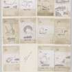
What are evidently the remains of a complex fort are situated on the crest of Black Hill, which is a prominent landmark at the southern end of Lauderdale. Tailored irregularly to the contours of the hill, the last plan of the defences to be drawn up was by James Hewat Craw in 1912 (RCAHMS 1915, 73-4, no.131, fig 71), at a time when the potential complexity of fort defences was neither appreciated nor understood. Reviewed in the light of aerial photography and satellite imagery there appear to be three elements in the defences, namely an inner enclosure with a rectilinear plan, a multivallate enclosure roughly following the contours, and an outer enclosure pursuing an entirely separate line further down the slope. As drawn by Craw, this outermost rampart returns up the slope on the NW to meet the outer rampart of the multivallate belt of defences at right-angles, suggesting that this represents a later phase. This relationship needs to be re-examined, however, for the aerial photographs show little trace of the outer enclosure completing the supposed junction, and in practice the field observation of such relationships where a rampart extends up the slope to meet another on the contour are seldom as clear cut as Craw has depicted. And while the Scheduling document suggests that the earliest phase is a palisaded enclosure on the summit, of which there is no other record and no trace in the available imagery, the outermost enclosure is potentially the remains of an early fort enclosing the upper slopes of this prominent hill. On the SE its rampart peters out on the lip of the steeper slopes along this flank, but in its original form may once have climbed the slope to cross the spine of the hill within the belt of multivallate defences. If so, such a fort would have measured up to 190m in length by 105m in breadth, enclosing an area in the order of 1.5ha. The belt of multivallate defences, which is over 20m deep, is best preserved on the NE and SW, where up to three and five ramparts respectively can be distinguished, though on the N the innermost and second ramparts converge and possibly represent separate phases of construction. The outermost on the NE is certainly accompanied by an external ditch, and other evidence of ditches may have been hidden elsewhere beneath the scarps of the collapsed ramparts. Roughly following the contours, these defences enclose an area measuring about 120m from NE to SW by 45m transversely (0.48ha) and are pierced by an entrance on the NE. Its interior is supposed to have been cultivated in the 19th century, which would certainly account for the degraded state of the innermost rectilinear enclosure. The latter's perimeter is most clearly visible on the SW, where a single rampart reduced to a grass-grown bank cuts across the interior of the multivallate fort, probably adopting the line of the innermost rampart along the flanks and almost obliterated where it returns across the interior on the NE; internally this enclosure measures about 70m from NE to SW by 45m transversely (0.35ha). The complexity of its relationship to the multivallate fort is visible at the S angle, where the innermost rampart of the multivallate system seems to have been reconstructed, doglegging round the corner to overlie the second rampart, which is perhaps evidence of an even later phase of re-fortification. The interior within the rectilinear enclosure is extensively dimpled with shallow scoops that are probably the stances of round-houses; Craw counted no fewer than twelve, but the aerial photographs suggest the presence of similar features throughout the interior.
Information from An Atlas of Hillforts of Great Britain and Ireland – 21 October 2016. Atlas of Hillforts SC3987
Sbc Note
Visibility: This is an upstanding earthwork or monument.
Information from Scottish Borders Council

