Bonchester Hill
Enclosure (Period Unassigned)
Site Name Bonchester Hill
Classification Enclosure (Period Unassigned)
Canmore ID 55334
Site Number NT51SE 9
NGR NT 5929 1193
Datum OSGB36 - NGR
Permalink http://canmore.org.uk/site/55334
- Council Scottish Borders, The
- Parish Hobkirk
- Former Region Borders
- Former District Roxburgh
- Former County Roxburghshire
NT51SE 9 5929 1193.
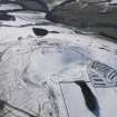
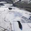
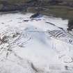
Enclosure, Bonchester Hill. Some slight remains of an enclosure, otherwise destroyed by cultivation, are visible on a flat on the NW side of Bonchester Hill 220 yds. NNE of Ring Plantation and at a height of 850 ft. OD. It is oval on plan and measures 175 ft. from NNE to SSW by 150 ft. from ESE to WNW within a single bank and ditch. The bank, which is spread to a thickness of 18 ft. and is not more than 1 ft. high, shows no stonework; while the ditch is 15ft. wide and up to 1 ft. 6 in. deep. The entrance was situated either on the SSW or the NE, where there are large gaps in the bank. The only internal featue is a scooped hollow, measuring 60 ft. by 40 ft. and 2 ft. in depth, which extends from the centre of the enclosure to within 15 ft. of the ESE side.
RCAHMS 1956, visited 1949
NT 5929 1193 The remains of this enclosure are as described by RCAHMS. There are traces of a small, circular scoop abutting the bottom of the inner face of the enclos-bank on the south side and to the south of the large, scooped hollow described by RCAHMS.
Surveyed at 1/2500.
Visited by OS (WDJ) 12 April 1965
Sbc Note
Visibility: This is an upstanding earthwork or monument.
Information from Scottish Borders Council


