Rule Water
Enclosure (Medieval)(Possible)
Site Name Rule Water
Classification Enclosure (Medieval)(Possible)
Canmore ID 55203
Site Number NT51NE 16
NGR NT 5953 1867
Datum OSGB36 - NGR
Permalink http://canmore.org.uk/site/55203
- Council Scottish Borders, The
- Parish Bedrule
- Former Region Borders
- Former District Roxburgh
- Former County Roxburghshire
NT51NE 16 5953 1867.
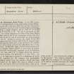
Enclosure, Rule Water. In the SW corner of a cultivated field on the right bank of Rule Water, 260 yds. NE of Bedrule Mill, there are the remains of a rectangular enclosure with rounded angles measuring, within a single rampart, 160 ft. from N to S by 170 ft. from E to W. The site is protected on the W by a steep descent to the floor of the Rule Water valley and on the S by a nameless ravine, but it is open on the N and
is overlooked by rising ground to the E. Owing to erosion the whole of the W rampart and the western half of the S rampart have been entirely obliterated, while elsewhere the remains have been much reduced by cultivation over a long period.
At the NW angle, where it is best preserved, the rampart, which appears to have been of simple earthwork construction, measures 19 ft. in thickness at the base and 6 ft. in height above the exterior ground-surface, but generally it is only from 1 ft. to 2 ft. high and is spread to a thickness of 30 ft. The material for the rampart was presumably obtained partly from the interior, which has been scooped on the higher (E) side, to obtain a level floor, and partly from an external ditch, some 20 ft. wide, on the N, now indicated by a slight depression in the ground. The original entrance at the NE angle has
been enlarged by cultivation to a width of 35 ft. and no internal structures are visible.
RCAHMS 1956, visited 1947
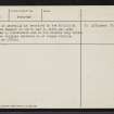
The enclosure is generally as described by the RCAHMS except that the rampart on the N and E sides has been further reduced by cultivation and is now visible only intermittently: the original entrance is no longer visible.
Surveyed at 1/2500.
Visited by OS (RD) 1 March 1967
Sbc Note
Visibility: This is an upstanding earthwork or monument.
Information from Scottish Borders Council


