Pricing Change
New pricing for orders of material from this site will come into place shortly. Charges for supply of digital images, digitisation on demand, prints and licensing will be altered.
Upcoming Maintenance
Please be advised that this website will undergo scheduled maintenance on the following dates:
Thursday, 9 January: 11:00 AM - 3:00 PM
Thursday, 23 January: 11:00 AM - 3:00 PM
Thursday, 30 January: 11:00 AM - 3:00 PM
During these times, some functionality such as image purchasing may be temporarily unavailable. We apologise for any inconvenience this may cause.
Port Seton
Settlement (Prehistoric)
Site Name Port Seton
Classification Settlement (Prehistoric)
Alternative Name(s) Fishers Road; Fishers Road East
Canmore ID 54931
Site Number NT47NW 21
NGR NT 40968 75397
Datum OSGB36 - NGR
Permalink http://canmore.org.uk/site/54931
- Council East Lothian
- Parish Tranent
- Former Region Lothian
- Former District East Lothian
- Former County East Lothian
NT47NW 21 NT 40968 75397
NT 409 754 Excavation by the University of Durham in March - April 1995 of a cropmark site revealed a major defended enclosure complex measuring about 0.8ha in internal area, and probably dating to the Iron Age. Lack of evidence for multiple phases suggests a relatively limited period of occupation, but activity on the site was clearly intensive.
The site comprised a double ditched enclosure to the E, connected to a larger single ditched enclosure, the whole complex being essentially of single phase construction. The outer enclosure was itself subdivided by a substantial ditch in two unequal parts. Opposed terminals facing E from the double-ditched enclosure probably reflect the main entrance to the complex. Elaborate, apparently decorative stone revetments beside the entrance terminals suggest an impressive original appearance. The ditches were generally of substantial U-shaped form with more complex arrangements of double slots at several points. Rampart material had been levelled into the ditches and the majority of the site was truncated to the top of the subsoil horizon by medieval and later ploughing. The ditches yielded animal bone, carbonised grain, artefacts associated with weaving, and small fragments of pottery. Waterlogged deposits were not encountered despite the presence in the ditches of groundwater up to 1m deep.
Four foci of domestic and related occupation were examined. The most substantial of these lay at the western side of the double-ditched enclosure. A circular stake-built house measuring close to 11m in diameter with part of an inner ring of post holes, an E-facing porch and a partial outer ring-ditch, was fully excavated. One of the stake holes yielded the rim of a hand-made vessel, provisionally given a broad Iron Age date. Associated fence lines and post hole structures indicate a range of activities taking place close to the dwelling.
The much more ephemeral remains of a second house were located in the entrance between the two sub-divisions of the outer enclosure. A shallow ring ditch 8.3m in diameter and a partial outer ring of post holes 13.5m in diameter were the only visible features. In the angle between the inner and outer enclosures a third house was represented by a ring ditch 9m in diameter with a NE-facing entrance. A number of both internal and external post holes may reflect weaving or other industrial activities. The fourth house lay in the centre of the western enclosure. It was formed by a ring ditch 13m in diameter with an ENE entrance. A ditch forming a parallel arc to the immediate SE probably represents a fence line. Internal post holes may reflect industrial activity. To the NE another fence line and a series of post holes suggest that the house may have been enclosed. A number of U-shaped gullies seem to be wind-breaks associated with industrial and other activities.
An irregular sunken structure, ovoid in shape and measuring 10m by 5m was located inside the E part of the circular enclosure, immediately W of the S inner ditch terminal. Its floor was composed of cobbles and had been penetrated by a large number of stake holes. The SE side was formed by a square-sectioned slot packed with stone for timber uprights. Fills above the floor contained a large quantity of animal bone, including a substantial proportion of whale bone fragments. The structure has provisionally been interpreted as a facility for processing carcasses.
The character of the site and the few finds recovered appear to be broadly comparable to other nearby excavated sites of probable Iron Age date, notably the enclosure site at Port Seton West excavated in 1994 and St Germains.
C C Haselgrove 1995
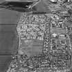
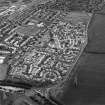
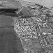
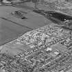
A housing estate (NT47NW 119) has now been constructed on the site of this settlement and that of an adjacent settlement (NT47NW 24).
Information from RCAHMS (SWC) 24 May 2004.
Aerial Photographic Transcription (14 June 1993 - 15 June 1993)
An aerial transcription was produced from oblique aerial photographs. Information from Historic Environment Scotland (BM) 31 March 2017.


![Excavation photographs: Stone setting [700].](http://i.rcahms.gov.uk/canmore/l/SC01110118.jpg)


![Excavation photographs: Slot [163] showing stone packing.](http://i.rcahms.gov.uk/canmore/l/SC01110114.jpg)


![Excavation photographs: Stone collapse [123] in Enclosure 1 outer ditch north.](http://i.rcahms.gov.uk/canmore/l/SC01110115.jpg)


![Excavation photographs: Sunken floor structure [189] viewed from above.](http://i.rcahms.gov.uk/canmore/l/SC01110119.jpg)


![Excavation photographs: Stone kerb [79] at terminal of Enclosure 1 outer ditch south.](http://i.rcahms.gov.uk/canmore/l/SC01110116.jpg)
![Excavation photographs: Posthole [688] with stone slab Find 5107 in situ.](http://i.rcahms.gov.uk/canmore/l/SC01110120.jpg)


![Excavation photographs: Stone setting [700].](http://i.rcahms.gov.uk/canmore/s/SC01110118.jpg)


![Excavation photographs: Slot [163] showing stone packing.](http://i.rcahms.gov.uk/canmore/s/SC01110114.jpg)


![Excavation photographs: Stone collapse [123] in Enclosure 1 outer ditch north.](http://i.rcahms.gov.uk/canmore/s/SC01110115.jpg)


![Excavation photographs: Sunken floor structure [189] viewed from above.](http://i.rcahms.gov.uk/canmore/s/SC01110119.jpg)


![Excavation photographs: Stone kerb [79] at terminal of Enclosure 1 outer ditch south.](http://i.rcahms.gov.uk/canmore/s/SC01110116.jpg)
![Excavation photographs: Posthole [688] with stone slab Find 5107 in situ.](http://i.rcahms.gov.uk/canmore/s/SC01110120.jpg)


