Pricing Change
New pricing for orders of material from this site will come into place shortly. Charges for supply of digital images, digitisation on demand, prints and licensing will be altered.
Ballencrieff Granary
Granary (16th Century), House (16th Century)
Site Name Ballencrieff Granary
Classification Granary (16th Century), House (16th Century)
Canmore ID 54899
Site Number NT47NE 4
NGR NT 48568 78109
Datum OSGB36 - NGR
Permalink http://canmore.org.uk/site/54899
- Council East Lothian
- Parish Aberlady
- Former Region Lothian
- Former District East Lothian
- Former County East Lothian
NT47NE 4 48497 78097
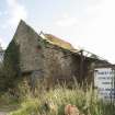
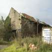
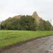
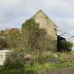
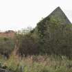
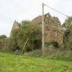
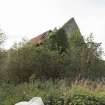
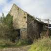
Ballencrieff Granary, 250 yds SSW of Ballencrieff House (NT47NE 5) is a 16th century L-plan building. There is no internal stair, and the high corbelled platform on the S side in the angle strengthens the traditional idea of its purpose; access to the upper levels would have been by ladder, and there could have been a winch on the platform. Though the RCAHMS assert that this granary was connected with St Cuthbert's Hospital (NT47NE 35), this cannot be as the hospital had ceased to function long before this building was erected.
C McWilliam 1978; RCAHMS 1924, visited 1913; D E Easson 1958
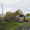
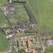
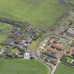
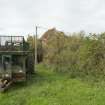
NT 48497 78097. Much of Ballencrieff Granary is hidden by adjacent modern farm structures.
Visited by OS (RDL) 24 October 1962 and (BS) 14 October 1975.
NT 484 7 80 An evaluation and historic building survey were carried out in April 2005 on a 1.07ha proposed residential
development. During the evaluation 14 trenches were excavated. No archaeologically significant remains were identified, though a compacted cobble track and drainage features associated with the farmstead were visible, particularly to the E of the buildings.
The steading consisted of a number of farm buildings which had been converted to piggeries in the 20th century but were originally used for storing and processing grain, with evidence of a fixed steam engine which would have driven a fixed threshing machine.
Archive to be deposited in NMRS.
Sponsor: GAP Developments Ltd.
M Roy, D Sproat 2005
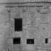
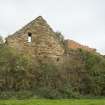
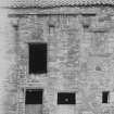
2-storey, L-plan former house and granary. Random rubble with freestone dressings. Irregular openings, several now built up; doorways at 1st floor formerly with forestair and with corbel course above indicating position of former lean-to, large modern sliding doors inserted at ground of NE gable. No internal communications between ground and 1st floor; access by ladder. Red pantiles, coped askews; crowstepped to E with brick stack. 6 beak skewputts, 3 with shields bearing arms.
A hospital dedicated to St Cuthbert is documented at Ballencrieff in the 13th century. This later building was apparently connected with it, as was Redhouse, formerly known as Red Spittal ( Historic Scotland)
Field Visit (27 June 1913)
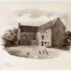
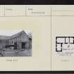
On the east of the farm steading of Ballencrieff and 250 yards south-south-west of the old mansion is a building L-shaped on plan and two storeys in height (fig. 37 [ELD 30/2]). The structure is built of rubble with freestone dressings and the roof is pantiled. The main block measures exteriorly 60 feet from west-south-west to east-north-east, has a breadth of 22 feet 8 inches and contains three apartments used as stables. The wing measures 26 feet by 20 ½ feet and is now occupied as a dwelling. The doorways and windows, several of which are built up, have a splay wrought on the jambs and lintels. There has been no internal communication between the ground and the upper floor; access to the latter has been obtained from a ladder. On the south wall, above the doorway of the upper storey and below the eaves, the stone weather table above three corbels indicates the former existence of a penthouse. Three of the six skewputs have shields bearing arms: N.E. main block: Three cinquefoils below a star; S.E. wing: A Greek or equal-armed cross; mid skewput, west wall: A saltire.
There was an hospital at Ballencrieff in the 13th century, dedicated to St. Cuthbert (1). The above mentioned structure, though dating from the 16th century, is apparently one of the buildings connected with it.
RCAHMS 1924, visited 27 June 1913.
(1) Calendar of Docts. ii. p. 227.
Photographic Survey (January 1966)
Photographic survey by the Scottish National Buildings Record/Ministry of Works in January 1966.


