Stow, Old Stow Bridge
Bridge (Period Unassigned)
Site Name Stow, Old Stow Bridge
Classification Bridge (Period Unassigned)
Alternative Name(s) Gala Water; Stow, Pack Horse Bridge
Canmore ID 54524
Site Number NT44SE 7
NGR NT 45837 44394
Datum OSGB36 - NGR
Permalink http://canmore.org.uk/site/54524
- Council Scottish Borders, The
- Parish Stow
- Former Region Borders
- Former District Ettrick And Lauderdale
- Former County Midlothian
NT44SE 7 45837 44394.
(NT 4583 4439) Bridge (NR) (rems of)
OS 6" map (1970)
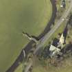
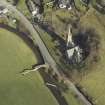
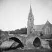
This ruinous bridge was built in 1654-5. It is 125ft [38.1m] long and 10ft [3.1m] wide, with three segmental arches; the roadway was 6 1/2ft [2m] wide. A cutwater projects on either side of the pier between the E and mid arches. The span across the river, the largest, is intact; the other two are broken.
(RCAHMS 1929, visited 1915)
Visited by OS Reviser (MR) 4 November 1953
Bridge, Stow (Gala Water), 1654-5. Three main arches of rubble, diminishing from E to W; disused and broken.
C E McWilliam 1978.
This bridge formerly carried a road or track over the Gala Water to the S of Stow village (NT44SE 19).
Information from RCAHMS (RJCM), 6 February 2006.
Photographic Survey (1941)
Photographic survey of Old Stow Bridge, Midlothian, for the National Buildings Record, Scottish Council in 1941.
Publication Account (2007)
This 1655 bridge spans the Gala Water directly opposite the church at the south end of the village and is easily seen from the A7. The overall length of the structure, which is partly a causeway, is about 125 ft and includes three segmental arches increasing in size from 10 ft to the main span of 47 ft which has a rise of about 12 ft and an arch ring of thin undressed stone. The bridge was built by the Kirk Session for the convenience of worshippers on the west bank of the river. It was no doubt also used by others as the former Edinburgh–Hawick road was then on the west bank of the Gala Water. Today the bridge comes under the jurisdiction of the Community Council. By the late 1990s the condition of its land arch had deteriorated to such an extent that action was taken in 2001 to prevent its collapse and preserve the original stonework at the cost in appearance of an unsightly steel reinforced lime concrete supporting arch.
R Paxton and J Shipway 2007
Reproduced from 'Civil Engineering heritage: Scotland - Lowlands and Borders' with kind permission from Thomas Telford Publishers.
Project (April 2009 - February 2015)
The Borders Railway Project proposals are to reinstate the Newcraighall to Tweedbank section of the former Waverley Line. The reinstated railway line will be approximately 48km long and the majority of the route will use the existing railway embankment.
Several field surveys, archaeological evaluations and standing building surveys were undertaken by CFA Archaeology from April 2009 until February 2015.
CFA Archaeology
Sbc Note
Visibility: Upstanding structure, which may not be intact.
Information from Scottish Borders Council.


