Torwoodlee
Broch (Iron Age)(Possible), Dun (Period Unassigned)(Possible), Fort (Period Unassigned)
Site Name Torwoodlee
Classification Broch (Iron Age)(Possible), Dun (Period Unassigned)(Possible), Fort (Period Unassigned)
Canmore ID 54353
Site Number NT43NE 2
NGR NT 4655 3847
Datum OSGB36 - NGR
Permalink http://canmore.org.uk/site/54353
- Council Scottish Borders, The
- Parish Caddonfoot
- Former Region Borders
- Former District Ettrick And Lauderdale
- Former County Selkirkshire
NT43NE 2 4655 3847.
(NT 4655 3847) Fort (NR)
(NT 4652 3844) Broch (NR)
OS 6" map (1971)
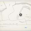
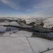
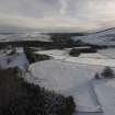
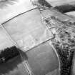
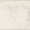
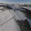
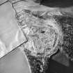
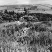
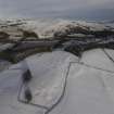
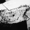
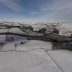
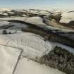
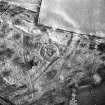
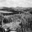
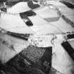
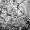
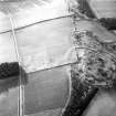
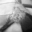
Fort and Broch, Torwoodlee: These structures lie on the shoulder of a ridge, over 800 ft O D, and command an extensive view.
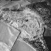
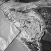
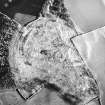
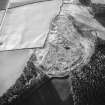
The fort has been much mutilated by stone-robbing, surface quarrying and cultivation. It appears to have been an irregular oval in shape, measuring about 450 ft by 350 ft. Along the W side the defences consisted of two ramparts each with an external ditch, and traces of these can be seen continuing round the N side. The S and E sectors of the defences have been destroyed or mutilated beyond recognition. There may have been an original entrance on the E. The interior has been planted with trees and is featureless.
RCAHMS 1957, visited 1950
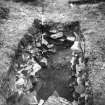
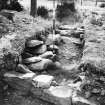
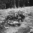
The broch was cleared out in 1891 (J Curle 1892), at which time a large quantity of Roman pottery and glass was found inside it. It was properly excavated in 1950 (S Piggott 1953), which showed that it had been built partly over the filled-in ditches of the fort.
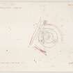
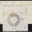
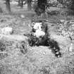
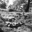
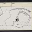
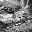
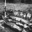
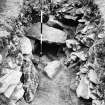
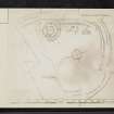
The site is now somewhat overgrown but the inner and outer wallfaces and the various intramural structures (see plan) can be easily traced. The circular, drystone structure is reduced in height to less than a metre in height all round and measures 23.2 m in overall diameter. The wall is 5.2 m thick so that the diameter of the central court, almost exactly circular, is from 11.9 m to 12.2 m.
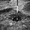
A series of post-holes were revealed in the interior, probably indicating that an inner range of timber buildings had been constructed against the wall. The entrance to the broch is on the E side, and there is a door-check in each wall of the passage.
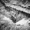
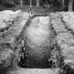
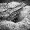
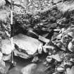
The broch is unusual in being surrounded by a ditch, with a causeway in front of the entrance. Excavation showed this to be V-shaped in section, some 2.7 m wide and 1.6 m deep, and also that it had been delibarately filled with rubble from the broch wall not long after it had been dug, before any silt had accumulated in it. The broch had evidently been systematically destroyed.
E W MacKie 1975
More Roman pottery and glass was found in 1950 beneath the wall of the broch. It was of 1st century date, similar to that found in 1891.
MacKie suggests that the fort was overthrown, and its ditches filled up, during the initial Agricolan campaign in about 80 A D.
The excavation showed that the broch was built soon after the Romans withdrew in about 100 A D, and was thrown down again shortly afterwards, probably by a Roman expedition preparing for the reoccupation of 140 A D.
The many fragments of Roman material found in the broch might be explained as loot from the fort at Newstead (NT53SE 20).
Material from this site is in the National Museum of Antiquities of Scotland (NMAS).
J N G Ritchie and A Ritchie 1972; A S Robertson 1970; J R Allen 1896; Proc Soc Antiq Scot 1912
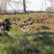
When visited in 1961, this fort and broch were generally as described above. "The broch is a ruin and its wall 5.2 m broad and 0.5 m high, is overgrown. Both outer and inner perimeters are clearly defined. The guard chamber adjacent to the entrance has been almost destroyed, but the stair compartment is still well-defined. The surrounding ditch is shallow and mutilated. Only the N and W defences of the fort are reasonably well-defined.
Visited by OS (WDJ) 16 January 1961
Publication Account (2007)
NT43 1 TORWOODLEEE
NT/4655 3847
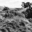
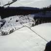
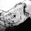
This large dun or probable solid-based broch in Caddonfoot is built on the ruins of a hillfort; the site stands on the shoulder of a ridge, over 800 ft OD, and commands an extensive view (visited in 1989). The hillfort has been much mutilated by stone-robbing, surface quarrying and cultivation but seems to have been an irregular oval in shape, measuring about 137m by 136m (450 ft by 350 ft). Two ramparts, each with an external ditch, can be traced along the north side but the south and east sectors of the defences have been destroyed or mutilated beyond recognition. There may have been an original entrance on the east [4, fig. 110]. The broch itself lies on the south-western side of the fort and partly on top of the defences [4, fig. 111]. As with the sites in the Forth Valley the wall stands only a metre or so in height so no direct evidence now remains that Torwoodlee was ever a hollow-walled tower.
Description of the broch
The broch was first cleared out by James Curle in 1891 [2] at which time much Roman pottery and glass – including some large pieces – together with a coin of Titus were found inside it; all this material gave the impression of a late 1st century occupation. It was systematically excavated in 1950 by Stuart Piggott [3], who showed that it had been built partly over the filled-in ditches of the fort. The numerous Roman finds – as well as the proximity of the site to the legionary base at Newstead – have caused the site to feature prominently in all discussions about the Roman occupation of southern Scotland. It also stands only about two miles south of Bow Castle broch (NT44 1).
The broch is unusual in being surrounded by a defensive ditch, with a causeway in front of the entrance. Excavation showed this ditch to be V-shaped in section, some 2.7m wide and 1.6m deep, and also that it had been deliberately filled with rubble from the broch wall not long after it had been dug, before any silt had accumulated in it. The broch had evidently been systematically destroyed and the stones from its wall thrown into the ditch [3].
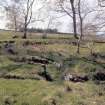
The site is now somewhat over-grown but the various structural features can be easily traced. The circular, drystone building is reduced to less than a metre in height all round and measures 23.2m in overall diameter - James Curle was told that some 2000 cartloads of stone were taken from the site about fifty years before his time – presumably in the 1840s – to build the surrounding dykes [2, 74]. The wall is 5.2m thick so that the diameter of the central court, almost exactly circular, is from 11.9m to 12.2m. The entrance is on the east side, and there is a door-check in each wall of the passage, at a distance of 2.0m from the exterior. A circle of post-holes was revealed in the interior – not concentric with the broch wall – suggesting that there had been an earlier wooden hut on the site (see Buchlyvie – NS59 2 – and Leckie – NS69 2).
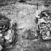
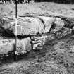
Apart from the entrance only two intra-mural features are preserved. The first is a curious square cell – presumably a guard chamber – on the left side of the passage immediately behind the door-frame; a raised sill is at the entrance to this [2, fig. 4]. The second is a doorway at 10 o’clock leading to a rectangular stair-foot guard cell on the left and, on the right, to the remains of a flight of stairs ascending clockwise.
Excavations in 1892
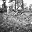
Piggott describes the earlier operation succinctly [4, 94].
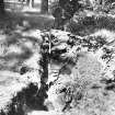
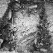
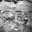
“When first identified, the site of the broch was a more or less level platform within its encircling ditch, and the excavations, supervised by Mr James Wilson of Galashiels, took the form of tracing the outer wallface by means of a trench following its line, and the clearance of the interior as well as the entrance passage, a guard-chamber opening from it and a wall chamber in the SW., discovered in the course of clearance. …
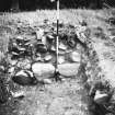
The inner area was found to be filled level with the wall footings, which stood to a height of from 2 to 3 ft., and consisted in most places of not more than two or three courses of facings stones, on outside and inside, with a rubble core. When the internal filling of debris was removed, the central area of the broch ‘was found to be covered with a layer of ashes, marking the old floor level. This layer was from 1 to 2 ft in depth. Under the superintendence of Mr Wilson these ashes were sifted and all relics of the inhabitants were collected.’ … The dump of stones from the broch interior made by the earlier excavators is still visible outside the building to the NE.”
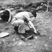
Excavations in 1950-51
The purpose of this work was primarily to ascertain the relationship between broch and hillfort and to find out the exact relationship between the broch and the numerous Roman finds made in it. It was also hoped that careful excavation of the broch floor might reveal features overlooked by the earlier investigators. The following is a summary of the results.
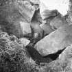
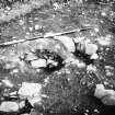
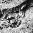
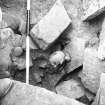
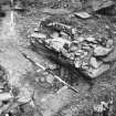
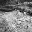
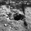
Relationship between broch and hill-fort. The ditch of the broch was shown to have been cut into that of the hillfort which was therefore older [4, 103]. No Roman finds were found in the hillfort ditches. As noted a mass of stones from the dismantled broch had fallen into the adjacent hillfort ditch, where they lay on at least a metre of accumulated silt. By contrast these huge tumbled stones (with large airspaces between them) fell to the bottom of the broch ditch. A massive burial cist – containing a female skull and fragments of the two humeri – was found in this rubble, a rare example of the grave of a broch occupant [4, fig.9, top]. This person must presumably have died – or at least been buried – while the broch was actually being demolished.
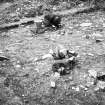
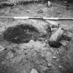
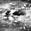
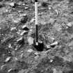
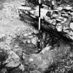
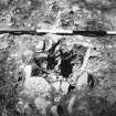
The broch floor. The clearance of the interior showed that the earlier excavators had not explored below the ash layer and that the layers below were intact. These consisted of a layer of earth and stones, containing Roman material, which had been immediately below the ash layer explored in 1892. Under this was the old ground surface, cut into which were three pits – which contained Roman material – and nine post-holes forming a sub-circular ring which did not. This hut – which had a maximum diameter of some 6.5m – was therefore deduced to belong to the hillfort period. A hearth was found which was assumed to belong to the hut although it was rather close to the supposed doorway. There was a fourth pit which was earlier [4, fig. 6] and which contained sherds of native pottery (as did the hillfort ditch).
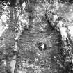
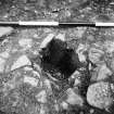
Conspicuously absent from the broch floor was the ring of large post-holes, concentric with the inner face, which was found at Leckie and several other sites; these posts are usually assumed to be the pillars of an elaborate wooden round-house the first floor of which rested on a scarcement about 1.8m above the floor. Neither were any smaller post-holes found suitable for a low, light roof. A single large hole in the exact centre of the broch (containing Roman material) might have supported a centre post for a low roof; however it seems to have been deliberately filled and was not holding a post at the time of the destruction.
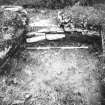
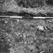
Relationship between Roman finds and broch. Three cuttings were made into the broch wall the core of which was found to be earth and rubble as well as some large stone blocks. Roman material was found in the core and on the old ground surface beneath. Pit 1, in the doorway to the stair, also contained Roman sherds and must have antedated the building of the broch, if only by a short time. Roman pottery was also found scattered on the floor of the guard chamber, in the entrance passage and on the causeway across the broch ditch leading to this. By contrast not a single Roman fragment was found in any of the many cuttings outside the area of broch and ditch.
Finds
The finds from both excavations are listed and discussed in detail by Piggott [4, 105], and specialist reports on the Roman pottery and glass are provided by K A Steer and D B Harden respectively. Unless otherwise indicated the objects mentioned here were found in the earlier excavations.
Iron Age metalwork: 1 bronze terret and 1 enamelled stud [2, figs. 10 and 11] were found in the ash layer in 1891-92.
Iron Age glass: 1 fragment of an armlet with D-shaped section is of yellowish green glass with an opaque yellow inlay [2. fig. 9: 3, 366, 389]. That these armlets were in use in southern Scotland in the late first and the second centuries AD is well shown by the several examples found at Leckie (NS69 2).
Roman pottery. A detailed report by K A Steer is published [4, 110-12]. And it is enough to mention here that all the fragments appeared to be pre-Hadrianic and could be Flavian (late 1st century). One piece of a carrot-shaped amphora – rare in the north – is from the time of Claudius or Nero “and can hardly be later than Flavian times”. [4, 112]
Roman glass. A detailed report on all the fragments found was compiled by D B Harden [4, 112-13] who identified three kinds of glass – colourless, green and amber. He suggested that the amber and green pieces were typical of the 1st/2nd centuries AD; in other words they could be either Flavian or Antonine, “but with a slight preference for the pre-Antonine. The colourless fragments are more likely to be Antonine or later; colourless glass of this type is not found in Britain before the beginning of the second century….” .
Recently the glass was re-examined by Ingemark who identified the following vessels (I am grateful to Fraser Hunter of the National Museums of Scotland for retailing this information to me. It is hoped that Ingemark’s thesis will be published as a monograph of the Museum.): –
1. 9 fragments from one tubular-rimmed bowl of form Isings 44b, dating to AD 60/65-160/170.
2. 4 fragments from one globular jar of form Isings 67c, tentatively dated to the early-to-mid 2nd century?
3. 43 fragments from a minimum of 3 cylindrical bottles, of the period AD 43-110.
4. 14 fragments of blue-green glass of form Isings 50 or 51, dated to AD 43-200.
5. 3 unidentified fragments.
Iron Age pottery. A few plain wall sherds were found in the lowest charcoal layer in the hearth in Pit 4. Also worth noting is a single sherd of hard, red ware with an almost burnished outer surface. Piggott’s suggestion of a connection with the haematite-coated wares of the early Iron Age cultures of southern England would seem implausible now were it not for the burnished, red, carinated jar from Dun Mor Vaul, Tiree.
Wooden bowls. Carbonised fragments of carved or turned wooden bowls were found in 1950-51 at three locations on the old surface of the broch floor. A similar fragment came from Leckie (NS69 2).
Discoid rotary quern. One un-expected find was the four fragments of a complete upper stone of a disc quern – not the standard bun-shaped Iron Age stone of the south mainland – which was found at a low level in the hillfort ditch, in cutting IX just north of the broch [4, fig. 4 (top) and fig. 10]. The quern was made of a local tuff, probably from the volcanic rocks of the Eildon complex not far away. No handle-hole is mentioned. The possible significance of this find is discussed below.
Discussion
There are two important points to consider – first, the nature of the ‘broch’ at Torwoodlee and, second, its date. Piggott’s conclusions are sumarized first, and these are followed by some thoughts of the author’s.
Piggott concluded that the broch had never been properly roofed; either it had not been finished (in which case the Roman finds represent a temporary settlement during construction) or it was occupied without a roof [4, 114].
His conclusions about the dating of Torwoodlee can be summarized as follows. The Roman pottery and glass – broadly of late first-century date – was on the site before the broch was built so the date of this event should be during, or immediately after, the Roman occupation of Scotland from c. AD 80-100. He preferred the idea that the Roman material was picked up on the abandoned site of Newstead not long after AD 100. The fact that hardly any silt had accumulated in the broch ditch indicates that the tower was thrown down not long after its construction. The Roman punitive raid of AD 117 and the re-occupation of Dere Street by Governor Lollius Urbicus in AD 139 are suitable occasions for its demolition.
With the benefit of the evidence from Leckie broch, and of a better under-standing of the dating of rotary querns and of the Roman glass from the site, the author would suggest modifying this scenario a little. It also has to be borne in mind that Torwoodlee only superficially resembles a broch; like Edinshall, which can never have been a tower (NT76 1), it is unusually large and the absence of a ring of heavy posts inside clearly shows that it was not like Leckie. It may therefore be a late, broch-like structure.
This idea is supported by the rotary quern in the hillfort ditch. We know now from the Roman and native rotary querns found at the Flavian camp at Elginhaugh, just south of the Firth of Forth, that discoid querns of Atlantic broch type appeared in central Scotland probably at the beginning of the Flavian occupation; they may indeed first appear as the result of the assembly of the tribal army – recruited doubtless from all over the country – brought together under the war chief Calgacus to resist the invader. One remarkably informative native quern was found at Elginhaugh. It consisted of one fragment of the upper stone and another of the matching lower stone, made of a rock from the north-west highlands and of a design typical of pre-Roman Brittany and south-west England (having a radial slot for the handle). In those days armies had to carry querns with them and this one seems best explained by supposing that a tribal unit from the far north was in the Elginhaugh area just before the camp was built. Certainly the occupations of Leckie – probably built in the AD 80s – used disc querns of Atlantic Scottish type.
The Torwoodlee quern was among some rubble at the bottom of the hillfort ditch, which suggests that the hilltop stronghold was built – or at least re-fortified – not earlier than the late AD 70s or early 80s. Since this ditch was well silted up when the ‘broch’ was built it would seem that the latter should be several decades younger.
The date of the destruction of Torwoodlee ‘broch’ obviously depends on the Roman material found inside and under it. Although the samian ware is evidently all Flavian (late 1st century) some of the glass could be Antonine as well as Flavian. However none of it is of a type that cannot be earlier than AD 140.
A working hypothesis taking account of this new evidence would suggest that a wealthy native community – doubtless under an influential chief (deduced to be such from the native bronze ornaments) – came to the abandoned hillfort shortly before either AD 117 or 139, intending to build a broch-like stronghold as a response to one of the Roman raids of those years. The community had already accumulated many Roman Flavian fragments from the abandoned camp at Newstead. Knowledge of how to build a true, hollow-walled broch tower had faded and a fairly low-walled, drystone stronghold of approximately the right size and ground plan was begun. The presence of the surrounding ditch – of a kind unknown around brochs in the Atlantic province – supports the idea that the building was a late imitation. Either Torwoodlee was attacked and thrown down before it was finished, or it was occupied roofless for a short while.
A construction and demolition at the start of the Antonine re-occupation – but before any Antonine pottery could be traded to the site – is supported by the clear evidence from Leckie, which was very probably destroyed then.
Dimensions
The overall diameter is 23.2m and the wall is 5.2m thick so that the diameter of the central court, almost exactly circular, is from 11.9m to 12.2m – unusually large. The wall proportion is thus about 45%, which is quite low despite the overall size.
Sources: 1. NMRS site no. NT 43 NE 2: 2. J Curle 1892: 3. Kilbride Jones 1938, 388-89: 4. Piggott 1953: 5. Steven-son 1956, 15: 6. RCAHMS 1957, 88-91 and figs. 110 and 111: 7. Stevenson 1966, 35: 8. Robertson 1970: 9. Macgregor 1976, nos. 60 and 176: 10. Stevenson 1976, 50: 11. Breeze 1982, 140: 12. MacInnes 1985, 235-49: 13. Armit 2003, 129-31. Several other passing references to the site are listed [1].
E W MacKie 2007
Note (30 September 2015 - 25 October 2016)
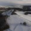
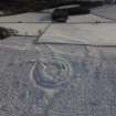
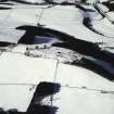
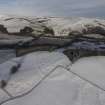
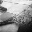
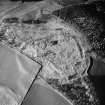
The fort at Torwoodlee, which is better known for the broch overlying its defences (Curle 1892), is situated on a gently sloping position on the E spur of Mains Hill, and while the approach from the W is relatively level, the ground falls away more steeply around the rest of the circuit. The defences are best preserved on the W and N, comprising at least two ramparts and ditches, the outer accompanied by a counterscarp bank, but they have been heavily distorted by stone-robbing, cultivation and tree planting, and little more than the line of the outer rampart can be followed through the improved fields in the S sector; the only trace of an entrance is a gap on the ENE. Oval on plan, the interior is probably rather smaller than the dimensions given by RCAHMS investigators, which appear to have conflated the inner and medial circuits at various points, and measures about 125m from N to S by a little over 100m transversely (c.1.1ha). Apart from the foundation of the broch, nothing is visible within the interior, the southern third of which has been subjected to shallow surface quarrying. Excavations in 1891 (Curle 1892) and 1950 (Piggott 1951) conclusively demonstrated that the broch was occupied in the Roman Iron Age, and that its wall overlies the inner rampart of the fort; the ditch encircling the broch is also cut through the inner rampart and recuts a segment of the inner fort ditch (Piggott 1951). Where the inner rampart was sectioned it measured about 3m in thickness and was composed of stones and yellow clay, and was fronted by a V-cut ditch was at least 4m in breadth by 2.5m in depth; there were traces of shallow quarrying to its rear. The medial rampart was entirely robbed out opposite the broch, but a section on the N revealed three courses of its outer face. Apart from a ring of post-holes probably associated with a timber round-house predating the broch, little trace of any occupation was recorded in a series of trenches excavated on the W side of the fort interior. Finds relating to this earlier occupation are limited to a few sherds of coarse pottery and a rotary quern from low down in the fill of the inner ditch, though one pit containing Roman pottery predated the construction of the broch and Roman finds were recovered from the core of its wall. The interior of the broch produced a rich assemblage of material, including a bronze terret and an enamelled stud, and a fragment of a glass armlet, while Roman goods include sherds of Samian, coarse wares and amphorae, and fragments of green and amber coloured glass (See Piggott 1951, 110-13). Amongst the mass of tumbled stones filling the ditch of the broch a rough cist containing the inhumation of a woman was discovered.
Information from An Atlas of Hillforts of Great Britain and Ireland – 25 October 2016. Atlas of Hillforts SC3542
Magnetometry (5 October 2018 - 11 October 2018)
NT 56980 34410 and NT 4655 3847 Survey work was continued, 5–11 October 2018, to investigate relations between natives and Romans from a landscape perspective. In 2015 and 2017 the region around the sites Burnswark and Birrens were surveyed. In 2018 we started to open a comparative perspective in the region around Newstead, Eildon Hill and Torwoodlee.
The Roman occupation of Newstead has been the subject of several investigations. The new magnetometry confirms many of the observations drawn from the previous aerial imagery, but reveals considerably more detail. Apart from the confirmation of detailed structures in the interior of the fort, the magnetometry also presents several ‘batteries’ of ovens or furnaces in its surroundings. It clearly shows the precise layout of the vicus in the S annexe of the fort and several of the camp structures underneath the fort and to the E and SE. Moreover, it identified a circular structure, already recognised by Dave Cowley in 2012. Our magnetometry shows post settings inside the circular ditch and suggests an opening in the NW. A possible interpretation could be a horse gyrus, currently only recognised at forts at the Lunt, Baginton, Coventry, as well as Kempten (Cambodunum) and Mainz (Mogontiacum) (both Germany). Moreover, traces of linear anomalies, possibly indicative of a larger road (Dere Street?), might show in the E edge of the surveyed area.
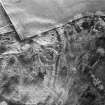
At Torwoodlee a double ditch system for the N part of the hillfort was traced. Its interior is disturbed by traces of ridge and furrow as well as highly thermo-remanent anomalies that might also be of younger date. Their character should be traced by further examinations. The fields W of the hillfort show only a few traces of anthropogenic activities, except of some modern intrusions. The data of the survey on the slope E of the hillfort still needs some further data processing, but shows some circular structures that might be of anthropogenic origin. Some of the S slopes were also probed and showed only a few traces of anomalies. Most of them might be modern or of geological origin. Nevertheless, traces of agriculture and or horticulture are visible on the surface in the E area underneath the broch. Thus, the area to be investigated has not been exhausted. A total of 8.4ha were surveyed on the site. The gradiometer works were conducted with a GPSsupported 14-sensor fluxgate GM650B gradiometer device, with a 3m rig drawn by a quad bike. The surveys on the broch and inside the hillfort at Torwoodlee were carried out with a 5-sensor rig with the similar technical configuration that was carried by two persons.
The works were carried out in collaboration with the Trimontium Trust Melrose, the Archaeology Officer, Scottish Borders Council and Historic Environment Scotland.
Archive: Survey results to HES and Communal Archaeology
Scottish Borders
Funder: RGK, Trimontium Trust
Ruth Beusing, Nina Dworschak and John Reid – Römisch-
Germanische Kommission, Frankfurt (RGK) of the German
Archaeological Institut (Deutsches Archäologisches Institut)
(Source: DES, Volume 19)
Sbc Note
Visibility: This is an upstanding earthwork or monument.
Information from Scottish Borders Council


