Selkirk Castle
Castle (Medieval), Motte (Medieval)
Site Name Selkirk Castle
Classification Castle (Medieval), Motte (Medieval)
Alternative Name(s) Peel Hill; The Haining; Haining Loch
Canmore ID 54272
Site Number NT42NE 9
NGR NT 47000 28100
Datum OSGB36 - NGR
Permalink http://canmore.org.uk/site/54272
- Council Scottish Borders, The
- Parish Selkirk
- Former Region Borders
- Former District Ettrick And Lauderdale
- Former County Selkirkshire
NT42NE 9 470 280.
(NT 4700 2810) Castle (NR) (Site of)
OS 6" map (1900)
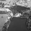
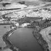
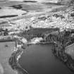
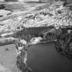
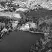
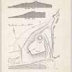
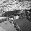
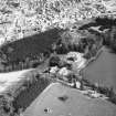
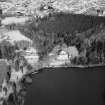
Selkirk Castle and Motte. Immediately NE. of The Haining and N of Haining Loch there rises a large mound which, though probably natural, has been adapted for defence - in the first instance as an earth-and-timber castle and in the second as an Edwardian pele.
The mound generally measures about 238ft by 185ft, and is about 40ft high except at the N end, where a round motte rises 16ft 6 in. higher. The summit, which has a diameter of 40ft, evidently bore the tower, both of the early castle and of the pele. On N and E a ditch may be seen, although it is much overgrown, and this probably extended to the loch on the S, it averages 40ft in width by 3ft in depth. There is no trace of a ditch on the W side of the mound, but the ground has been much interfered with here in the construction of the mansion-house and its garden.
Beyond the mansion to the W there is a ravine marked "Clock Sorrow" on the OS map. This seems to be mainly natural, being the outlet of the loch; it is uncertain whether it formed part of the defences of either castle or pele.
Historical Note. The castle is mentioned in the foundation charter of Selkirk Abbey, dateable to about the year 1119. During the English usurpation, at the turn of the 13th and 14th centuries, it was either ruinous or no longer adequate, and Edward 1 decided to rebuild. Accordingly, in February 1301-2 he and his council appointed the Warden of The Forest Sir Alexander de Balliol of Cavers, and the Sheriff of Roxburgh, Sir Robert Hastings, to be surveyors.
By the following September the work had been pressed on so energetically that Balliol became warden "of the fortress which the king has made". This fortress was mainly of earth-and-timber construction, with some masonry features (infra); its constituents were a tower and a pele, the latter a defensible enclosure of earth and timer.
Notwithstanding its defences the new "Pele of Selkirk" was taken by the Scots in 1302; Balliol, its keeper, fell into disgrace, but was forgiven in 1305 and disappears from the scene about 1310. In 1311, after Edward II's invasion, Selkirk, like Cavers and Jedburgh, was again in English hands. It had evidently disappeared by 1334, as the charter of that year ceding the southern counties to Edward III alludes, in the case of Selkirk, simply to the "town and county", whereas in the cases of Roxburgh, Edinburgh, Peebles and Dumfries the style is "town, castle and county".
RCAHMS 1957, visited 1946, 1950
This motte with bailey is as described above - the motte being reduced to a rounded much-spread mound.
Visited by OS (WDJ) 23 January 1961
Publication Account (1980)
References to a castle at Selkirk predates the accession of David I in 1124. It occurs in the c.1120 foundation charter to Selkirk Abbey. The castle served as a royal residence until the reign of Alexander Ill, and was undoubtedly constructed of earth and timber (RCAM, 1957, 23). Although Selkirk castle was not mentioned in the list of twenty-three surrendered to John Baliol by Edward I in 1292, it was in Scottish possession until the summer of 1301, when it was captured by the English (Barrow, 1965, 171). The English strengthened the stronghold by the addition of a pele (RCAM, 1957, 23) and stonework (CDS, ii, 1324) and from that position were able to maintain a good 'watching brief' on events in Galloway. Edward II at one time mounted operations against Bruce from the Castle and in 1309 the commander, Aymer de Valence, received orders 'to provision the castle of Selkirk with men and victuals with all expedition against the king's enemies and rebles' (Craig-Brown, 1886, ii,12). After the defeat of the Scots at Hailidon Hill in 1333, Selkirk Castle was once again in English hands.
All that now remains of the Castle and Edwardian pele is a much reduced earthwork, which is located in the grounds of a Georgian mansion on the outskirts of Selkirk (RCAM, 1957, 23). The mound is about 238 feet by 185 feet and is about 40 feet high, except at the north end, where a round motte rises 16 feet 6 inches higher. On the north and east a ditch may be seen although it is much overgrown, and this probably extended to the loch on the south; it averages 40 feet in width by 3 feet in depth. On the west side of the mound there is trace of a ditch but it has been much interfered with (RCAM, 1957, 47).
Information from ‘Historic Selkirk: The Archaeological Implications of Development’ (1980).
External Reference (8 July 2015)
The entry in the Schedule of Monuments relating to this monument was amended in 2015.
Information from Historic Scotland, 8th July 2015
Note (7 March 2016)
In March 2016 scheduled monument consent was granted to remove some of the trees from the monument.
Information from Historic Environment Scotland, 7th March 2016
Archaeological Evaluation
Small scale trial excavation by Northlight Heritage and local volunteers on behalf of the Haining Charitable Trust
Sbc Note
Visibility: This is an upstanding earthwork or monument.
Information from Scottish Borders Council


