Hawick Motte
Motte (Medieval)
Site Name Hawick Motte
Classification Motte (Medieval)
Alternative Name(s) Hawick Mote; Hawick Moat Park; Siltrig Water
Canmore ID 54150
Site Number NT41SE 18
NGR NT 49943 14073
Datum OSGB36 - NGR
Permalink http://canmore.org.uk/site/54150
- Council Scottish Borders, The
- Parish Hawick
- Former Region Borders
- Former District Roxburgh
- Former County Roxburghshire
NT41SE 18 4994 1407
(NT 4994 1407) Motte (NR)
OS 6" map (1970)
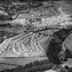
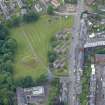
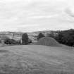
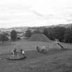
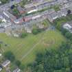
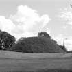
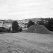
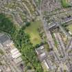
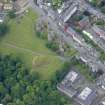
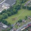
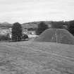
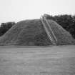
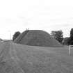
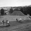
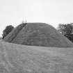
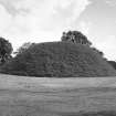
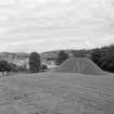
This motte, known as Hawick Mote, is a grass-covered truncated cone, situated 430' OD. Its is apparently entirely artificial, with an almost obliterated ditch round its base.
The flat top is 41' in diameter, standing c.25' above the base, which is 97 1/2' in diameter. The flat-bottomed ditch was discovered by Curle in 1912 when it was found to range in width from 28' to 14' and from 7' to 4' in depth. Curle obtained numerous sherds, a bone needle and a Henry II silver penny from a section in the NE arc of the ditch, all suggesting a 12th century date, when a member of the Lovel farm held Hawick.
A O Curle 1914; RCAHMS 1956, visited 1950.
All the finds from the excavation are in Hawick Museum, except the coin, which is in the National Museum of Antiquities of Scotland (NMAS).
Hawick Museum Catalogue, undated
Generally as described above, although no trace of the ditch can now be seen. Pottery from the site is in Hawick Museum.
Surveyed at 1/2500 and 1/1250.
Visited by OS (RDL) 11 January 1963 and (JP) 18 August 1971
Material from the 1912 excavation, including the Henry II coin are in Wilton Lodge Museum, Hawick (HAKMG 4159).
Museum Catalogue 1981.
(Undated) information in NMRS.
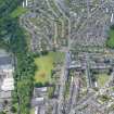
Scheduled as Hawick Moat Park... an artificial earthen motte of truncated conical form, located on the high ground above the W bank of the Siltrig Water. It rises to a height of some 7.6m and has a diameter at the base of about 29.75m.
Information from Historic Scotland, scheduling document dated 29 October 2003.
Publication Account (1980)
The motte, known as the motte of Hawick, located about a quarter of a mile south west of the confluence of the two streams Teviot and Slitrig, has been dated to the twelfth century, a date when the Lovell family held Hawick (RCAM, 1956, 135). The top is flat and stands about twenty five feet above the level of the base which itself measured ninety-seven feet six inches in diameter.
Information from ‘Historic Hawick: The Archaeological Implications of Development’ (1980).
Publication Account (1985)
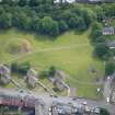
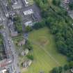
The site of Hawick Motte forms the extremity of the watershed about 500m south-south-west of the meeting of the River Teviot and the Slitrig Water. The ditch surrounding the motte is now almost obliterated, but the mound itself is still a high, truncated cone apparently artificial in its construction. When excavated in 1912, the ditch yielded objects which included a bone needle, a coin of Henry II and numerous sherds of pottery, all pointing to a likely 12th century date. In the time ofWilliam the Lion, Richard Lovel of the Somersetshire Lovels was granted Hawick and Branxholm. This was doubtless his castle!
Some 10 or so km due north lies Riddell Motte (NT 520248) - an oval motte formed by trimming'the tail of a natural ridge and surrounded by a rectangular bailey which was defended on one, and probably on three sides, by a wide, steep-sided ditch flanked by two ramparts.
Information from 'Exploring Scotland's Heritage: Lothian and Borders', (1985).
Sbc Note
Visibility: This is an upstanding earthwork or monument.
Information from Scottish Borders Council


