Pricing Change
New pricing for orders of material from this site will come into place shortly. Charges for supply of digital images, digitisation on demand, prints and licensing will be altered.
Upcoming Maintenance
Please be advised that this website will undergo scheduled maintenance on the following dates:
Thursday, 9 January: 11:00 AM - 3:00 PM
Thursday, 23 January: 11:00 AM - 3:00 PM
Thursday, 30 January: 11:00 AM - 3:00 PM
During these times, some functionality such as image purchasing may be temporarily unavailable. We apologise for any inconvenience this may cause.
Cropmark(S) (Period Unknown), Settlement (Period Unknown)
Site Name Howe Mire
Classification Cropmark(S) (Period Unknown), Settlement (Period Unknown)
Canmore ID 53679
Site Number NT37SE 37
NGR NT 35977 71609
Datum OSGB36 - NGR
Permalink http://canmore.org.uk/site/53679
Ordnance Survey licence number AC0000807262. All rights reserved.
Canmore Disclaimer.
© Bluesky International Limited 2025. Public Sector Viewing Terms
- Correction
- Favourite

SC 1737079
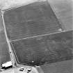
Oblique aerial photograph
RCAHMS Aerial Photography
1978
© Crown Copyright: HES


SC 1737717
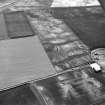
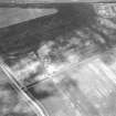
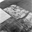
Howe Mire, settlement, coal sinks and cropmarks: oblique air photograph
RCAHMS Aerial Photography
1979
© Crown Copyright: HES

SC 1737732
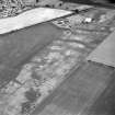
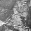
Howe Mire, settlement and cropmarks: oblique air photograph
RCAHMS Aerial Photography
1990
© Crown Copyright: HES

SC 1737795
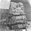
Howe Mire, oblique aerial view, taken from the NE, centred on cropmarks which include those of a settlement, and coal pits.
RCAHMS Aerial Photography
26/6/1995
© Crown Copyright: HES

SC 1737799
Howe Mire, oblique aerial view, taken from the WNW, centred on cropmarks which include those of a settlement and coal pits.
RCAHMS Aerial Photography
26/6/1995
© Crown Copyright: HES

SC 1737862
Howe Mire, settlement, coal sinks and cropmarks: oblique air photograph
RCAHMS Aerial Photography
1979
© Crown Copyright: HES

SC 1737870
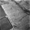
Howe Mire, settlement and cropmarks: oblique air photograph
RCAHMS Aerial Photography
1982
© Crown Copyright: HES

SC 2445953
Howe Mire, NT37SE 37, Ordnance Survey index card, Recto
Records of the Ordnance Survey, Southampton, Hampshire, England
c. 1958
© Crown Copyright: HES (Ordnance Survey Archaeology Division Collection)

DP 216686
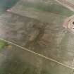
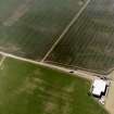
Oblique aerial view of the cropmarks of the settlement, looking SE.
RCAHMS Aerial Photography Digital
9/7/2015
© Crown Copyright: HES

SC 1737312
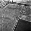
Howe Mire and Barbachlaw, oblique aerial view, taken from the NE, showing cropmarks which include those of an enclosure in the centre of the photograph, a possible enclosure in the bottom right-hand corner, and a settlement in the top right-hand corner.
RCAHMS Aerial Photography
26/6/1995
© Crown Copyright: HES

SC 1737329
Howe Mire, oblique aerial view, taken from the NE, showing the cropmarks of a series of coal pits in the top half of the photograph. Cropmarks of a settlement are visible in the centre.
RCAHMS Aerial Photography
27/6/1996
© Crown Copyright: HES

SC 1737399
Howe Mire, settlement, coal sinks and cropmarks: oblique air photograph
John Dewar
1975
© HES (John Dewar Collection)

SC 1737726
Howe Mire, settlement and cropmarks: oblique air photograph
RCAHMS Aerial Photography
1989
© Crown Copyright: HES

SC 1737728
Howe Mire, settlement and cropmarks: oblique air photograph
RCAHMS Aerial Photography
1989
© Crown Copyright: HES

SC 1737739
Howe Mire, settlement and cropmarks and Barbachlaw, enclosure, cultivation remains and cropmarks: oblique air photograph
RCAHMS Aerial Photography
1991
© Crown Copyright: HES

SC 1737801
Howe Mire, oblique aerial view, taken from the E, centred on cropmarks which include those of a settlement and coal pits.
RCAHMS Aerial Photography
26/6/1995
© Crown Copyright: HES

SC 1737821
Oblique aerial view centred on the cropmarks of the settlement and further cropmarks, taken from the NE.
RCAHMS Aerial Photography
27/7/2000
© Crown Copyright: HES

SC 1737838
Oblique aerial view centred on the cropmarks of the coal-pits and field-boundary with other cropmarks including those of the settlement, the linear cropmarks, the ring-ditch, pits and rig adjacent adjacent, taken from the SSW.
RCAHMS Aerial Photography
25/6/2003
© Crown Copyright: HES

SC 1737857
Howe Mire, settlement and cropmarks: oblique air photograph
Papers of Professor Dennis W Harding, archaeologist, Edinburgh, Scotland
1979
© Professor Dennis W Harding. Courtesy of HES

SC 1737865
Howe Mire, settlement, coal sinks and cropmarks: oblique air photograph
RCAHMS Aerial Photography
1981
© Crown Copyright: HES

SC 1928466
Howe Mire, settlement and cropmarks: oblique air photograph
Papers of Professor Dennis W Harding, archaeologist, Edinburgh, Scotland
1979
© Professor Dennis W Harding. Courtesy of HES

SC 2445955
Howe Mire, NT37SE 37, Ordnance Survey index card, page number 1, Recto
Records of the Ordnance Survey, Southampton, Hampshire, England
c. 1958
© Crown Copyright: HES (Ordnance Survey Archaeology Division Collection)

DP 163905
Oblique aerial view of the cropmarks of the settlement features at Howe Mire, looking S.
RCAHMS Aerial Photography Digital
8/7/2013
© Crown Copyright: HES

SC 1737307
Howe Mire, settlement, coal pits and cropmarks: oblique air photograph
RCAHMS Aerial Photography
1992
© Crown Copyright: HES

SC 1737331
Howe Mire, oblique aerial view, taken from the SSW, showing the cropmarks of a series of coal pits in the bottom half of the photograph. Cropmarks of a settlement are visible in the centre.
RCAHMS Aerial Photography
27/6/1996
© Crown Copyright: HES

SC 1737724
Howe Mire, settlement and cropmarks: oblique air photograph
RCAHMS Aerial Photography
1989
© Crown Copyright: HES

SC 1737731
Howe Mire, settlement and cropmarks: oblique air photograph
RCAHMS Aerial Photography
1990
© Crown Copyright: HES

SC 1737733
Howe Mire, settlement and cropmarks: oblique air photograph
RCAHMS Aerial Photography
1990
© Crown Copyright: HES

SC 1737743
Howe Mire, settlement and cropmarks: oblique air photograph
RCAHMS Aerial Photography
1991
© Crown Copyright: HES

SC 1737745
Howe Mire, settlement and cropmarks: oblique air photograph
RCAHMS Aerial Photography
1991
© Crown Copyright: HES

SC 1737793
Howe Mire, settlement, coal pits and cropmarks: oblique air photograph
RCAHMS Aerial Photography
1992
© Crown Copyright: HES

SC 1737851
Howe Mire, settlement and cropmarks: oblique air photograph
RCAHMS Aerial Photography
1976
© Crown Copyright: HES

SC 1928465
Howe Mire, settlement and cropmarks: oblique air photograph
Papers of Professor Dennis W Harding, archaeologist, Edinburgh, Scotland
1979
© Professor Dennis W Harding. Courtesy of HES

SC 2445954
Howe Mire, NT37SE 37, Ordnance Survey index card, Recto
Records of the Ordnance Survey, Southampton, Hampshire, England
c. 1958
© Crown Copyright: HES (Ordnance Survey Archaeology Division Collection)

SC 2445956
Howe Mire, NT37SE 37, Ordnance Survey index card, page number 3, Recto
Records of the Ordnance Survey, Southampton, Hampshire, England
c. 1958
© Crown Copyright: HES (Ordnance Survey Archaeology Division Collection)

SC 2445957
Howe Mire, NT37SE 37, Ordnance Survey index card, Recto
Records of the Ordnance Survey, Southampton, Hampshire, England
c. 1958
© Crown Copyright: HES (Ordnance Survey Archaeology Division Collection)

DP 052463
Oblique aerial view centred on the cropmarks of the settlement at Howe Mire, taken from the NNW.
RCAHMS Aerial Photography Digital
24/7/2008
© Crown Copyright: HES

SC 1737214
Oblique aerial photograph
RCAHMS Aerial Photography
1978
© Crown Copyright: HES

SC 1737328
Howe Mire, oblique aerial view, taken from the NNE, showing the cropmarks of a series of coal pits in the top half of the photograph. Cropmarks of a settlement are visible in the centre.
RCAHMS Aerial Photography
27/6/1996
© Crown Copyright: HES

SC 1737720
Howe Mire, settlement and cropmarks: oblique air photograph
RCAHMS Aerial Photography
1986
© Crown Copyright: HES

SC 1737725
Howe Mire, settlement and cropmarks: oblique air photograph
RCAHMS Aerial Photography
1989
© Crown Copyright: HES

SC 1737727
Howe Mire, settlement and cropmarks: oblique air photograph
RCAHMS Aerial Photography
1989
© Crown Copyright: HES

SC 1737730
Howe Mire, settlement and cropmarks: oblique air photograph
RCAHMS Aerial Photography
1990
© Crown Copyright: HES

SC 1737734
Howe Mire, settlement and cropmarks: oblique air photograph
RCAHMS Aerial Photography
1990
© Crown Copyright: HES

SC 1737744
Howe Mire, settlement and cropmarks: oblique air photograph
RCAHMS Aerial Photography
1991
© Crown Copyright: HES

SC 1737802
Howe Mire, oblique aerial view, taken from the ENE, centred on cropmarks which include those of a settlement and coal pits.
RCAHMS Aerial Photography
26/6/1995
© Crown Copyright: HES

SC 1737819
Oblique aerial view centred on the cropmarks of the settlement and further cropmarks, taken from the N.
RCAHMS Aerial Photography
27/7/2000
© Crown Copyright: HES

SC 1737860
Howe Mire, settlement, coal sinks and cropmarks: oblique air photograph
RCAHMS Aerial Photography
1979
© Crown Copyright: HES

SC 1737861
Howe Mire, settlement, coal sinks and cropmarks: oblique air photograph
RCAHMS Aerial Photography
1979
© Crown Copyright: HES

SC 1737868
Howe Mire, settlement, coal sinks and cropmarks: oblique air photograph
RCAHMS Aerial Photography
1981
© Crown Copyright: HES

SC 1737871
Howe Mire, settlement and cropmarks: oblique air photograph
RCAHMS Aerial Photography
1982
© Crown Copyright: HES

DP 216685
Oblique aerial view of the cropmarks of the settlement, looking SE.
RCAHMS Aerial Photography Digital
9/7/2015
© Crown Copyright: HES

SC 1737313
Howe Mire, oblique aerial view, taken from the NNE, centred on the cropmarks of coal pits, a field boundary, and a settlement.
RCAHMS Aerial Photography
24/7/1995
© Crown Copyright: HES

SC 1737686
Howe Mire, oblique aerial view, taken from the SSW, showing the cropmarks of a series of coal pits in the bottom half of the photograph. Cropmarks of a settlement are visible in the centre right.
RCAHMS Aerial Photography
27/6/1996
© Crown Copyright: HES

SC 1737792
Howe Mire, settlement, coal pits and cropmarks: oblique air photograph
RCAHMS Aerial Photography
1992
© Crown Copyright: HES

SC 1737796
Howe Mire, oblique aerial view, taken from the NNE, centred on cropmarks which include those of a settlement and coal pits.
RCAHMS Aerial Photography
26/6/1995
© Crown Copyright: HES

SC 1737797
Howe Mire, oblique aerial view, taken from the NNW, centred on cropmarks which include those of a settlement and coal pits.
RCAHMS Aerial Photography
26/6/1995
© Crown Copyright: HES

SC 1737820
Oblique aerial view centred on the cropmarks of the coal pits, field boundary and further cropmarks with settlement adjacent, taken from the NNE.
RCAHMS Aerial Photography
27/7/2000
© Crown Copyright: HES

SC 1737822
Oblique aerial view centred on the cropmarks of the settlement with coal pits, field boundary and further cropmarks adjacent, taken from the ENE.
RCAHMS Aerial Photography
27/7/2000
© Crown Copyright: HES

SC 1737834
Oblique aerial view centred on cropmarks of the settlement, taken from the ESE.
RCAHMS Aerial Photography
14/8/2001
© Crown Copyright: HES

SC 1737837
Oblique aerial view centred on the cropmarks of the coal-pits and field-boundary with other cropmarks, including those of the settlement, adjacent, taken from the SSW.
RCAHMS Aerial Photography
25/6/2003
© Crown Copyright: HES

SC 1737852
Howe Mire, settlement and cropmarks: oblique air photograph
RCAHMS Aerial Photography
1976
© Crown Copyright: HES

SC 1737856
Howe Mire, settlement and cropmarks: oblique air photograph
RCAHMS Aerial Photography
1978
© Crown Copyright: HES

SC 1737866
Howe Mire, settlement, coal sinks and cropmarks: oblique air photograph
RCAHMS Aerial Photography
1981
© Crown Copyright: HES

SC 1737872
Howe Mire, settlement and cropmarks: oblique air photograph
RCAHMS Aerial Photography
1982
© Crown Copyright: HES

DP 052462
Oblique aerial view centred on the cropmarks of the settlement at Howe Mire, taken from the NE.
RCAHMS Aerial Photography Digital
24/7/2008
© Crown Copyright: HES

DP 052465
Oblique aerial view centred on the cropmarks of the settlement at Howe Mire, taken from the W.
RCAHMS Aerial Photography Digital
24/7/2008
© Crown Copyright: HES

SC 1737397
Howe Mire, settlement, coal sinks and cropmarks: oblique air photograph
RCAHMS Aerial Photography
1979
© Crown Copyright: HES

SC 1737719
Howe Mire, settlement and cropmarks: oblique air photograph
RCAHMS Aerial Photography
1986
© Crown Copyright: HES

SC 1737738
Howe Mire, settlement and cropmarks and Barbachlaw, enclosure, cultivation remains and cropmarks: oblique air photograph
RCAHMS Aerial Photography
1991
© Crown Copyright: HES

SC 1737800
Howe Mire, oblique aerial view, taken from the N, centred on cropmarks which include those of a settlement and coal pits.
RCAHMS Aerial Photography
26/6/1995
© Crown Copyright: HES

SC 1737806
Oblique aerial view centred on the cropmarks of the settlement, cropmarks, coal pits and field boundary, taken from the E.
RCAHMS Aerial Photography
24/9/1995
© Crown Copyright: HES

SC 1737811
Howe Mire, oblique aerial view, taken from the NW, showing the cropmarks of a series of coal pits in the top half of the photograph. Cropmarks of a settlement are visible in the top left-hand corner. The photograph is centred on a linear cropmark and indeterminate marks.
RCAHMS Aerial Photography
27/6/1996
© Crown Copyright: HES

SC 1737839
Oblique aerial view centred on the cropmarks of the coal-pits and field-boundary with other cropmarks including those of the settlement, the linear cropmarks, the ring-ditch, pits and rig adjacent adjacent, taken from the S.
RCAHMS Aerial Photography
25/6/2003
© Crown Copyright: HES

SC 1737840
Oblique aerial view centred on the cropmarks of the coal-pits, field-boundary, settlement and further cropmarks, taken from the S.
RCAHMS Aerial Photography
25/6/2003
© Crown Copyright: HES

SC 1737863
Howe Mire, settlement, coal sinks and cropmarks: oblique air photograph
John Dewar
1975
© HES (John Dewar Collection)

SC 1737867
Howe Mire, settlement, coal sinks and cropmarks: oblique air photograph
RCAHMS Aerial Photography
1981
© Crown Copyright: HES

SC 1737873
Howe Mire, settlement and cropmarks: oblique air photograph
RCAHMS Aerial Photography
1982
© Crown Copyright: HES

SC 1928464
Howe Mire, settlement and cropmarks: oblique air photograph
Papers of Professor Dennis W Harding, archaeologist, Edinburgh, Scotland
1979
© Professor Dennis W Harding. Courtesy of HES

DP 052464
Oblique aerial view centred on the cropmarks of the settlement at Howe Mire, taken from the WNW.
RCAHMS Aerial Photography Digital
24/7/2008
© Crown Copyright: HES

DP 216684
Oblique aerial view of the cropmarks of the settlement, looking SSE.
RCAHMS Aerial Photography Digital
9/7/2015
© Crown Copyright: HES

SC 1737587
Howe Mire, settlement and cropmarks: oblique air photograph
RCAHMS Aerial Photography
1992
© Crown Copyright: HES

SC 1737735
Howe Mire, settlement and cropmarks: oblique air photograph
RCAHMS Aerial Photography
1990
© Crown Copyright: HES

SC 1737736
Howe Mire, settlement and cropmarks and Barbachlaw, enclosure, cultivation remains and cropmarks: oblique air photograph
RCAHMS Aerial Photography
1991
© Crown Copyright: HES

SC 1737737
Howe Mire, settlement and cropmarks and Barbachlaw, enclosure, cultivation remains and cropmarks: oblique air photograph
RCAHMS Aerial Photography
1991
© Crown Copyright: HES

SC 1737753
Howe Mire, settlement and cropmarks: oblique air photograph
RCAHMS Aerial Photography
1992
© Crown Copyright: HES

SC 1737798
Howe Mire, oblique aerial view, taken from the NW, centred on cropmarks which include those of a settlement and coal pits.
RCAHMS Aerial Photography
26/6/1995
© Crown Copyright: HES

SC 1737803
Howe Mire, oblique aerial view, taken from the N, showing cropmarks which include those of a settlement and coal pits in the top right-hand corner of the photograph, and an enclosure in the centre left.
RCAHMS Aerial Photography
26/6/1995
© Crown Copyright: HES

SC 1737807
Howe Mire, oblique aerial view, taken from the E, centred on the cropmarks of coal pits and a field boundary. A settlement enclosure is visible in the bottom right-hand corner of the photograph.
RCAHMS Aerial Photography
24/7/1995
© Crown Copyright: HES

SC 1737808
Howe Mire, oblique aerial view, taken from the ENE, centred on the cropmarks of coal pits, a field boundary, and a settlement.
RCAHMS Aerial Photography
24/7/1995
© Crown Copyright: HES

SC 1737809
Howe Mire, oblique aerial view, taken from the SSW, centred on the cropmarks of a series of coal pits. Cropmarks of a settlement are visible in the top right-hand corner of the photograph.
RCAHMS Aerial Photography
27/6/1996
© Crown Copyright: HES

SC 1737835
Oblique aerial view centred on cropmarks of the settlement, taken from the NE.
RCAHMS Aerial Photography
14/8/2001
© Crown Copyright: HES

SC 1737854
Oblique aerial photograph
RCAHMS Aerial Photography
1978
© Crown Copyright: HES

SC 1737855
Howe Mire, settlement and cropmarks: oblique air photograph
RCAHMS Aerial Photography
1978
© Crown Copyright: HES

SC 1737858
Howe Mire, settlement and cropmarks: oblique air photograph
Papers of Professor Dennis W Harding, archaeologist, Edinburgh, Scotland
1979
© Professor Dennis W Harding. Courtesy of HES

SC 1737859
Howe Mire, settlement and cropmarks: oblique air photograph
Papers of Professor Dennis W Harding, archaeologist, Edinburgh, Scotland
1979
© Professor Dennis W Harding. Courtesy of HES

SC 2082092
Oblique aerial view showing Howe Mire, settlement, coal sinks and cropmarks.
John Dewar
1975
© HES (John Dewar Collection)

SC 2082093
Oblique aerial view showing Howe Mire, settlement, coal sinks and cropmarks.
John Dewar
1975
© HES (John Dewar Collection)

SC 1737327
Howe Mire, oblique aerial view, taken from the NNE, showing the cropmarks of a series of coal pits in the top half of the photograph. Cropmarks of a settlement are visible in the centre.
RCAHMS Aerial Photography
27/6/1996
© Crown Copyright: HES
































First 100 images shown. See the Collections panel (below) for a link to all digital images.
- Council East Lothian
- Parish Inveresk (East Lothian)
- Former Region Lothian
- Former District East Lothian
- Former County Midlothian
NT37SE 37 NT 35977 71609
(NT 3599 7160) Crop marks of native site.
(Undated) information in NMRS.
This crop marks falls in a flat arable field. No trace exists and there is no knowledge of any surface finds.
Visited by OS (SFS) 26 August 1975
Enclosure, Howe Mire: visible on RCAHMS aerial photographs.
(Undated) information in NMRS.
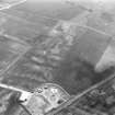
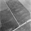
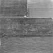
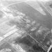
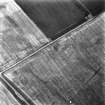
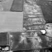
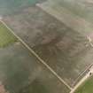
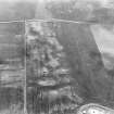
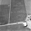
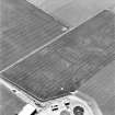
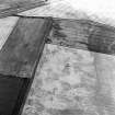
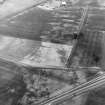
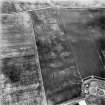
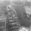
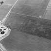
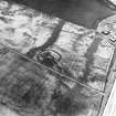
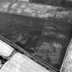
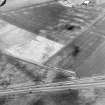
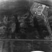
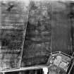
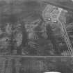
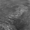
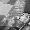
Air photographs show a series of cropmarks, including those of an enclosure, 350m SW of Barbachlaw farmsteading. The enclosure, possibly a settlement, is roughly circular, measuring about 30m in diameter within a ditch up to 3m broad, with a possible entrance on the NE side. There are a number of small indeterminate cropmarks visible internally and externally. This settlement was previously classified as an enclosure. Immediately to the S is a further area of cropmarks, which include coal pits (NT37SE 62).
Information from RCAHMS (KB) 2 March 1999.


