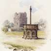
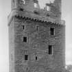
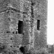
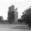
Preston Tower
Tower House (Medieval)
Site Name Preston Tower
Classification Tower House (Medieval)
Canmore ID 53671
Site Number NT37SE 3
NGR NT 39026 74064
Datum OSGB36 - NGR
Permalink http://canmore.org.uk/site/53671
- Council East Lothian
- Parish Prestonpans
- Former Region Lothian
- Former District East Lothian
- Former County East Lothian
NT37SE 3 39026 74064
See also NT37SE 22
(NT 3902 7405) Preston Tower (NR)
OS 6" map (1966)
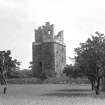
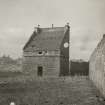
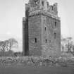
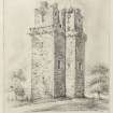
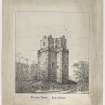
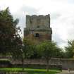
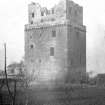
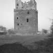
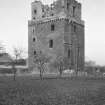
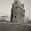
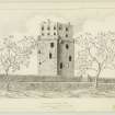
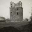
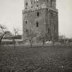
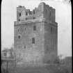
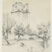
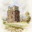
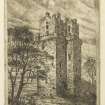
Preston Tower, which dates mainly from the 15th century, stands within a 17th century enclosure wall. L-shaped on plan, the tower measures 34' N-S by 39 1/2' transversely over walls which are 6' 9" thick in the main block, and 4' thick in the wing. It stands 67' high, the top 21' of which, within a parapet walk, is a 17th c. addition. A monogram dated 1626 on the S side gave the date of this addition, though now only the first two figures remain. Initials on the E pediment record the repair of this part after its burning in 1650, by Cromwell's soldiers after the Battle of Dunbar. It was also burned in 1544 by the English under the Earl of Hereford; and finally accidentally set on fire in 1663 and never again occupied.
Preston belonged to a branch of the Hamiltons from the latter half of the 14th century, and the tower was almost certainly built by Sir Robert Hamilton, who inherited the estates c.1460.
RCAHMS 1924, visited 1913; T Ross 1905
As described.
Visited by OS (RD) 4 January 1972
NT 390 740 The insertion of floodlighting by East Lothian District Council necessitated digging cable trenches on three sides of the tower at Preston (NMRS NT37SE 3). A scheduled monument, the tower was probably built in the 15th century and a further two storeys were added in the 17th century. Examination of the trenches revealed that the upper deposit consisted of garden soil and in many areas the trench did not penetrate this deposit. Where the topsoil was thin, archaeological features were noted. These consisted of a cobbled path leading to the entrance on the ground floor (SE corner), a spread of sand with mortar around the E and N sides of the tower and, under this, a layer of grey soil containing many stone spalls which lay directly on orange boulder clay. The grey deposit may represent a construction level but, like the sand with mortar, may simply have been a working surface. The foundations of a wall ran from the SE corner of the tower, E to the present boundary wall. Only modern artefacts were recovered, from the bottom of the garden soil.
Sponsor: East Lothian District Council.
AOC (Scotland) Ltd 1996.
Scheduled with NT37SE 22 as Preston Tower and Dovecot.
Information from Historic Scotland, scheduling document dated 13 December 2000.
NT37SE 3.00 39026 74064
NT37SE 22 39003 74157 dovecot
NT37SE 3.01 39061 74062 walls; gate piers
NMRS REFERENCE:
Non-Guardianship Sites Plan Collection, DC28454- DC28465, 1937 & 1938.
EXTERNAL REFERENCE:
The Builder, March 17th 1888 - 1 printed sheet of plans, elevation & section. by Walter F. Lyon.
Field Visit (4 September 1913)
This tower (fig. ISO), which is mainly a 15th century structure, stands within an enclosure about ¼ mile north of Prestonpans railway station. It is L-shaped on plan (fig. lSI) and measures over all 34 feet from north to south and 39 feet 6 inches from east to west; the re-entering angle faces west .The walls, 6 feet 9 inches thick in the main block and about 4 feet thick in the wing, are built of a soft reddish sandstone with grey dressings in 14 inch courses of stones 18 inches long, but the lower portion of the south wall, where a softer stone has been used, is much eroded.
The body of the building is 67 feet high and contains six storeys, while the jamb contains seven. The upper storeys, which rise 21 feet above and within a parapet walk, which returns round the building except at the north wall of the shorter wing, are an addition of the early 17th century, built in a lighter coloured stone and exhibit Renaissance mouldings on the jambs and entablatures of the windows. The remaining semicircular pediments of the uppermost windows bear the following initials. On the south side the initials S. I. H. are for Sir John Hamilton (1565-1644), and on the next a monogram which may be read S. I. D. K. H. apparently represents Sir John Hamilton and his second wife Dame Katherine Howieson. Their married life covered the years 1620-9, and it is said that below the monogram was the date 1626, of which only the first two figures now remain (1). A painted heraldic panel of wood, with round arch and fluted column decoration, which came from the old church of Prestonpans but is now in private ownership, bears the same initials (cf. Proc. Soc. Ant. Scot. vol. 26, pp. 241-50). Thus we get name and date for the builder of this upper portion of the tower. Of the eastern pediments one has its initials reduced to the letters S. T., and what may be the lower part of an H., while on the other survivor are the initials D. R. B., which seem to have been recut. The latter probably stand for Dame Rachael Burnet third wife of Sir Thomas Hamilton (1618-c.1672) and sister of Bishop Burnet, so that the other initials were apparently those of Sir Thomas. We should thus have a record of the repair of this part after its burning in 1650 and the novodamus charter after the Restoration (See below). Sir Thomas married Rachael Burnet after 1662
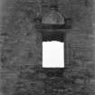
The parapet and angle rounds are contemporary with the upper storeys, but the corbelling appears to be earlier and might date from the 16th century. The windows, where unaltered, have a small chamfer worked on the jambs; the later windows have moulded jambs or backset margins or both.
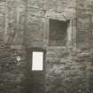
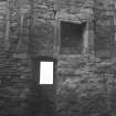
The entrances to the tower are in the east wall and not within the re-entering angle. A great corbel, at the level of the parapet corbels, and a vestige of a neighbour show where a machicolated projection served these as a defence. The basement is entered through a round-headed doorway, which had two doors, the outer of timber, the inner an iron yett. Above the lower entrance, but nearer the south-east angle, there is a second, from which the Hall is reached. In form it has been similar to the other but at a later time altered to its present shouldered head. At the southeast angle of the tower the presence of raggles, corbels and mortise holes denotes that a hoarding of two storeys covered with a lean-to roof once projected from the walls. This construction has certainly been an addition, for its roof would prevent the use of the defensive feature above the entrance, and moreover the raggles and mortise holes have been formed after the walls of the tower were built.
The basement is barrel-vaulted and contained two storeys dimly lit by narrow window slits. The upper floor joists rested on the corbels still in situ 6 feet above the present floor level. The only internal communication between the basement and the Hall on the first floor is a hatch formed in the vault. At a late period an access was formed through the west wall at the southern end, leading into the lowest portion of the short wing-a prison or pit with vaulted roof-originally reached from a hatch in its vault. The only light and ventilation this prison received was from a flue some 7 inches square formed in a window breast in the apartment above, which leads downwards through the vault. At the north-west angle of the prison is a slop sink.
The chamber above the pit, probably an upper prison, is also vaulted and in this vault there is a hatch. It is only lighted by one narrow window. The stair at the north-eastern angle, which ascends to the Hall, is probably secondary. Above this chamber is a second, which is at the same level as the Hall; it has a vaulted roof; the north-wedst angle contains a fireplace, the south-west angle a garderobe.
The Hall is ceiled with a semicircular barrel vault and has windows in the south gable and lateral walls. In the north gable there remains in situ one moulded jamb of an elaborate 15th century fireplace; beyond it to the west is a rectangular and dog-legged mural recess. A staircase ascending from the Hall to the upper floors projects within the apartment at the south-west angle; though now entered from the ingoing of a window in the south wall, it was originally reached from the angle doorway now built up. Beneath the south window lay a mural chamber, demolished when the present entrance to the staircase was formed. The Hall has been coated with plaster, and traces of this still remain. An interesting feature is a moulded plaster cornice of c. 16th century, which returns across the north wall at the level of the vault springing, but below this the wall was probably panelled. .The remaining storeys call for no special mention.The building has been conserved within recent years and is in a fairly good state of preservation.
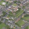
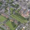
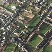
DOVECOT. One hundred yards north of the tower is a 17th century dovecot oblong on plan measuring 19 ¼ by 17 ¼ feet and containing over 1000 stone built nests.
BOUNDARY WALLS, ETC. The walls of the enclosure within which the tower stands date at least from the 17th century. The entrances are treated in the Renaissance style. West of the tower there is a square on the boundary wall, loopholed for guns, resembling those on the garden wall at Seton Castle.
HISTORICAL NOTE. Preston belonged to a branch of the Hamiltons from the latter half of the 14th century. In 1544 the ‘town and castle’ were burnt by the .English army under the Earl of Hertford. The’ house’ was again burned by Cromwell's soldiers in October 1650 after the battle of Dunbar, when also the ‘charter kist’ was ‘totallie spoiled and destroyed’ (2), and a new charter to all the lands of the family had to be issued in 1663 (3). Sir Thomas Hamilton was then the laird, succeeding under a special provision of entail made by his childless predecessor John, grandson of the Sir John Hamilton (1565-1644) who built the upper part of the tower. The family possessed also estates in Renfrewshire and Lanarkshire, and members of it are therefore occasionally referred to as of Fingalton in Renfrew. The tower was accidentally set on fire in 1663 and not thereafter occupied (4). The Preston family was of the Covenanting party, and the last male of the direct line was Robert Hamilton, who commanded the Covenanters at Drumclog and Bothwell Bridge and died in 1701.
RCAHMS 1924, visited 4 September 1913.
(1) Proc. Soc. Ant. Scot. vol. xxvi., p. 243; (2) Act. Parl. Scot. vol. vii., p. 98 ; (3) R.M.S. s.a. No. 416; (4) Prestonpans and Vicinity. P. McNeil, p. 187. Anderson's Memorials of the House of Hamilton.
Standing Building Recording (10 August 2021 - 22 November 2022)
NT 39026 74064 An architectural survey of Preston Tower was carried out order to provide expert advice to support the artistic reconstruction of the tower and second to provide an architectural history of the tower for use by the Preston Tower Conservation Project managed by GRAS Ltd. An archaeological survey by CFA Archaeology was used as the baseline for the interpretation along with site visits. Two site visits were made in conjunction with Bob Marshall, historical reconstruction artist, to carry out a visual survey in order to provide input to the artistic reconstruction of the main phases of the tower in 1450, 1560 and 1650. The second module was a written report comprising an architectural history of the tower based on the three site visits, the archaeological record and online documentary searches.
P. Dixon
Source: (OASIS ID: piersdix1-520948)
Archaeological Evaluation (28 June 2021 - 13 July 2021)
A targeted trench evaluation was carried out by CFA Archaeology in the grounds of Preston Tower, Prestonpans, to examine the potential impact of works related to consolidation, access and interpretation on the cultural significance of the monument.
Two perpendicular trenches were excavated, reaching the natural substratum at a depth of 0.70-1.0m. The profile consistently comprised topsoil over 19th century rubble levelling and backfill, sealing a setting of curvilinear sandstone kerbing and rough paving orientated north-south towards the ground entrance of the Tower. The setting measured 2.9m by 2.0m and 0.15m thick, situated 2.3m from the base of the Tower in Trench 1. The setting was likely an ornamental entranceway within the post-medieval landscaping of the monument, bedded on a trample layer of redeposited natural gritty sand. All finds recovered were post-medieval in date. No additional archaeological features or deposits were identified.
Information from OASIS Id: cfaarcha1-426024 (O Rusk) 2021


