Pricing Change
New pricing for orders of material from this site will come into place shortly. Charges for supply of digital images, digitisation on demand, prints and licensing will be altered.
Cardrona Tower
Tower House (Medieval)
Site Name Cardrona Tower
Classification Tower House (Medieval)
Alternative Name(s) Cardrona Hill; Cardrona House Policies
Canmore ID 53137
Site Number NT33NW 2
NGR NT 30092 37863
Datum OSGB36 - NGR
Permalink http://canmore.org.uk/site/53137
- Council Scottish Borders, The
- Parish Traquair
- Former Region Borders
- Former District Tweeddale
- Former County Peebles-shire
NT33NW 2 30092 37863.
(NT 3009 3786) Tower (NR) (remains of)
OS 6" map (1964)
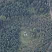
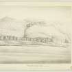
Cardrona Tower stands on the E shoulder of Cardrona Hill and overlooks the valley of the Tweed to N, E and S.
The tower is L-shaped on plan with the re-entrant angle facing S. The main block measures about 33'6" from NW-SE by 22'2" from NE-SW. The wing, provided to house the stair, projects about 6'10" to the SW in alignment with the NW gable, and measures 10' 1" NW-SE.
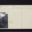
The building is dilapidated, but some parts still stand to a height of about 30' and the SE gable is almost entire. There has been a parapet-walk on the SW wall of the main block, reached from the staircase, which consequently rises above the main wall-heads. In the main block there are three main storeys and there was probably a garret in the roof space.
The entrance, situated in the SE wall of the wing, is represented by a gap recently repaired and arched over, above which there is space for a panel, now empty.
The lands of Cardrona appear to have been in the possession of the Govans from the 14th century until the end of the 17th century, the tower itself probably dating from the second half of the 16th c. In 1685 the property passed to the Williamsons, who built a new house lower down the hillside. It was no doubt at this time that the tower was abandoned, but the building was "still almost entire" in 1794. In the middle of the 19th century the remains of "very strong and substantially built walls" could be seen round the tower, but there is no trace of these today, the ground being obscured by dense undergrowth.
RCAHMS 1967, visited 1958
This tower is as described. The remains are in good condition.
Visited by OS (WDJ) 28 June 1961 and (SFS) 3 September 1974.
Standing Building Recording (11 November 2010 - 16 November 2010)
NT 30092 37863 A detailed historic building survey was undertaken, 11–16 November 2010, on the remains of the 16th-century tower house in advance of consolidation works on the building. The work consisted of map regression, a written, photographic and 3D scanner survey of the building.
The tower is accessible to two storeys in height and the floor of the first floor ‘main hall’ remains intact. There is a ground floor vaulted basement. The building is L-shaped in plan, with a tall stair tower attached to the N side of the SW elevation. Constructed of whinstone, the SE wall still retains much of its steeply pitched gable, with wall heads surviving to the second and third floor level in places. A projecting piece of stonework on the S side of the SW elevation indicates a possible parapet walk or the foundation of a corbelled tower.
Archive: RCAHMS (intended)
Funder: The Forestry Commission Scotland
AOC Archaeology Group, 2010
Information also reported in Oasis (aocarcha1-90330) 12 October 2011
Note (5 July 2022)
Cardrona was the home of a branch of the Govan family between the fourteenth and later seventeenth centuries, and it was presumably a member of that family who built the tower now seen, most likely around the later decades of the sixteenth century.
In 1685 the estate was acquired by James Williamson of Hutchinfield, and he appears to have taken an immediate decision to abandon the tower in favour of a new house further down the hillside. An inscribed stone with his initials and the date 1686 is built into the later house, which in its present form dates from a further rebuilding of 1840.
Cardrona is an example of the type of small residence built by many lairds, who were keen to be accommodated within houses displaying the accepted towered symbolism of moderate defensibility, but who could afford to do so on no more than a very limited scale. It is located within a hollow on the steep hillside above the Tweed Valley, and there are traces of a courtyard on the south-west side of the tower.
The tower, which is of the common L-shaped plan, has its main body aligned from north-west to south-east, and has a small stair tower projecting at its western angle with the entrance doorway at its base. The walls, which are relatively thin, are built of roughly coursed whinstone, with only minimal ashlar dressings. Any worked stonework around the doorway has been robbed, and its place now taken by modern masonry, above the doorway is a framed recess, which was presumably intended to house an armorial panel.
The ground floor of the tower is occupied by a low barrel vaulted chamber that has been lit by narrow slit openings in the two gable walls. Above that level are two floors with a single rectangular chamber on each, and there was presumably a garret within the roof space. There are the remains of fireplaces in the south-east gable wall of the two levels of chambers, but there is nothing to suggest that either they or the windows at those levels were treated with any more than a minimal degree of finish.
There appears to have been a wall walk on the south-west side of the tower, reached from a cap house at the head of the stair tower. Why that wall walk should have been provided on the side towards the courtyard is unclear. There is evidence of some 'lairdish' repairs. In addition to those around the doorway which have already been mentioned, some areas around the windows appear to have been rebuilt.
C Cruft, J Dunbar and R Fawcett 2006; D MacGibbon and T Ross 1889; RCAHMS 1967
Information from the HES Castle Conservation Register, 5 July 2022
Sbc Note
Visibility: Upstanding building, which may not be intact.
Information from Scottish Borders Council


