
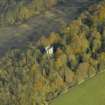
Raith Estate, Cormie Hill, Raith Tower


Tower (19th Century)
Site Name Raith Estate, Cormie Hill, Raith Tower
Classification Tower (19th Century)
Alternative Name(s) Raith House Estate; Raith House Policies; Raith Estate Gardens; Raith Park
Canmore ID 52961
Site Number NT29SW 10
NGR NT 24957 91880
Datum OSGB36 - NGR
Permalink http://canmore.org.uk/site/52961


- Council Fife
- Parish Kirkcaldy And Dysart
- Former Region Fife
- Former District Kirkcaldy
- Former County Fife
NT29SW 10 24957 91880
See also NT29SE 4.00 25625 91768 Raith House

