Piteadie Castle
Tower (Medieval)
Site Name Piteadie Castle
Classification Tower (Medieval)
Alternative Name(s) Pitteadie Castle
Canmore ID 52730
Site Number NT28NE 1
NGR NT 25739 89128
Datum OSGB36 - NGR
Permalink http://canmore.org.uk/site/52730
- Council Fife
- Parish Kinghorn
- Former Region Fife
- Former District Kirkcaldy
- Former County Fife
NT28NE 1.00 25739 89128
NT28NE 1.01 257 891 garden
(NT 2574 8912) Piteadie Castle (NR) (remains of)
OS 6" map, (1967)
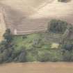
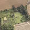
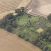
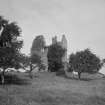
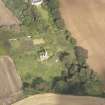
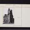
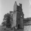
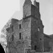
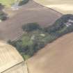
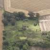
The remains of Pitteadie Castle stand 1 1/2 miles N of Kinghorn. They are in a bad state, the upper works being in a dangerous condition. The castle is a free-standing, rubble-built oblong tower, measuring 33 1/2' by 27 1/2'. It was originally built probably towards the end of the 15th century, but considerably altered two centuries later. The castle is surrounded by a 17th century park wall, in which are two Renaissance gateways.
RCAHMS 1933.
Piteadie Castle, as described by the RCAHMS, is in a fair state of preservation. The two Renaissance gateways, dated 1686, are situated at NT 2568 8912 and NT 2575 8913.
Visited by OS (W D J) 5 February 1959.
No change to previous field report.
Visited by OS (S F S) 15 December 1975.
Field Visit (5 June 1925)
Pitteadie Castle.
The remains of this castle, are pleasantly situated on a steep grassy slope looking southwards towards Kinghorn, 1 ½ miles distant. They are in a bad state, the upper works being in a dangerous condition. The castle is a free-standing oblong tower, originally built probably towards the end of the 15th century but considerably altered two centuries later and that in a manner which is largely responsible for its present ruinous condition.
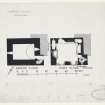
The tower is built of rubble, with dressings at the voids, and measures 33 ½ by 27 ½ feet over the main block, the stair-wing having a projection of only 4 feet. There are three storeys beneath the wall-head, and there is evidence of an attic and garret within the roof. The projection which contained the stair was from a gable, as at Seafield Tower (NT28NE 5) and Whittinghame (NT67SW 2), and not from a lateral wall, as is more usual. It was at the south-east angle, and the re-entrant therefore opened to the north-east but is now filled in with later building. The south-east angle is carried up as a two-storeyed cap-house, and there is a turret stair within the re-entrant. At the north-eastern and south-western angles were 'rounds,' only the corbelling for which survives. The original entrance, which was at first-floor level, may still be traced on the south wall in the remains of an arched doorway with corbels for a wooden landing. It opened into the hall, close to the narrow newel-stair which rose to the upper floors and descended to the ground floor. The earliest alteration that can be detected was a lowering of the stair descending to the ground floor, to suit a new entrance there, and an increase in its width. In the more important alterations of the 17th century an entrance was formed at the ground level, the former entrance being built up. As the walls at the first-floor level were thinned in places and were virtually rebuilt from the second-floor level upwards, the greater part of the structure must be of the 17th century.
The ground floor is vaulted and is lit from east and west; there is no fireplace. The first floor has a window looking north, a mural chamber at the north-west corner, and what maybe a second at the east end of the north wall. These, as well as a large fireplace in the east gable, are all original features, but the large south windows and the fireplace with moulded jambs set in the west gable are insertions of the 17th century. The second floor was divided into two rooms in the 17th century. In its east gable there are traces of the 15th-century fireplace with a 17th-century window broken out through the back of it, while a 17th-century fireplace has been inserted in the same gable and another in the gable opposite. The mural chamber at the north-east angle is original, but the whole of the windows are of later date.
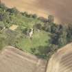
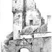
The castle is surrounded by the walls of a 17th-century park with a simple Renaissance gateway on the east side. On the pediment of this is an armorial panel with helm, mantling and shield, the latter bearing: A (palm) tree surmounted by a saltire, on a chief three mullets, the arms of William Calderwood of Pitteadie, apothecary, and burgess of Edinburgh. On either side of the shield are his initials and below is the date 1686. The crest is a hand grasping a quill pen, and above it is a label with a motto, unfortunately illegible. The date and initials are repeated on the west entrance to the garden.
HISTORICAL NOTE. - In 1519 John Vallance ("Wallangis") was served heir to his father David in Easter and Wester Pitteadie, as separate holdings in the barony of Easter Kinghorn (1). The original tower was apparently built by this family. Subsequently the lands were in possession of a family named Sandilands, but in 1612 they were erected into a barony in favour of John Boswell (2), “the fortalice of Wester Pitteadie to be the principal messuage." To the Boswells may be attributed the 17th-century reconstructions. In 1710 Pitteadie belonged to a "gentleman of the name of Calderwood" (3), a descendant of the Calderwood mentioned above.
RCAHMS 1933, visited 5 June 1925.
(1) Sheriff Court Book of Fife (S.H.S.), pp.140-1, 158. (2) Reg. Mag. Sig., s.a., No. 722. (3) Sibbald's History of Fife, etc. (ed. 1803), p. 317.


