Edinburgh, Blackford Hill
Fort (Period Unassigned)
Site Name Edinburgh, Blackford Hill
Classification Fort (Period Unassigned)
Canmore ID 52558
Site Number NT27SE 90
NGR NT 2545 7064
Datum OSGB36 - NGR
Permalink http://canmore.org.uk/site/52558
- Council Edinburgh, City Of
- Parish Edinburgh (Edinburgh, City Of)
- Former Region Lothian
- Former District City Of Edinburgh
- Former County Midlothian
NT27SE 90 2545 7064.
(NT 2545 7064) Fort (NR)
OS 1:10,000 map, (1976)
There are indefinite remains of a walled fort on the highest point of Blackford Hill, about 300 yards W of the Observatory buildings. The remains consist of the much-broken fragments of two portions of wall foundations on the NE, and indications of a 24ft wide entrance in the E. The fort seems to have had at least two lines of defence on the N and NE, the inner one having a spread of 9ft and a scarp of 21ft which sinks to a fairly level terrace some 13ft wide before reaching the outer at a lower level, which shows a spread of about 7ft. The outer ridge on the E appears to have had a retaining faces of stone. The fort is in a strong defensive position.
RCAHMS 1929, visited 1927.
The slight traces of the fort are generally as described above. The two scarps on the NE side form the main remnants of the fort. The entrance on the E side is 4.0m wide. Both scarps bear traces of walling on the crests (up to 3.0m wide in places), and debris can be seen on their slopes. The base of the inner wall or rampart can be traced running round the SW side of the site in the form of a scatter of stones; here and there the line of an outer revetment face can be seen. The outer line of defence is traceable on the NW side as a short scarp with traces of walling on its crest. A possible entrance, 3.0m wide, is near the SW corner of the fort. Both inner and outer ramparts end on the cliff edge of the hill on the S and SE.
Surveyed at 1:2500.
Visited by OS (J L D) 29 December 1953.
This fort is as described in the various field reports.
Visited by OS (S F S) 8 December 1975.
Aerial Photography (1971)
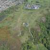
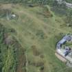
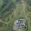
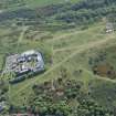
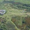
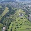
Oblique aerial photographs of Blackford Hill fort, Edinburgh, by Mr John Dewar in 1971.
Note (6 November 2015 - 18 May 2016)
The remains of a fort are situated on the summit of Blackford Hill, but the ramparts are very heavily robbed and few details of its size or shape have been recorded. Probably roughly D-shaped on plan, backing onto the cliff-edge along the S flank, its defences comprise two ramparts, which are most clearly visible on the N and NE, springing from the cliff edge on the SE. The Scheduling inspector estimated the interior at 70m from E to W by 50m transversely, an area of about 0.3ha. There is one entrance on the E, while the OS noted a possible second close to where they found a sector of inner rampart at the cliff-edge on the SW. The interior is featureless, but the Scheduling inspector in 1997 noted the footings of four round-houses on an area of level ground immediately E of the defences.
Information from An Atlas of Hillforts of Great Britain and Ireland – 18 May 2016. Atlas of Hillforts SC3714
Project (28 July 2016 - 11 August 2016)
A cultural heritage desk based assessment for the proposed redevelopment focused on the Geosciences Buildings and Engineering Buildings, King's Buildings, University of Edinburgh was undertaken in August 2016. The proposed development site is located at the west extent of the King's Buildings Campus in the south of Edinburgh centred on NGR NT 26466 70599. The proposed development comprises redevelopment of the Geosciences and Engineering buildings within the King's Buildings Campus.
Information from Callum Allsop (Rubicon Heritage Services) 11 August 2016: OASIS ID: rubiconh1-261722


